I have some good news to pass along: It doesn’t look quite as hot today as it looked like it would be in the model guidance yesterday or the day before. Oh, it will be plenty hot. Just maybe not quite as hot. How hot? It will be near the all-time record high in many places.
We just won’t blow by those records quite as easily.
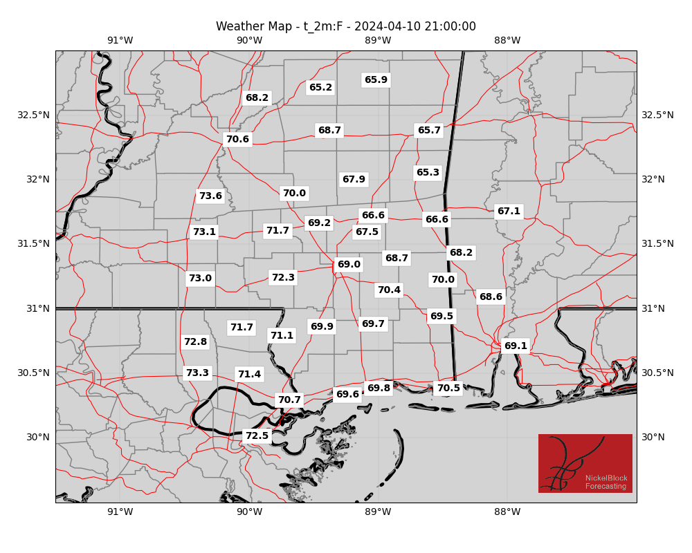

Temperatures topping out around 105F today and tomorrow in many spots, some places may climb all the way to near 110F. Unreal stuff for South Mississippi, but really does showcase the power of water – or lack thereof.
The lack of recent rains, coupled with the big ridge of high pressure nearby is the reason for the heat. When we have been this dry, we lose a little bit of the humidity in the air. That humidity – while it does make it feel 110F at times – keeps temperatures in the 90s because humid air is tougher to warm up and cool down than drier air.
That is why after a ton of summertime storms in the evening, that night may be cooler to start, but tends to stay warmer overnight. And why when we haven’t seen meaningful rain across much of the area in more than a month, temperatures can climb past 100F nearly every afternoon.
Couple all of that with the background of our warming climate and you get near all-time record heat! Crazy stuff.
We will get a brief bit of relief. Friday and Saturday there is a chance we only top out in the upper 90s to around 100F instead of in the 100F-105F range.
Then as we move through next week, temperatures should drop back into the 90s for highs.
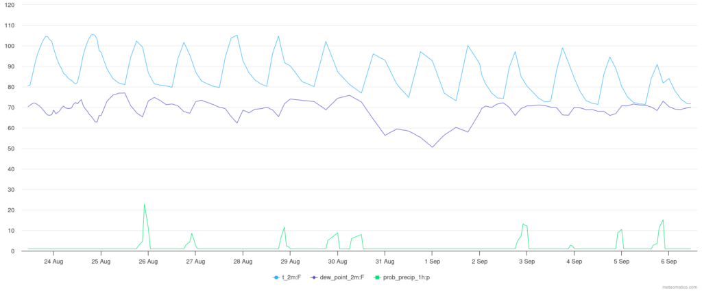
Looking at the chart above, notice the little blips on bottom, that is the shot for rain each day. Notice how meager it looks. Not great.
But all the way toward the end of the forecast, notice by September 6th, the model guidance is suggesting temperatures topping out around 90F. I’m not totally sold on that yet, but it is worth monitoring. Keep in mind that 90F-93F is still warmer than normal (though, not by much), but will probably feel like an Arctic Blast compared to this recent stretch of heat.
[wpcode id=”41149″]
REGIONAL DAY-TO-DAY FORECAST
Wednesday: Sunny, hot with highs around 105. North winds 5 to 10 mph. Heat index values up to 116.
Wednesday Night: Mostly clear. Lows in the upper 70s. Southeast winds 5 to 10 mph. Heat index values up to 111 early in the evening.
Thursday: Mostly sunny. A slight chance of showers and thunderstorms in the afternoon. Hot with highs around 105. Southeast winds 5 to 10 mph. Chance of rain 20 percent. Heat index values up to 116.
Thursday Night: Partly cloudy in the evening, then becoming mostly clear. Lows in the upper 70s. South winds around 10 mph, diminishing to around 5 mph after midnight. Heat index values up to 108 early in the evening.
Friday: Sunny. A chance of showers and thunderstorms in the afternoon. Hot with highs 100 to 105. Chance of rain 30 percent. Heat index values up to 115.
Friday Night: Mostly clear. Lows in the upper 70s. Heat index values up to 110 early in the evening.
Saturday: Sunny. A slight chance of showers and thunderstorms in the afternoon. Hot with highs 100 to 105. Chance of rain 20 percent. Heat index values up to 115.
Saturday Night: Mostly clear. Lows in the upper 70s. Heat index values up to 105 early in the evening.
Sunday: Sunny. A slight chance of showers and thunderstorms in the afternoon. Hot with highs 100 to 105. Chance of rain 20 percent. Heat index values up to 110.
Sunday Night: Partly cloudy with a slight chance of showers and thunderstorms in the evening, then mostly clear after midnight. Lows in the upper 70s. Chance of rain 20 percent. Heat index values up to 105 early in the evening.
Monday: Mostly sunny. A chance of showers and thunderstorms in the afternoon. Hot with highs around 100. Chance of rain 30 percent. Heat index values up to 110.
Monday Night: Partly cloudy. A slight chance of showers and thunderstorms in the evening. Lows in the mid 70s. Chance of rain 20 percent.
Tuesday: Mostly sunny. A chance of showers and thunderstorms in the afternoon. Highs in the upper 90s. Chance of rain 30 percent.


