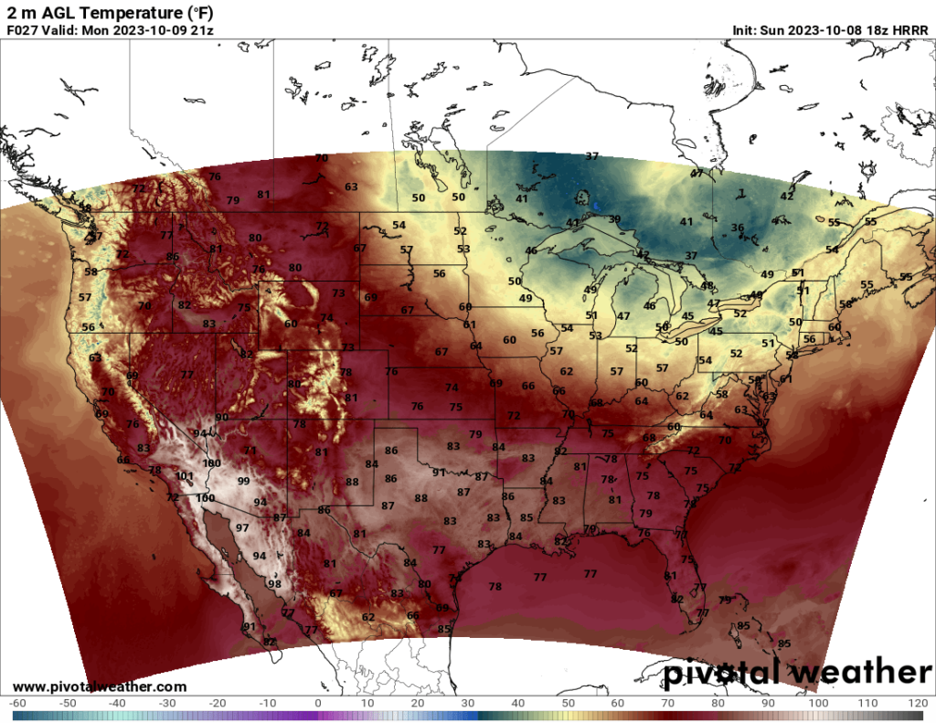
At the start of the work week, a ridge is situated over the western US, and an upper low/trough is situated over the Northeast US, the Great Lakes region, and eastern Canada. The ridge will bring warm temperatures to the western US, while the trough will bring cool to cold weather to the Northeast and Great Lakes states. Some places may only see highs in the 40s on Monday, particularly in the Great Lakes region.
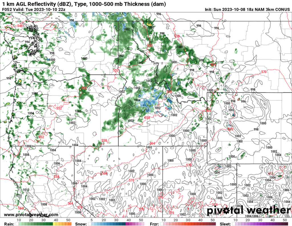
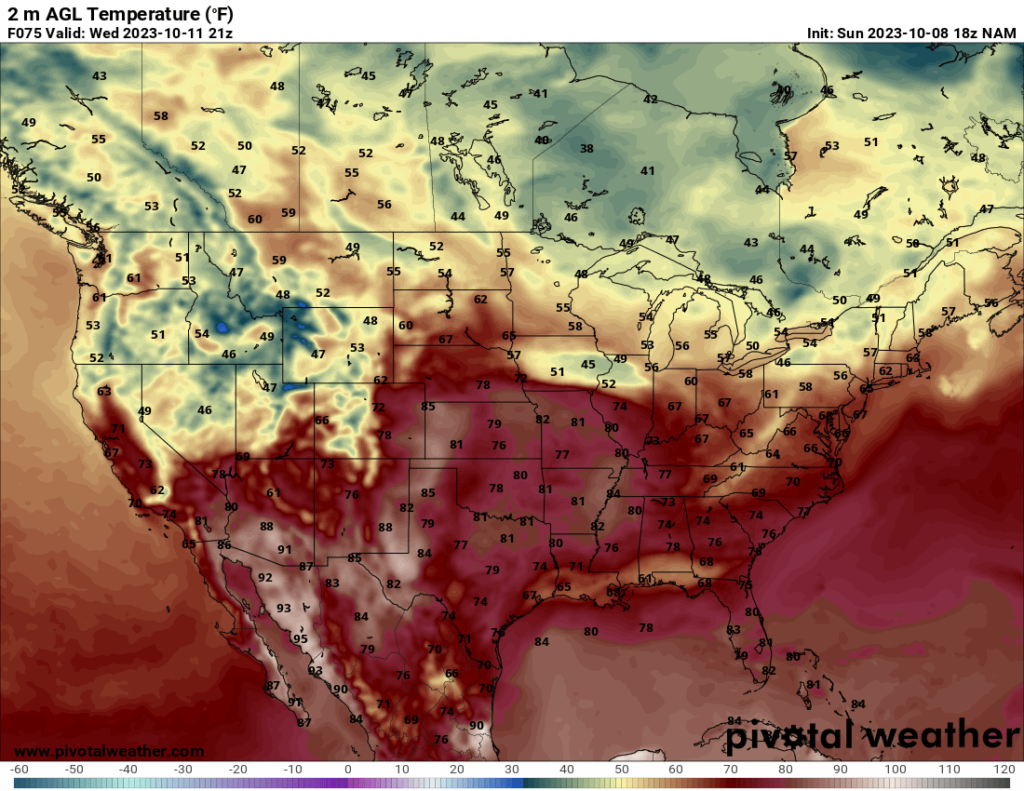
On Tuesday, a trough is forecast to start moving across the northwestern states, bringing cooler temperatures as well as precipitation. A few of the higher elevations in the Northwest may even see some snow. The cooler air will be in place over most of the western states by Wednesday.
Severe weather chances should be fairly low until at least Wednesday. According to the Storm Prediction Center’s Day 4 and 5 discussions, Wednesday and Thursday may see some severe potential in parts of the central US, but predictability is too low at this time.


