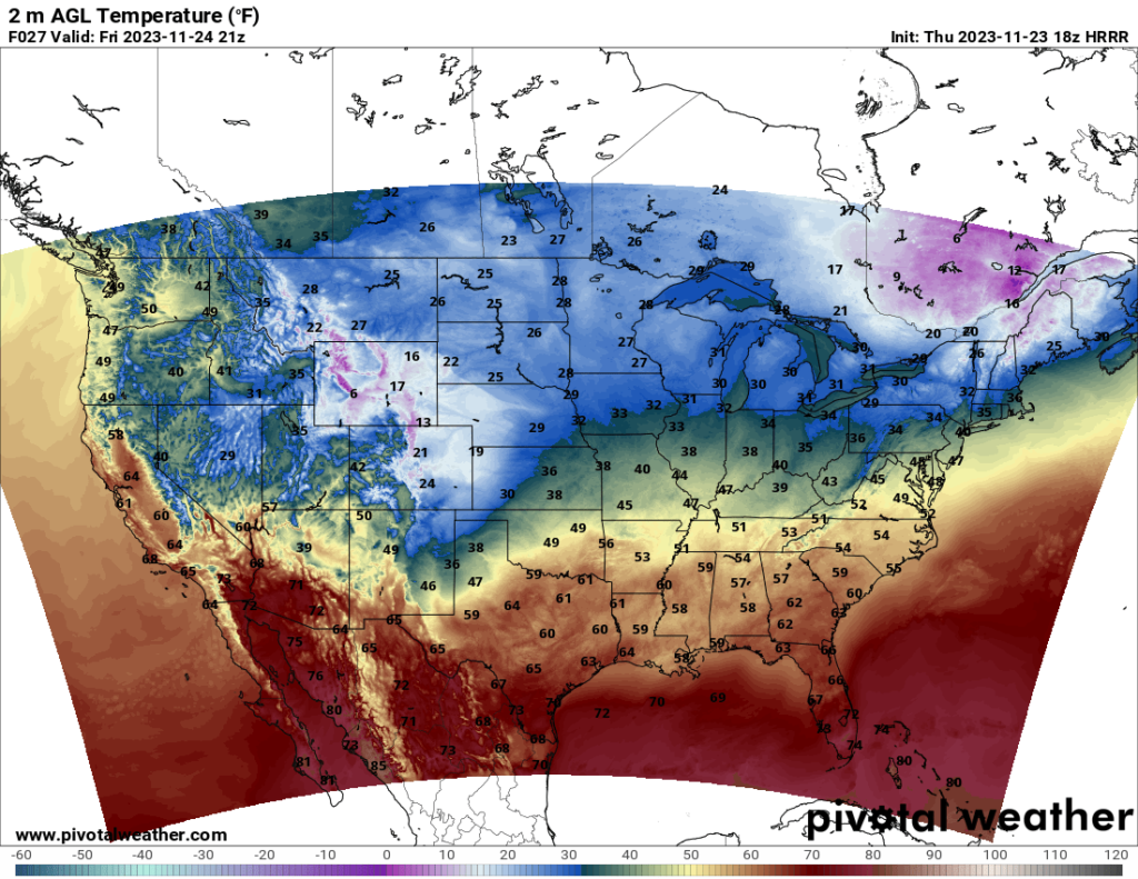
Black Friday weekend is looking to be a cold one for many. It will feel like winter in a lot of states, with the worst of the cold being felt in the northern Plains states as well as Montana and Wyoming, with some places not seeing temperatures get above the mid 20s.
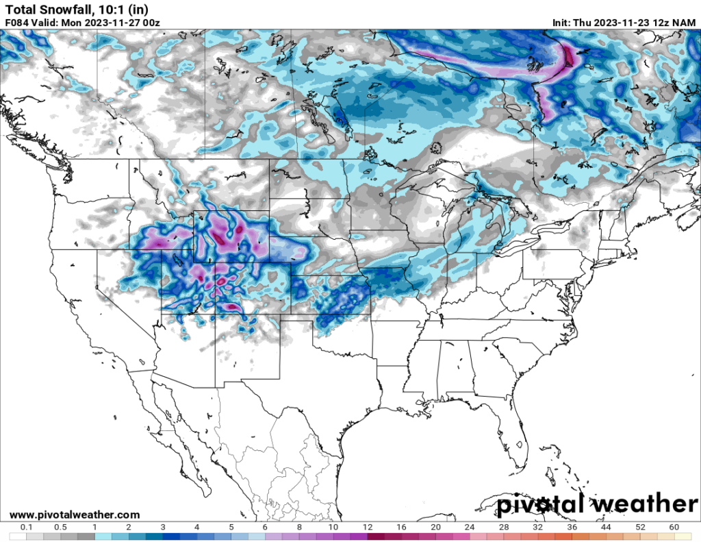
The snow that affected the northern Mountain West states will continue to spread southward into Colorado and Utah by Friday and into Kansas and other central/northern Plains states on Friday and Saturday. By Sunday, it is forecast to move into the Midwest along with another system trailing behind it from the northern Plains. The above map shows the snowfall estimate until Sunday evening.
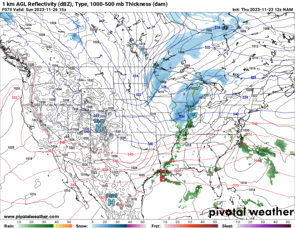
Farther south, rainfall is expected to move eastward across the South Saturday night and Sunday. The amount of rainfall is still unclear, as models disagree right now as to the extent of the rain. It should move fairly quick, though, so most places will not see all-day rain.


