BIG NEWS: Both the Android and iOS apps have a big upgrade! Don’t miss out on a new radar, dark mode, and other small upgrades and fixes. Later today, I’m hoping we get our new menu deployed on the app, too!


The radar update is the big one. It lets to seamlessly go from current radar to an extrapolation of radar during the next hour. Which will (we hope) really help you during all types of weather to know when things will be close by and then when things will pass by.
On top of that, we will have some big changes to the website coming up during the next few weeks.
We are leveling up!

… Now, ontot he forecast!
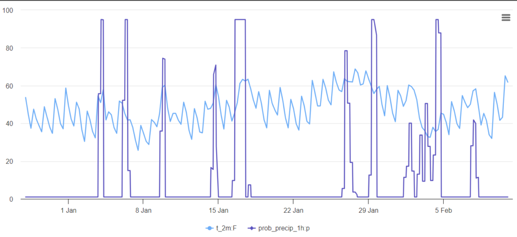
We have an active and interesting stretch of weather moving our direction as we close out 2023 and move into 2024. Until then, though, things will be calm and seasonably cool. Enjoy it!
Because it looks like we have a train of systems ready to slide through the region to kick of 2024. We look to have a shot for rain on the 1st, 3rd, perhaps again on the 5th, and then again around the 10th of January. And perhaps even another shot around the 12th!
So far, it looks like severe weather isn’t in the card for any of these passing systems (neither is snow, sorry kids!) but there will be beneficial rainfall!
It looks like the system around the 10th may off a pretty good shot for some heavier rain and perhaps some storms, too. But it is still a bit too far out for specifics on that one.
Then looking way down the road, the VAREPS model wants to paint in a shot for some much cooler weather as we move into February. As well as a shot for some more precip.
Still a lot to figure out int eh coming days and weeks! Simply keep tabs on the weather as we move into 2024!
REGIONAL DAY TO DAY FORECAST
Thursday: Sunny, cooler with highs in the lower 50s. Northwest winds 5 to 10 mph.
Thursday Night: Mostly clear. Cold with lows in the lower 30s. Northwest winds around 5 mph.
Friday: Sunny. Highs in the lower 50s. West winds 5 to 10 mph.
Friday Night: Clear, cold with lows around 30. West winds around 5 mph.
Saturday: Sunny. Highs in the mid 50s.
Saturday Night: Clear, cold with lows in the lower 30s.
Sunday: Sunny. Highs in the lower 60s.
Sunday Night: Mostly clear in the evening, then mostly cloudy with a slight chance of showers after midnight. Not as cool with lows in the lower 40s. Chance of rain 20 percent.
New Years Day: Mostly cloudy. A chance of showers, mainly in the morning. Highs around 60. Temperature falling into the mid 50s in the afternoon. Chance of rain 30 percent.
Monday Night: Partly cloudy in the evening, then clearing. Cooler with lows in the lower 30s.
Tuesday: Sunny. Highs in the mid 50s.
Tuesday Night: Mostly cloudy. A chance of showers after midnight. Lows around 40. Chance of rain 30 percent.
Wednesday: Mostly cloudy with a 30 percent chance of showers. Highs in the mid 50s.


