Hello everyone, the weekend has arrived, but there are going to be scattered thunderstorms and showers roaming around in Mississippi and Alabama for today. For the temperatures for today, the low temp will be at low 70s to mid 70s and the high temp will be at mid 80s to upper 80s. The dew point temperatures will be at mid 70s throughout the day. In short, it will be cloudy in the morning with storms starting to develop in the afternoon and cooler temperatures.
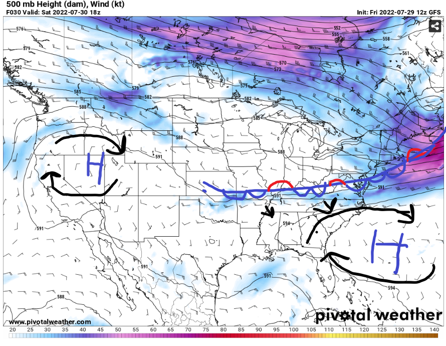
The high pressure will be slowly retreating to the Atlantic Ocean, but it will play as a factor on the amount of rain for some parts of Alabama and Mississippi. This stationary cold front will be slowly coming down to the southeast to produce showers and thunderstorms for today.
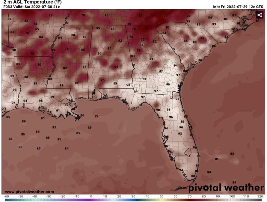
For some good news, that the temperatures will be in the mid 80s up to upper 80s. It will determine on where the storms will produce in the Mississippi and Alabama. The heat index values will be up to low 90s to mid 90s for today.
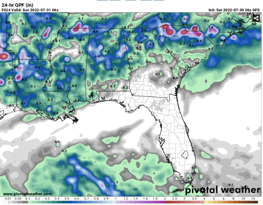
Depending on the arrival for the cold front in SE MS and SW AL, it will tell the amount of rain will be in this area. The estimate rainfall for today will be around .3 to .6 inches of rain.
Day to Day Forecast
Saturday
Mostly cloudy in the morning with a 70-percent chance for scattered showers and thunderstorms developing in the afternoon. The high temperature will be at mid 80s to upper 80s. The heat index values will be at low 90s to mid 90s.
Sunday
Mostly sunny with few cloudy with a 20-percent chance for stray showers or thunderstorms. The high temp will be at mid 90s. The high index values will be at low 100s.
Monday
Partly cloudy with a 20-percent chance for stray showers or thunderstorms. The high temp will be at low 90s. The heat index values will be at upper 90s.
Tuesday
Partly cloudy with a 50-percent chance for scattered showers or thunderstorms. The high temp will be at low 90s. The heat index values will be at mid 90s.
Wednesday
Sunny to partly cloudy with a 40-percent chance for scattered showers or thunderstorms. The high temp will be at low 90s. The heat index values will be at upper 90s.
Thursday
Partly cloudy with a 40-percent chance for scattered showers or thunderstorms. The high temp will be at low 90s. The heat index values will be at upper 90s.
Friday
Sunny to Partly cloudy with a 20- percent for a stray shower or thunderstorms. The high temp will be at low 90s to mid 90s. The high index values will be at low 100s.


