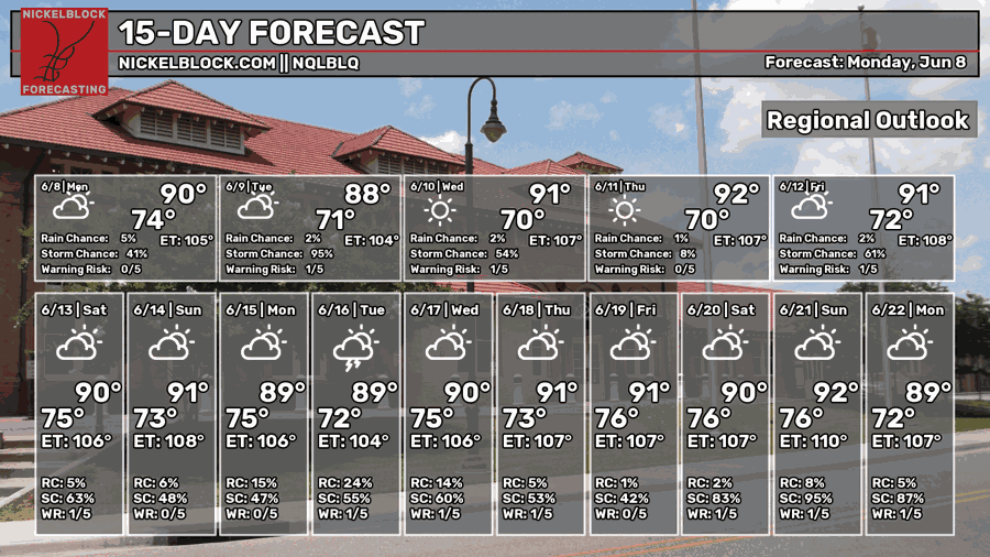
After another soggy weekend, we’re all wondering, “is there any relief? Can I go outside without getting rained on?” The answer is not quite a resounding yes, but mostly yes. The storms will quiet down for a few days this week which is great news for us that work outdoors or want to go outside after work. However, we’re soon back in another rainy pattern as another stationary front moves in by this weekend.

Today’s Atmospheric Setup
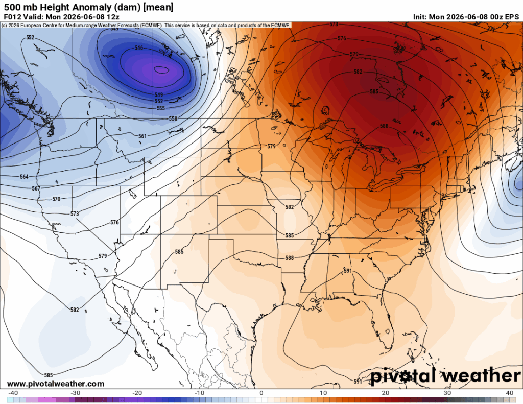
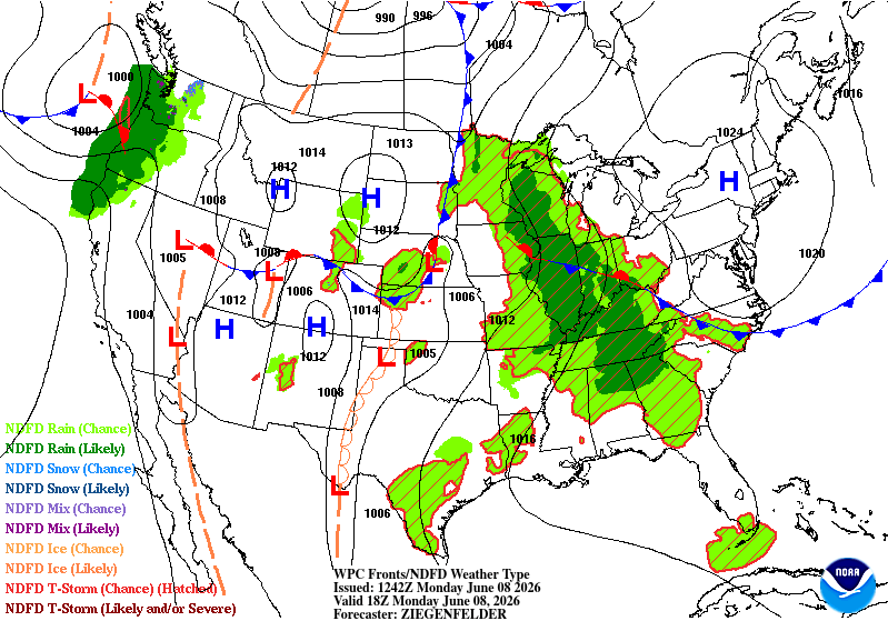
Looking at the 500mb map above, there is a very pronounced ridge across the eastern Great Lakes and a closed ridge over the southeast. At the surface, there’s a large closed high pressure zone in the New England region that coincides with the upper level high’s location. Due to the surface high’s location in the north, this will quell some of the storm development for a few days for us while the Midwest and western Appalachian region will still see more rain. The upper level high will begin to grow and morph until it spans most of the Eastern US in size.
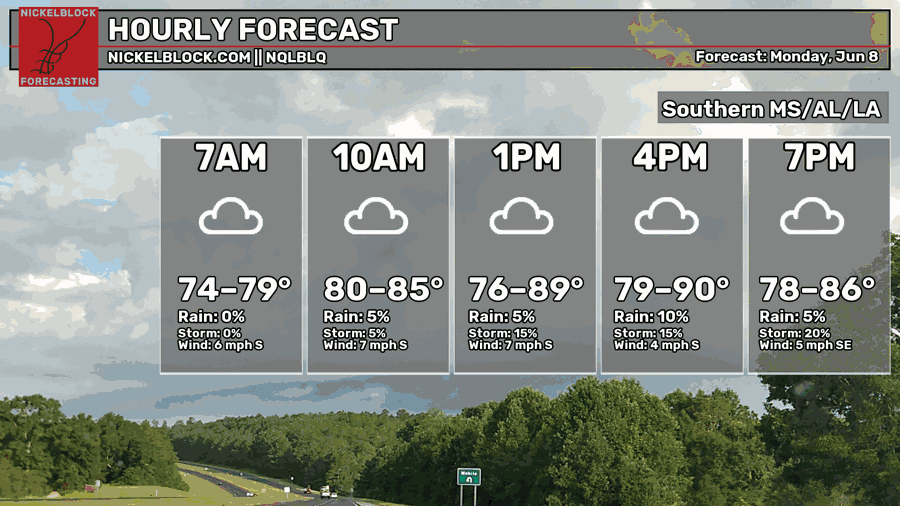
Onto today’s forecast, expect partly to mostly cloudy skies today as winds come out of the south. Highs will top just around 90. A few spotty showers and thunderstorms are possible this afternoon until the early evening, but nothing like what we had this weekend. Overnight, we’ll still have a mix of clouds with a low in the low 70s.

Tomorrow
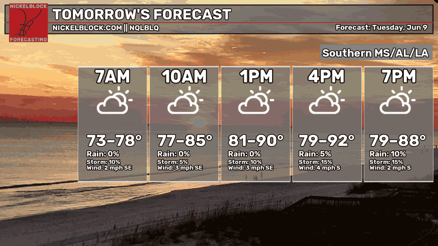
It’ll feel a little drier outside tomorrow as the dewpoint takes a dip into the 60s instead of the 70s. It’ll be another partly cloudy day with a very limited chance for thunderstorm development, but not zero. A few areas around the southern Pine Belt and southeastern Louisiana may see a stray thunderstorm develop, but otherwise we’ll reach the low 90s during the day with winds out of the southeast. Overnight, temperatures fall back into the low 70s with partly cloudy skies.
Wednesday
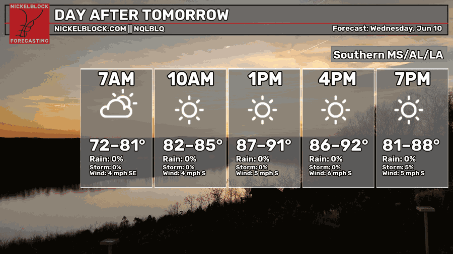
Wednesday will be our driest day with a few clouds in the sky. We’ll reach the low 90s for most of the Pine Belt with a heat index in the mid 90s. For an early Summer day, not too bad for it being a hot one. Winds will be out of the south and we’ll fall back into the low 70s overnight.
Sorry to Rain on Your Parade This Weekend…
Yeah, unfortunately the dry period won’t last too long. We have another dry day on Thursday before another stationary front inches towards the eastern US by Saturday.
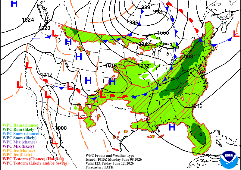
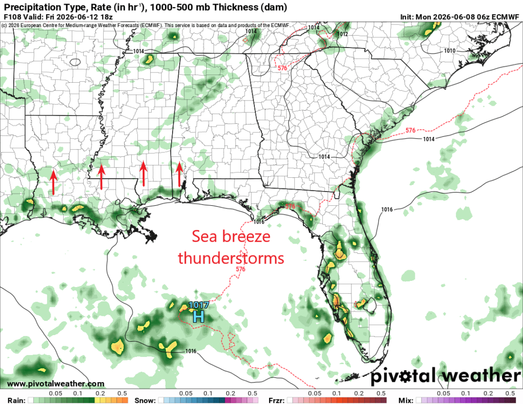
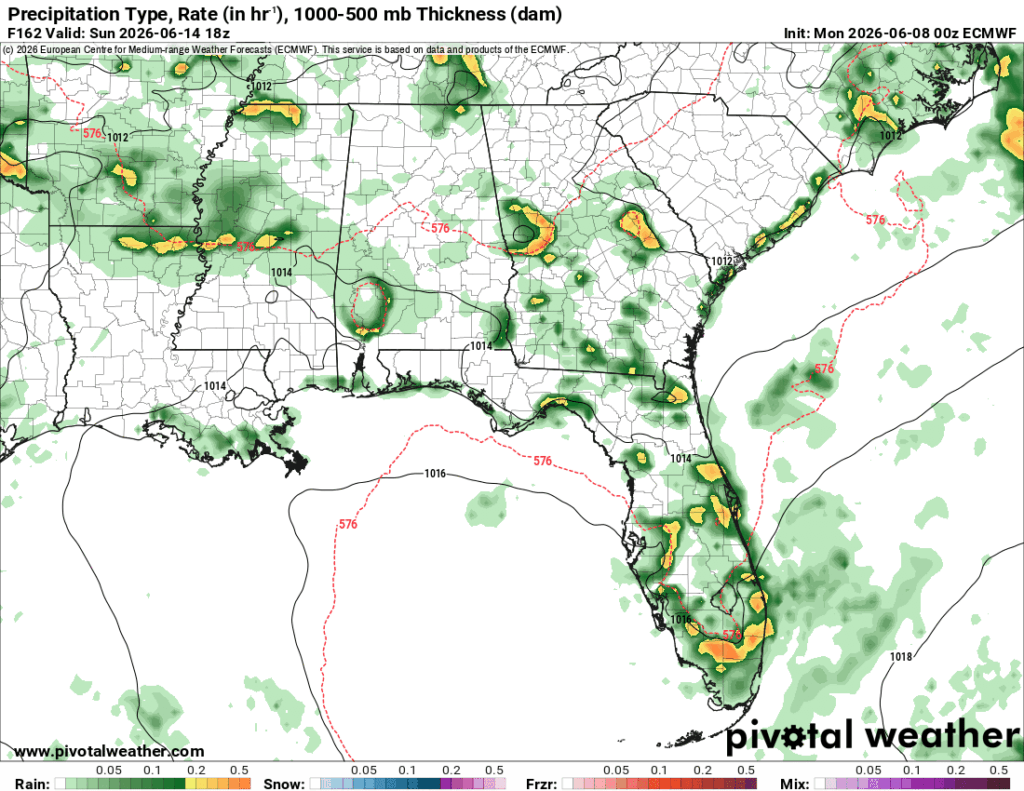
The incoming rain on Friday will be influenced by the sea breeze so expect a few storms to move in that way before they die down in the evening. By Saturday, however, we’re back into the wet pattern. The front spans the entire eastern portion of North America from the Hudson Bay to Texas and it’s going to squeeze out a lot of moisture from the Gulf as it moves southward. For us, that obviously means sticky conditions and thunderstorms. For the most part, the developing storms will move in from the sea breeze on Friday and Saturday. By Sunday, however, the front will move in from the north bringing a mixed bag of sea breeze thunderstorms and MCS thunderstorms.