I feel a bit like a broken record here, but the forecast – in one word – is: Dry.
Today, we can expect sunny skies with highs in the mid-80s and southeast winds at 10 to 15 mph. Tonight, it will be mostly clear with lows in the lower 60s and east winds at 5 to 10 mph. Wednesday it’ll be about the same — mostly sunny conditions and highs in the lower 80s, accompanied by east winds at 10 to 15 mph. Wednesday night is expected to be mostly clear with lows in the lower 60s and east winds at 5 to 10 mph.
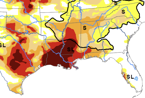
The drought continues. With D3 and D4 drought across much of the area.
Moving into the latter part of the week, the high-pressure system is expected to shift eastward, promoting subtle southerly moist return flow aloft. That doesn’t mean rain, but it may limit the wildfire risk a bit. So, even with the higher winds wildfire concerns are expected to remain low (ish).
The weather on Thursday? Welp, more of the same. Mostly sunny skies and highs in the lower 80s, along with southeast winds at 10 to 15 mph with gusts up to 20mph. Thursday night remains mostly clear with lows in the lower 60s.
As we look ahead to the extended forecast, dry and warm conditions are set to persist. The dominating 592 dm high-pressure system across the southeast region will keep moisture flow suppressed and maintain a “limited” wildfire danger. Sustained winds around 10 mph, gusting at times between 15-20 mph, will add to the dry conditions.
Friday, Saturday and Sunday the southerly flow will continue with highs around 80F and lows around 60F. No real chance for rain.
Looking further ahead, there may be some possible showers early next week as a cold front pushes east across the area. But the chance for rain right now is below 20-percent.
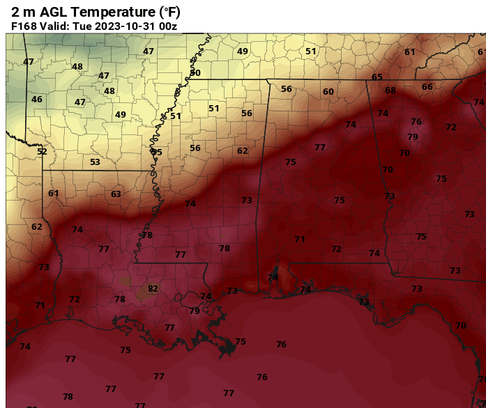
Remember that post talking about “some forecasts” including “maybe some snow” around Halloween. Welp. Tell me the last time you saw it snow at 78F.
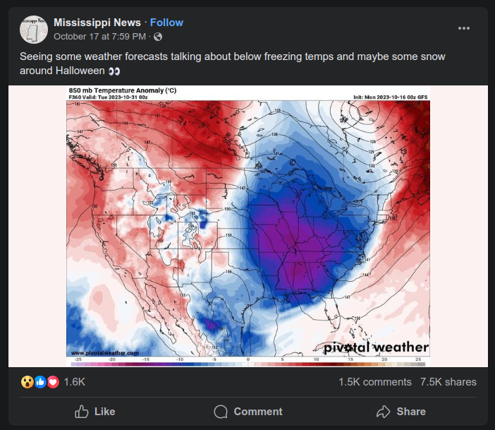
If you want a longer range forecast, don’t get it from Facebook. Or the Farmer’s Almanac. Come to an actual meteorologist.
In fact, the estimates for total precipitation – of any kind – during the next two weeks, from the GFS computer weather model, for our area is almost zero. with a bullseye of zero right on top of Marion County, Mississippi.
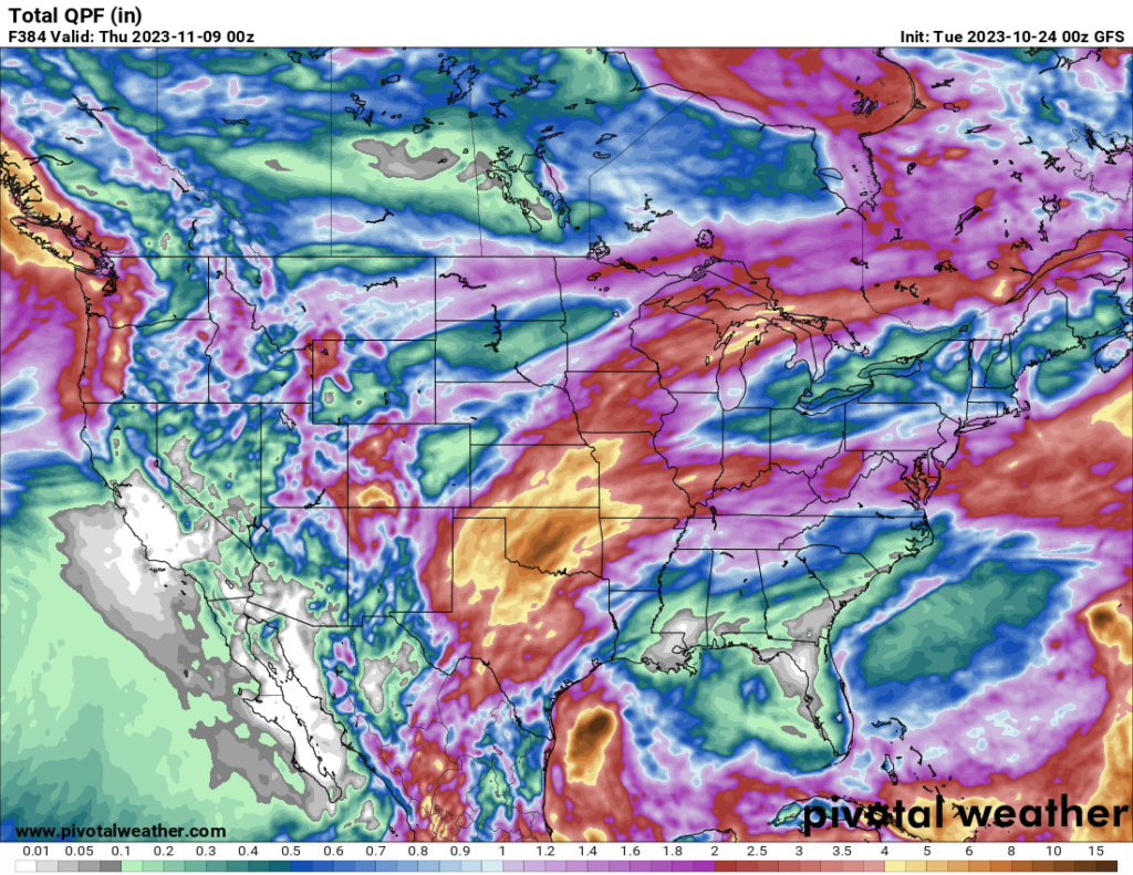
While I think that is a bit of an exaggeration and I do expect more than “zero” rain during the next two weeks… It paints a good idea that things will remain drier than normal around here.


