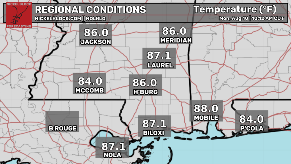
Good morning! As of this morning, the temperatures are already pretty toasty. Temperatures in the mid-upper 80s are widespread throughout our area, and they’re only going to continue to rise.
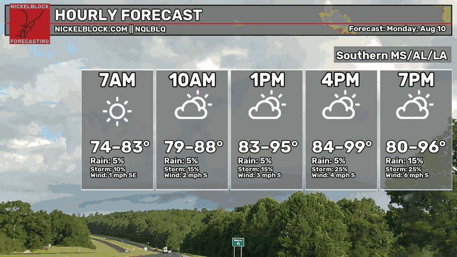
This afternoon and early evening, the high are expected to rise into the stifling upper 90s. A few 100ºF readings are not out of the question either.
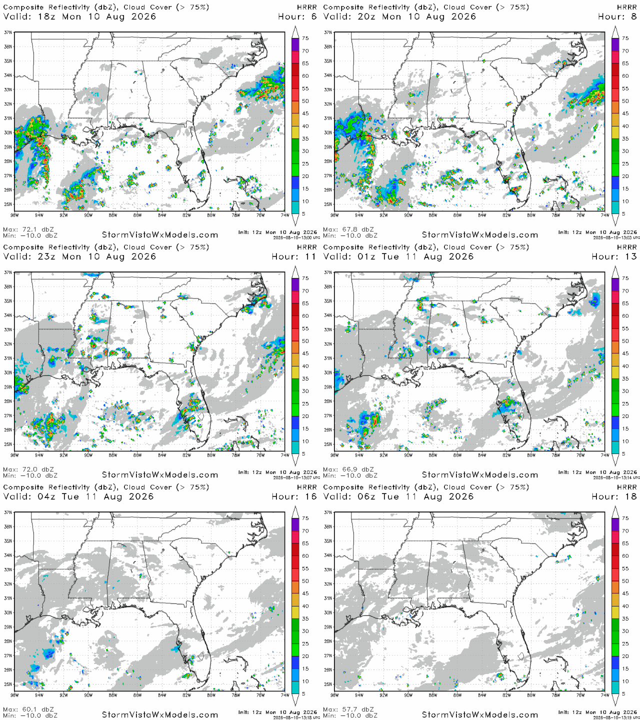
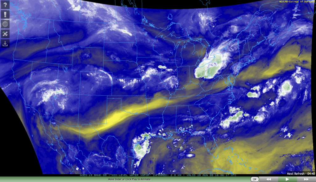
Early this afternoon, we’re expecting a few sea breeze storms to fire up, particularly out in Louisiana and the southern half of Mississippi, and the Mobile area in Alabama. If you look at the image on the right, there is plenty of mid-level moisture, so it’s no surprise we’re expecting some storms today. Most storms should be gone by 10 tonight.
Be on the lookout for periods of heavy rain, gusty winds, and lightning. Rainfall totals aren’t likely to exceed a quarter of an inch, but areas hit directly by a thunderstorm are likely to receive more. Since yesterday, storms seem to have become more robust, possibly due to higher than expected moisture levels in the mid-level atmosphere.
Tomorrow
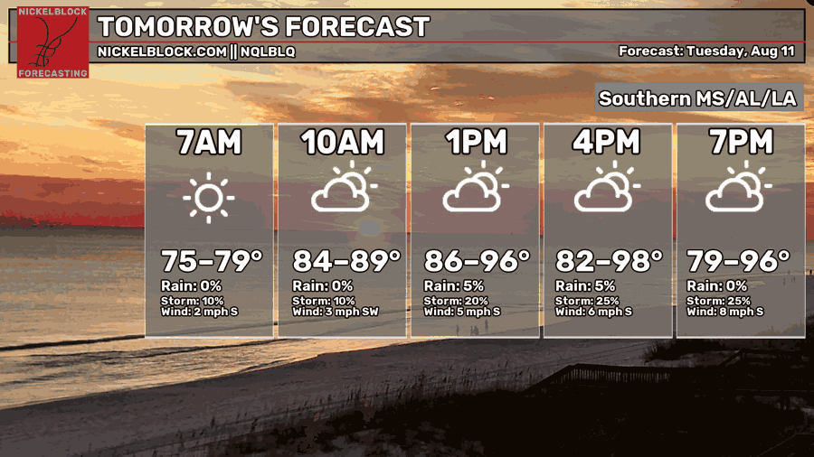
We’re expecting another sultry day tomorrow, with afternoon highs in the mid-upper 90s for most. Morning lows in the mid-upper 70s won’t provide much relief either. Skies will be sunny in the morning, then cloud cover will increase as the day goes on.
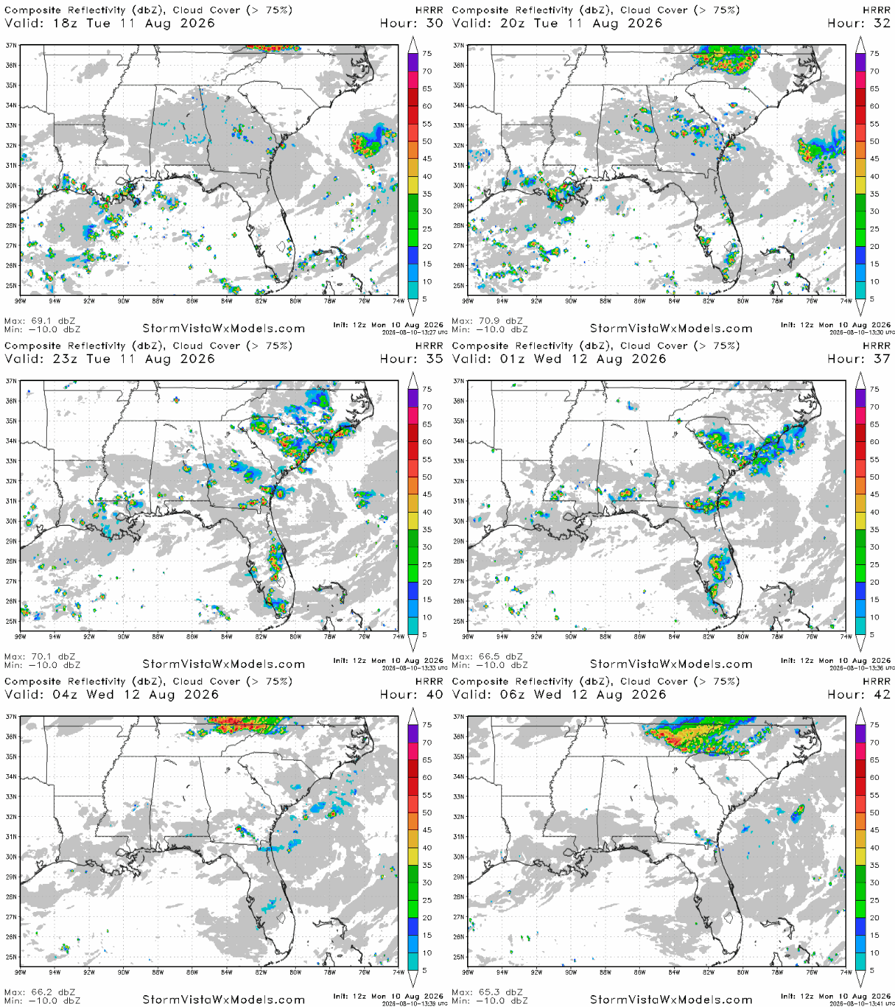
A few sea breeze storms are in store for tomorrow, although they don’t look to be as widespread as today. Storms look to fire up in the early afternoon and should be mostly gone by 9 tomorrow night. Southeastern Louisiana and southwestern Mississippi look to be the two places most likely to see storms tomorrow, but anywhere relatively close to the coast could see some action.
Rainfall totals will be at most a quarter of an inch, but expect higher totals in places hit directly by storms.


