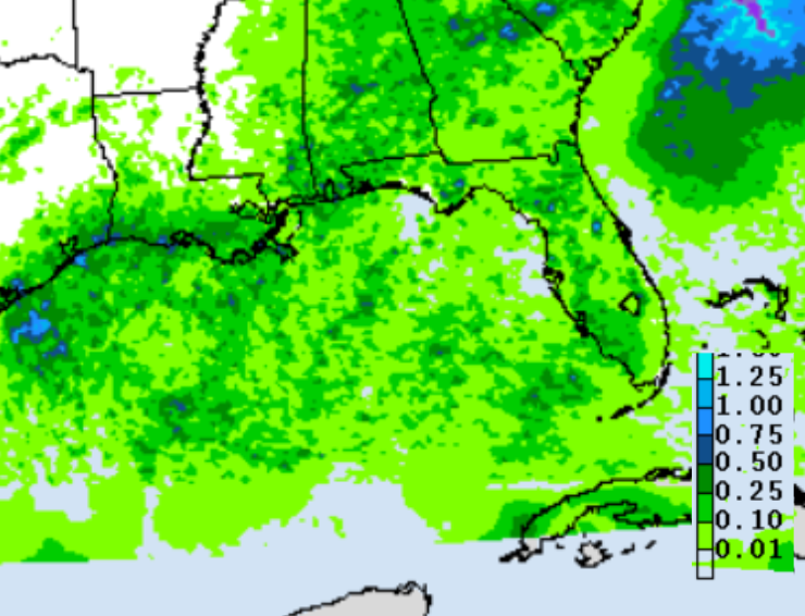
This week, the best shot at rain is during the Mon-Tue timeframe, as spotty showers and storms are possible each afternoon, with the highest rain totals in the southernmost portions of Louisiana.
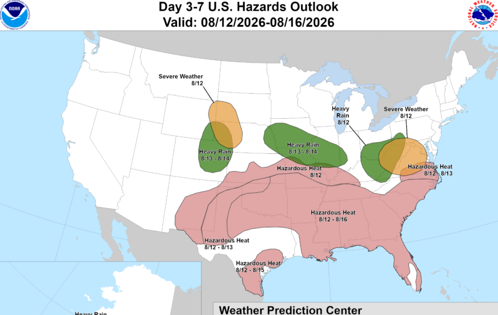
The likelihood of rain decreases by Wednesday, and in its place, extreme heat returns. In the latter half of the week, the weather should remain fairly similar day to day, with very warm daytime temperatures in the mid to upper 90s, reaching 100 by the weekend.
When combined with the humidity, heat index values could range from 100-109 degrees! Therefore, it’s no surprise the WPC has our area highlighted for hazardous heat during the Wed-Sun timeframe.

TONIGHT
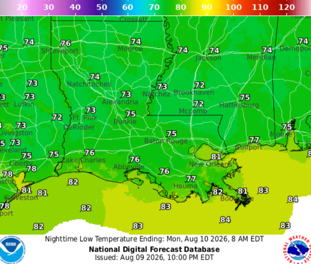
A few lingering showers are possible, but things should dry out by midnight. After that, expect a partly cloudy night with temperatures dropping to around 75. Patchy fog is also possible near Hattiesburg and Jackson.
TOMORROW
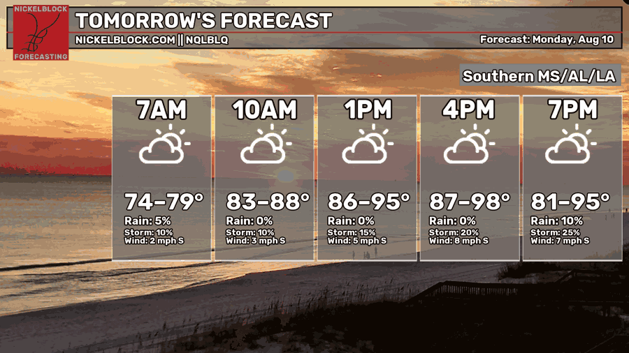
Monday, there is a chance for some light fog around sunrise, especially in areas that received rain today.
A plume of tropical moisture will move onshore and could trigger a few isolated storms during the afternoon as well as cranking up the humidity. Any stronger storm could bring minor flooding, wind gusts up to 40 mph, and frequent lightning.
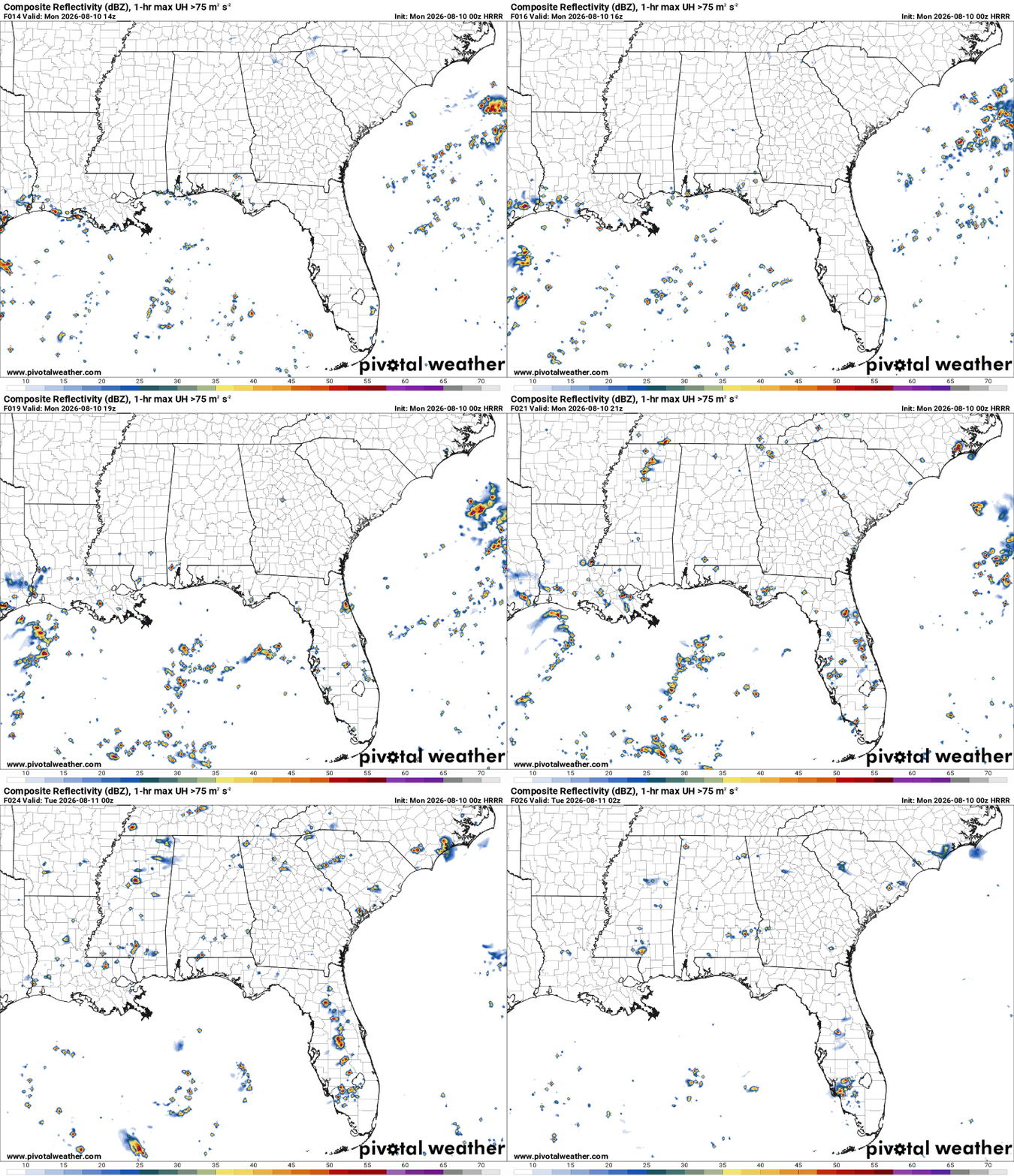

DAY AFTER TOMORROW
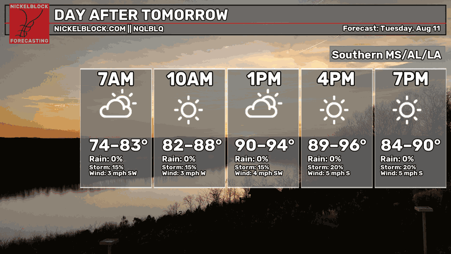
Tuesday, patchy fog and low clouds are possible around sunrise. After that, we’ll see mostly sunny skies with a few scattered storms popping up around lunchtime.
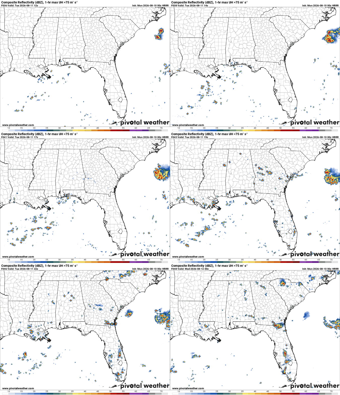
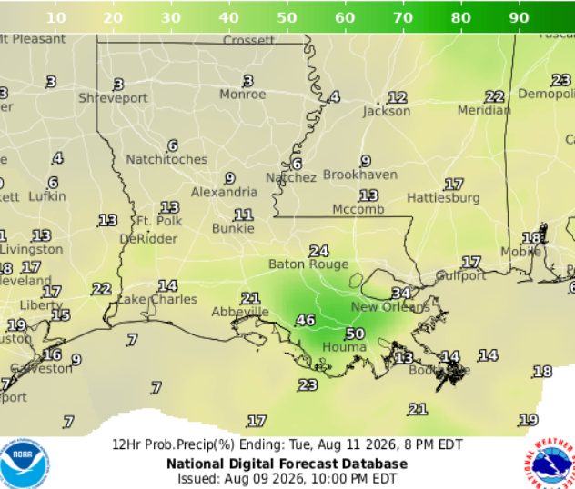
Short-range models keep these showers and thunderstorms mainly confined to southern Louisiana, especially near Houma and New Orleans (shown below).

EXTENDED OUTLOOK
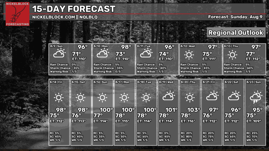
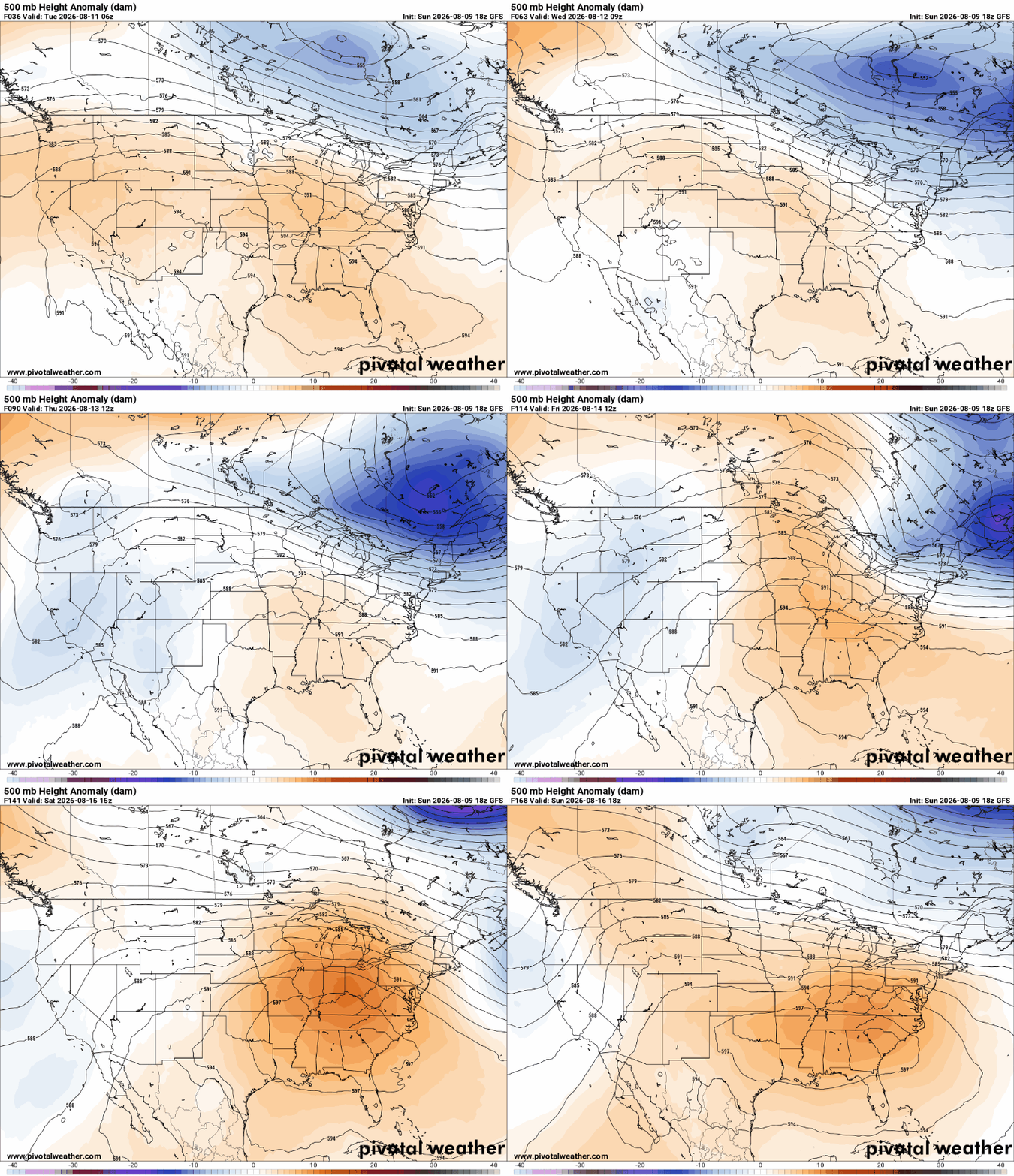
By midweek, high pressure will become centered over the region and strengthen throughout the week. For us, this means sunny skies and rising temperatures, with highs possibly reaching 100 by the weekend!
DAY-BY-DAY FORECAST
Tonight: Some lingering showers are possible, but they should dry out by midnight before we settle into a partly cloudy night. Temperatures will drop to around 75, with patchy fog likely near Hattiesburg and Jackson.
Monday – Morning fog fades quickly, followed by a mix of sun and clouds. Humid and hot, highs around 95. Keep an eye on the sky during the afternoon as scattered showers and thunderstorms are expected. Rain chance: 60%
Monday Night – A stray evening shower remains possible before skies settle into a mostly clear night. Low around 76. Light breeze from the south. Rain chance: 20%
Tuesday – Highs in the lower 90s. Plenty of sunshine with scattered showers and thunderstorms possible in the afternoon. Light breeze from the south at 5mph. Rain chance: 30%
Tuesday Night – Clear skies and mild overnight with lows near 75. Winds blowing from the south at 5mph.
Wednesday – Stretch of heat begins. Highs ranging from 90 in Houma to 97 in Jackson, will feel closer to 105. Mostly sunny, but cannot rule out an afternoon stray storm, mainly along the coast. Breeze from the southwest at 5-10mph. Rain chance: 15%
Wednesday Night – Clear skies and mild temps overnight with lows near 75. Winds blowing from the south at 5mph.
Thursday – Heat and humidity continue to build in with highs hovering around 95, will feel closer to 105. Light breeze from the southwest at 5-10mph. Cannot rule out an afternoon stray storm. Rain chance: 10%
Thursday Night – Mostly clear, with lows around 75. Winds blowing from the south at 5-10mph in the evening and decreasing overnight.
Friday – Abundant sun and -hot-. Highs in the upper 90s, nearing 100. Light breeze from the southwest at 5mph.
Friday Night – Mostly clear, with lows around 76. Winds blowing from the south at 5-10mph. in the evening and decreasing overnight.
Saturday – Plenty of sunshine with highs in the upper 90s, nearing 100 in some places. Watch out for humidity as it can make it feel like 106 outside. Calm winds.
Saturday Night – Warm night under clear skies, with lows around 76. Light breeze from the south.


