It’s gonna be another hot one today and of course, that will come with chance of storms.
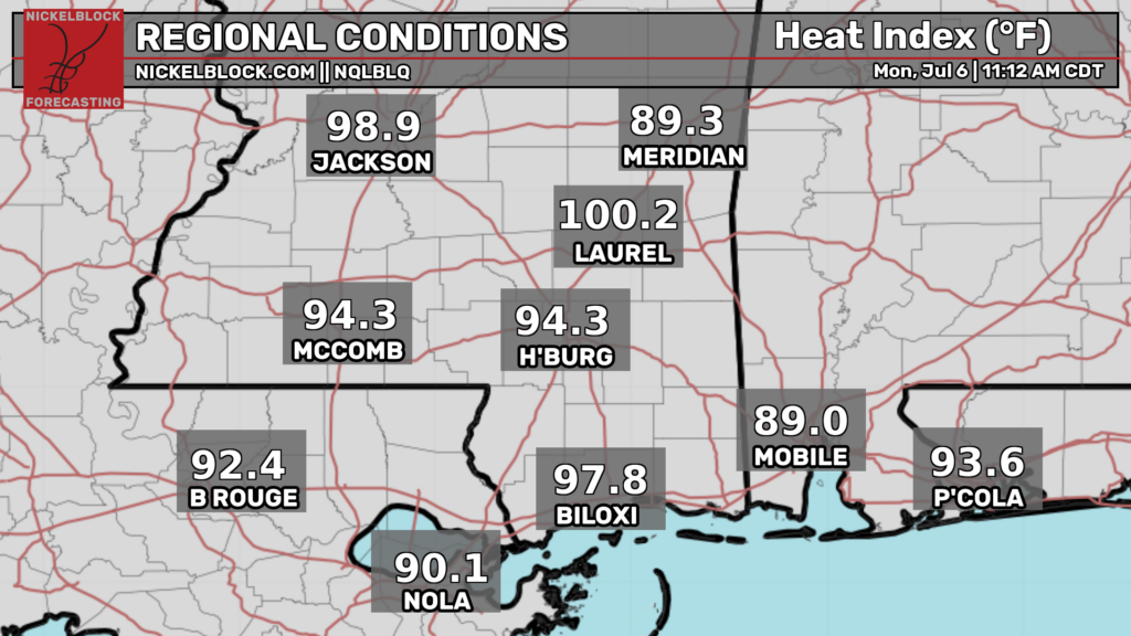
Heat indexes will likely exceed 100 in most locations by late afternoon given highs in the 90s along with mid 70s dewpoints. This heat may be dangerous for sensitive groups such as the very old and the very young. Regardless, anyone who must be outside should drink plenty of water and take breaks in air conditioning.
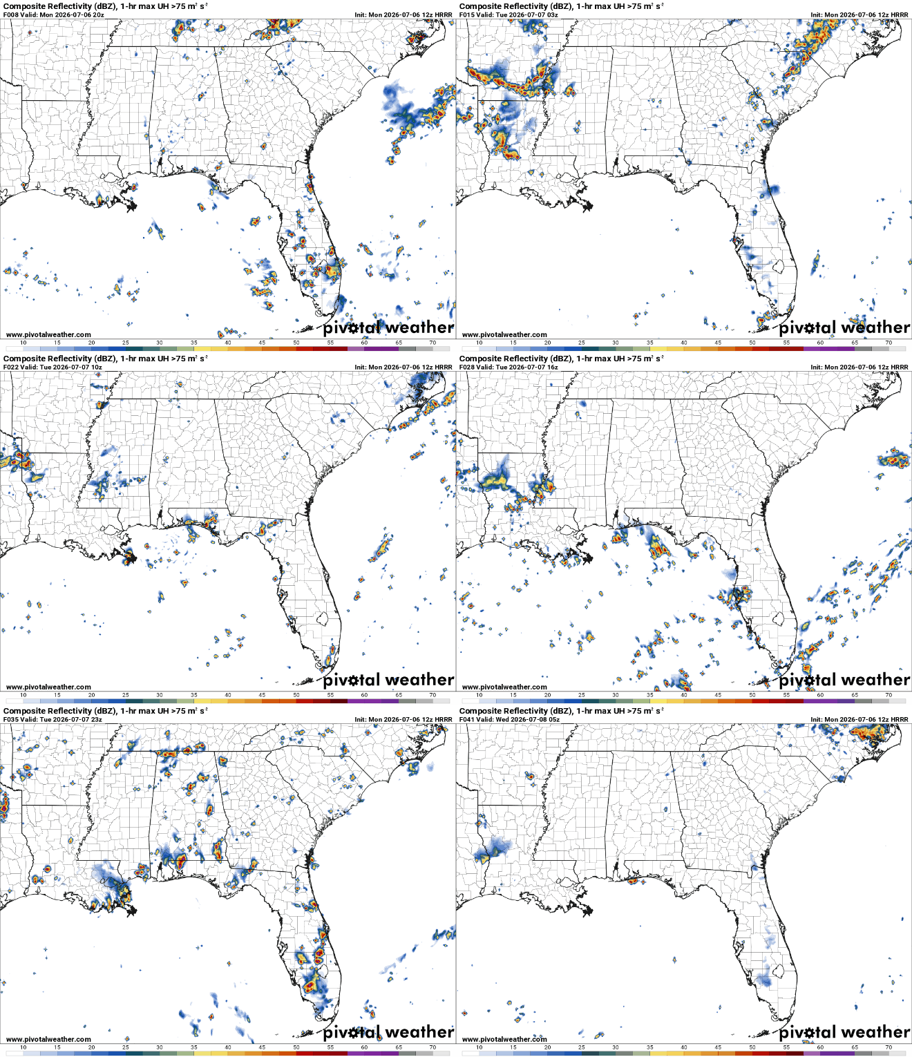
The other piece of the forecast for today is the threat for afternoon thunderstorms. Chances appear to have decreased a bit compared to what we expected yesterday but it still looks like we’ll have at least widely scattered afternoon to early evening thunderstorms. These will be capable of frequent cloud to ground lightning and very heavy downpours along with a lower chance of damaging downbursts. Remember, when thunder roars, go indoors (or into a car)!
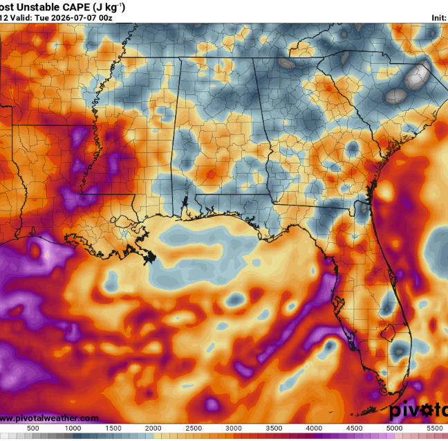
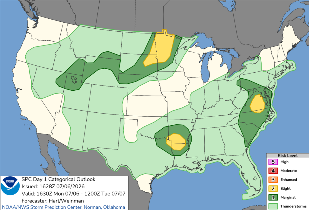
These storms will be driven by very strong instability allowing for robust updrafts. Fortunately, shear will be pretty weak so we shouldn’t get anything too significant. That said, the Storm Prediction center has outlined southern Arkansas into northern Louisiana at a slight risk for damaging winds.
Storms should be weakening as they move into Mississippi given the decrease in bulk wind shear. Convection should slowly die off after sunset leaving a steamy but calm night.
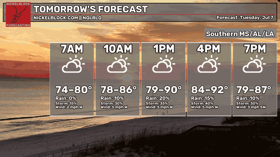
Tomorrow will likely be more of the same as the lethargic jet stream stays well to the north. Great weather to go swimming (assuming there isn’t a storm nearby) but not for much else!


