Heat + humidity = muggy and stormy.
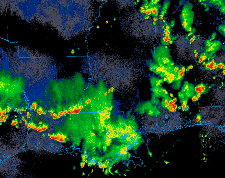
Yup, there’s a lot of convection out there. For places that have been rained on, temperatures have dropped into the 70s providing some relief from the heat.
This pattern will remain in place for the foreseeable future as the summer ridge remains in place. Small perturbations in the jet stream will traverse the area providing a bit of extra forcing for convection. Otherwise, it’ll be business as usual with hot humid days leading to scattered afternoon thunderstorms.
These storms won’t be anything noteworthy but may be strong enough to produce winds up to 60mph along with the typical hazards of heavy rain and frequent lightning.

Tonight
It’ll be a steamy one.
Any remaining storms should die off after sunset as the nocturnal inversion builds in. When considering the amount of rain that has fallen and the environmental dew points (mid 70s), relative humidity values will be very high.
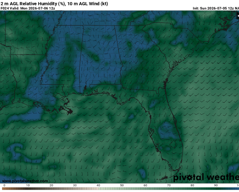
Given the weak surface winds and expected clear skies, fog will be very possible. This will be most likely in areas that have recently received rainfall or low lying valleys. Make sure to use caution on the roads when encountering fog.
Temperatures will fall to about the mid 70s.
Tomorrow
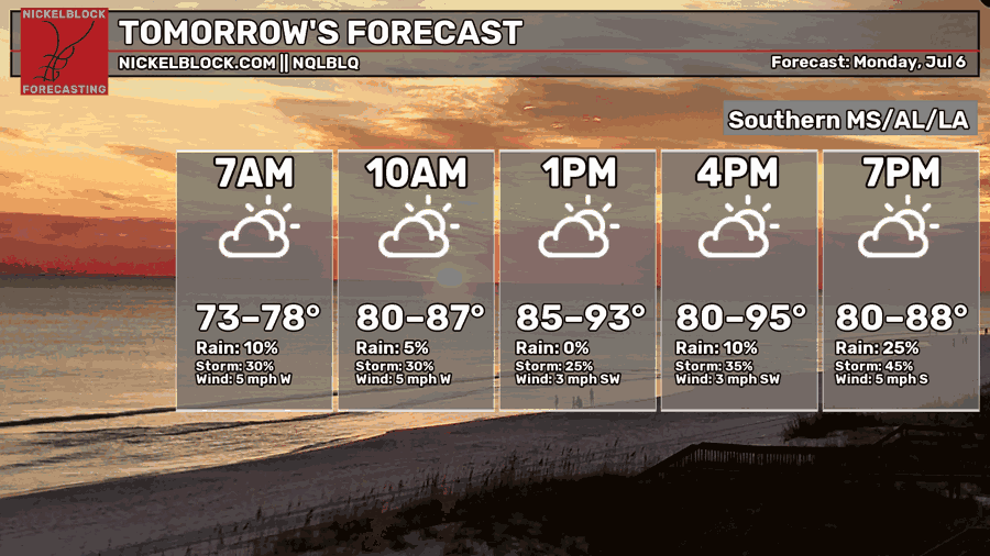
It’ll start off as just humid and then it’ll get hot. As surface temperatures warm, cumulus clouds will build and eventually become thunderstorms. The question is where.
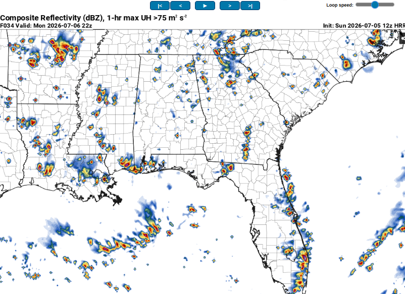
Not everyone will get hit, but those that do will experience very heavy rain and cloud to ground lightning. Damaging winds will also be possible if storms cluster together more or if wet microbursts occur.
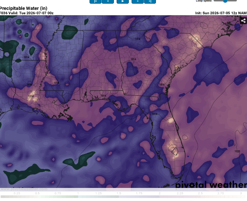
There will be a lot of moisture in the atmosphere tomorrow. PWATs well over two inches will lead to water loaded downdrafts and intense humidity even outside of the storms.
Heat indexes may top 100 so make sure to drink plenty of water and take frequent breaks in the AC.

The Day After Tomorrow
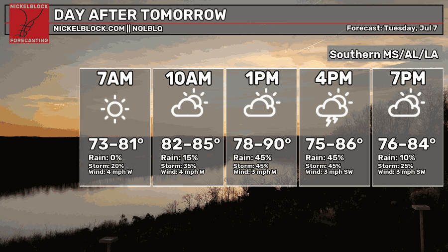
Another hot and humid day with the potential for scattered afternoon convection. Very similar to Monday.
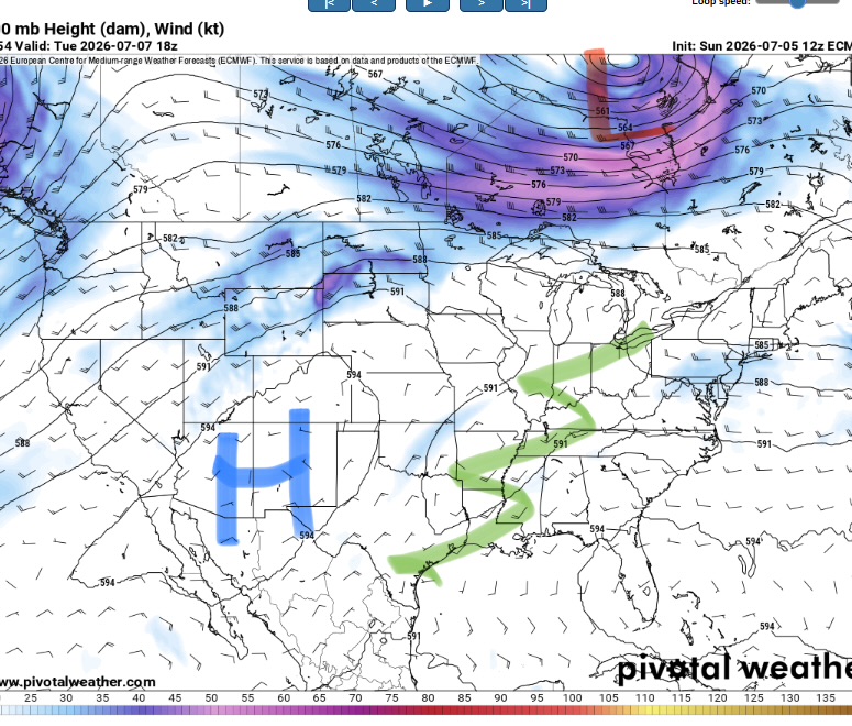
While the ridge remains anchored over the Southwest, a weak trough will traverse the region (axis marked in green). This will allow for increased forcing for clouds and storms. Shear will still be very weak, so storms will likely be of the pulse variety with a chance at growing into clusters towards evening.
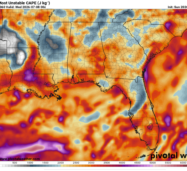
CAPE, a measure of storm fuel, will be seasonably high. This will allow for robust updrafts capable of very heavy rain and frequent lightning. Strong downdrafts may also occur with a potential for some isolated wind damage.
Otherwise, highs will be in the low 90s. Given the high humidity, heat indexes may approach dangerous levels for sensitive groups such as the very young or very old. Make sure to drink plenty of water and try to limit time outside during the peak of the day.

Extended Outlook
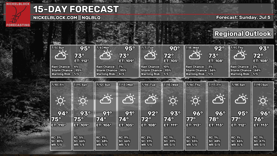
Guess what? More heat and more afternoon storms.
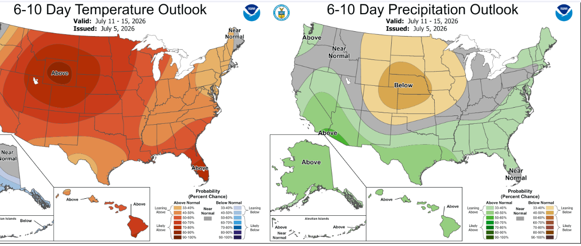
The Climate Prediction Center’s outlook suggests warmer than average temperatures and above average precipitation. This will likely mean very warm overnight lows and hot daytime highs (though this may be modulated by convection). There doesn’t appear to be any huge chances for severe weather or record breaking heat but it’ll be a steamy pattern nonetheless.
Some long range models indicate a potential ring of fire pattern developing where large MCS’s slide southeast towards us along the edge of the ridge, but this is still very uncertain.
Day-By-Day Forecast
Tonight- Low in the mid 70s. Storms die off early with fog possible towards sunrise.
Tomorrow- Scattered afternoon thunderstorms likely. Increasing clouds with a high in the low 90s.
Tomorrow Night- Scattered thunderstorms possible early. Partly cloudy with a low in the mid 70s
Tuesday- Increasing clouds with scattered afternoon thunderstorms possible. High in the low 90s.
Tuesday Night- Mostly clear with a low in the mid 70s. No rain but some fog is possible.
Wednesday- Mostly sunny with a high in the low 90s. Scattered afternoon thunderstorms possible.
Wednesday Night- Mostly clear with a low in the mid 70s. Dry.
Thursday- Mostly sunny with a high in the mid 90s. Isolated afternoon thunderstorms possible.
Thursday Night- Mostly clear and dry with a low in the mid 70s.
Friday- Same ole same ole. High in the mid 90s and mostly sunny with a chance of afternoon thunderstorms.
Friday Night- Mostly clear with no precipitation. Low in the mid 70s.
Saturday- Mostly sunny with a high in the mid 90s. Scattered afternoon thunderstorms possible.
Saturday Night- Partly cloudy and dry with a low in the mid 70s.


