Temperatures have been just at or below average for the last few days and will remain that way through the rest of the week. Instead of highs in the lower 80s, we will see highs in the middle to upper 70s with only some low humidity. There will also be some offshore shower activity over the next few days, and some of it could come onshore, bringing isolated showers.
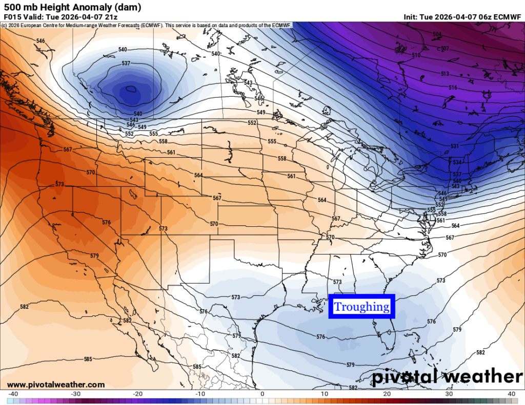
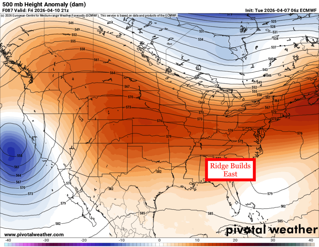
Overall, because of the current 500 mb pattern, which shows some troughiness over the Deep South, we will see a “cooler” and cloudier pattern up until Friday. That is when we will gradually warm back to above average and see more sunshine, thanks to the western ridge moving east.

Tonight’s Forecast
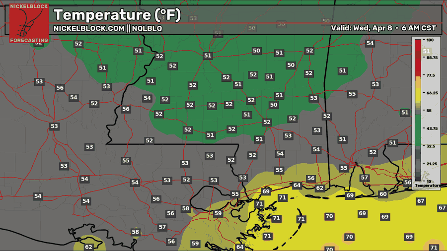
Tonight, under that trough pattern and northeasterly flow, we will see temperatures about 5-8 degrees below average, in the lower 50s. Expect partly to mostly cloudy skies overnight.

Tomorrow’s Forecast: Wednesday, April 8th
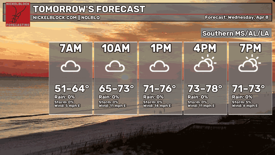
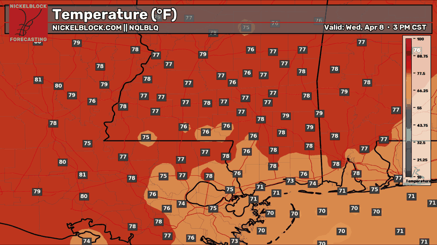
We will warm up gradually through the morning tomorrow to a high in the mid-to-upper 70s. There will be mostly cloudy skies with some peaks of sunshine later in the day. Again, an isolated shower or two is possible, especially closer to the coast, as some of those offshore showers could try to sneak onshore. Overall, it will be a dry day for mostly everyone, though.
Thursday’s Forecast: April 9th
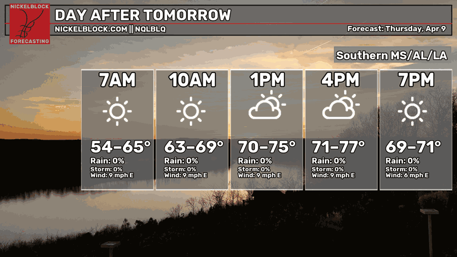
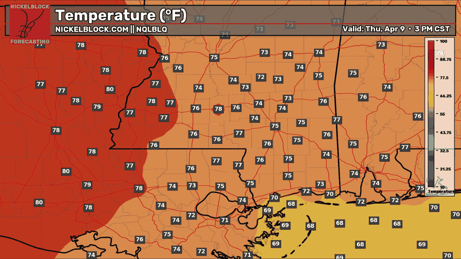
A slightly cooler day for Thursday with temperatures in the low-to-mid 70s. The further west you go, towards central to northern Louisiana, the higher the highs will be, closer to the upper 70s. There will be more sun on Thursday, so a nice day on tap! This is the last day of temps in the 70s for the near-future, so enjoy it while you can!

Extended Local Outlook
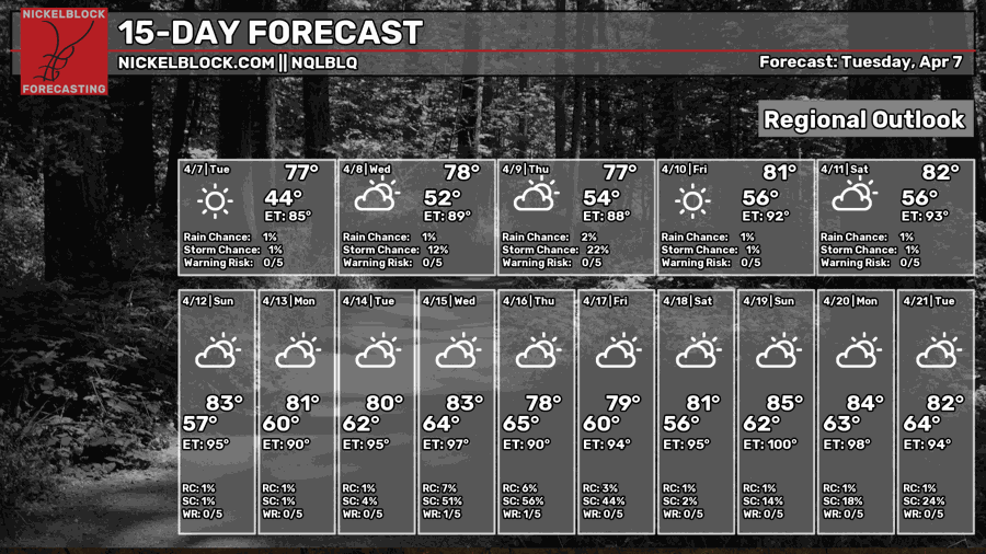
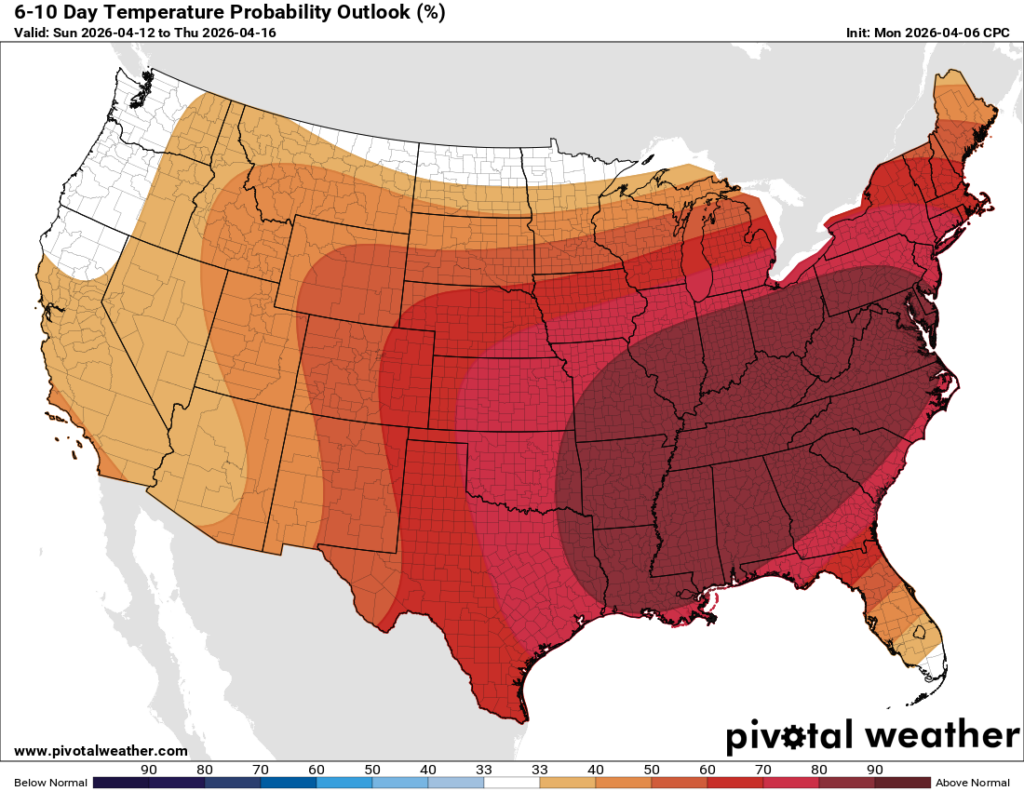
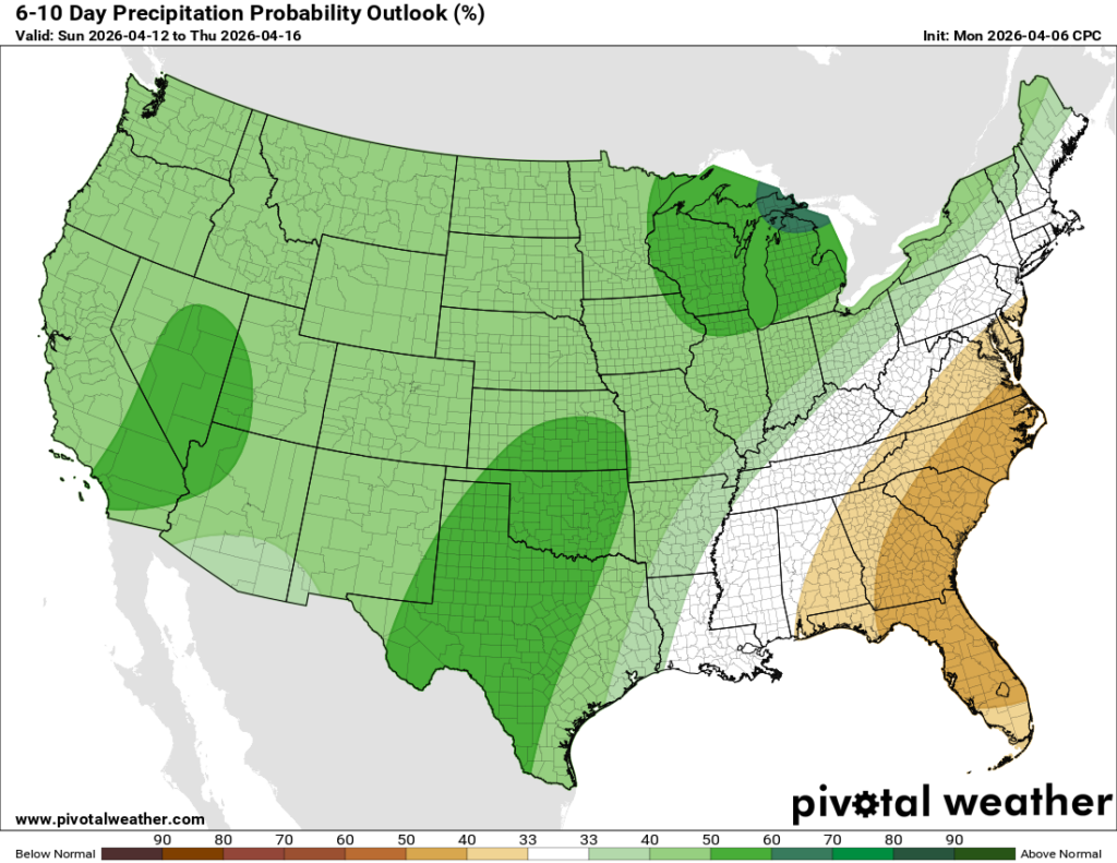
No storm systems are expected to pass by this weekend, but temperatures will return to above-normal in the lower 80s each day. Similarly, next week will generally feature warmer-than-normal temperatures as that western ridge slides eastward, as shown in the 6-10-day temperature outlook above. As for precipitation next week, nothing out of the ordinary, as the CPC has given a “near-normal” outlook.


