Currently, we are experiencing isolated showers and thunderstorms in our area, moving northeast. A lot is going on north of us in MS and AL. Western LA has showers moving into the area.
More warm and humid weather is coming our way. We’ll be seeing more scattered showers and thunderstorms in our area, but not as much as the past few weeks! The extended outlook suggests some organized weather could follow with near-normal temperatures.


Today
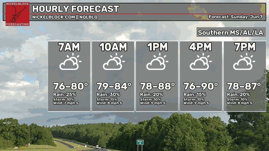
Warm, humid day with highs in the lower-90s.
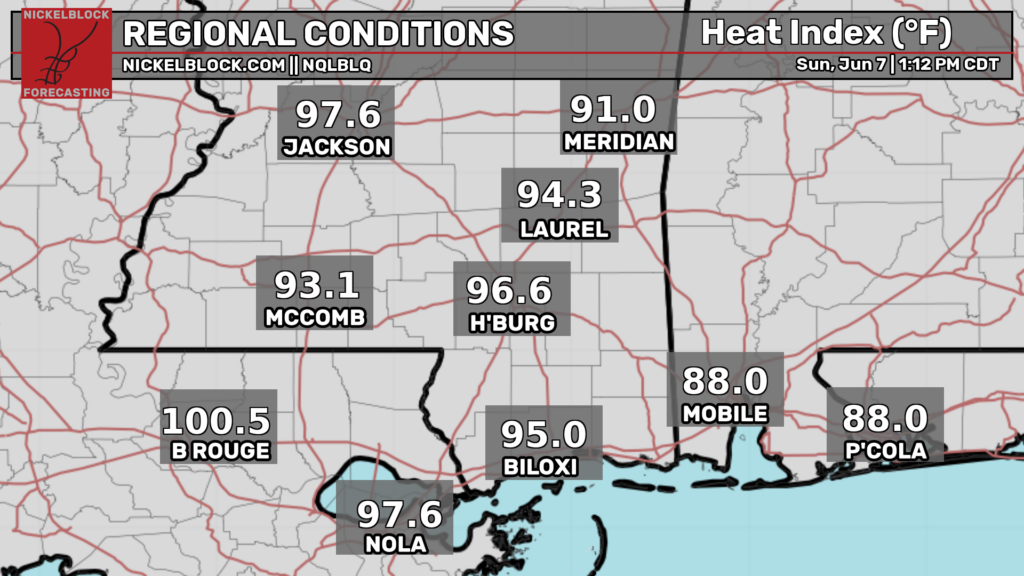
With the humidity, it can feel like we’re in the upper-90s! Coming out of the south, winds will be relatively calm from 5 to 10 mph. Some gusts from 15 to 20 mph. Chances for rain and storms will be steady throughout the day.
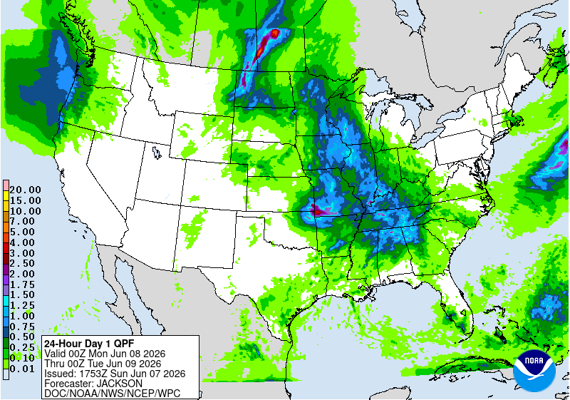
Here in the South, we’ll see scattered showers and thunderstorms in AL and MS until late evening, then isolated showers and possible thunderstorms. In LA, there will be isolated showers and possible thunderstorms throughout today. Late in the evening, showers will move northeast into Western LA. Our southern area will clear around 8 pm. The excessive rainfall is mostly in northern MS and AL, moving into GA.
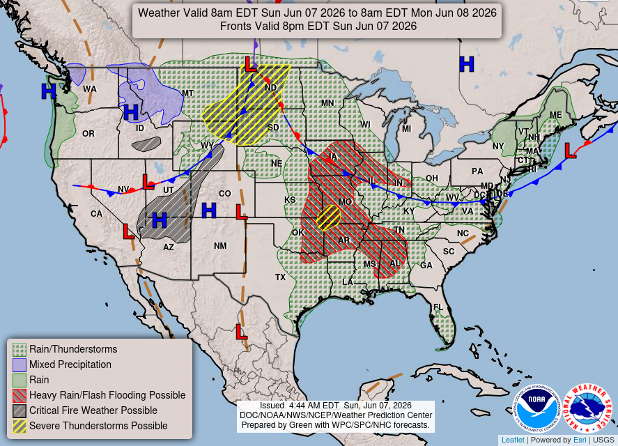
Our area should expect rain and thunderstorms. The heavy rain will affect portions of Southern MS/ AL near the border. Flooding could be possible.
Tomorrow
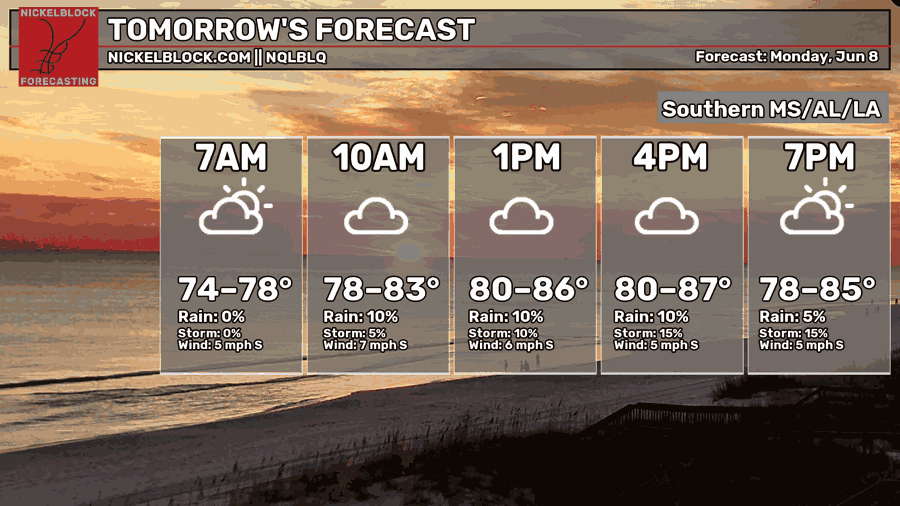
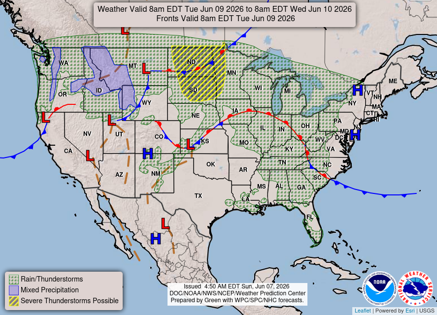
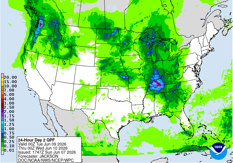
Another warm and humid day. Our chances for rain and storms are lower than yesterday. Relatively calm winds are coming out of the south. It will be breezier in LA than in MS and AL.
Our area will stay mostly dry until the late afternoon. A small line of showers and thunderstorms will move east out of LA. Once reaching MS and AL, we’ll see scattered showers around the evening. This is the normal summer setup here in the South, southeasterly winds with the warm Gulf moisture driving afternoon showers and thunderstorms.
These showers and thunderstorms will bring the most rain into LA and near the LA/MS border.

Tuesday
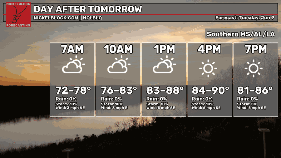
You guessed it, warm and humid on Tuesday. Chances for rain and storms are low to near zero! Calm winds coming out of the southeast and warm, moist air from the Gulf could fuel afternoon storms.
A small portion of MS and AL could see rain and/or thunderstorms throughout Tuesday. Again, most likely be the normal afternoon summertime setup.
Total rain accumulation from Monday evening to Tuesday evening will be < half an inch.

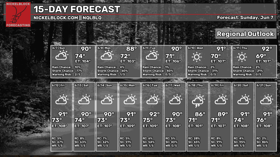
Extended Forecast


The CPC temperature and precipitation outlook next week into the week after suggests slightly above normal temperatures and above normal precipitation. I would have to agree.
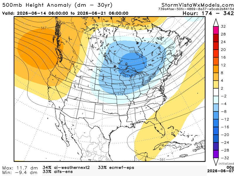
Above are 3 of the most accurate models blended into one outcome from June 14th to the 21st. Our area will be in a zonal flow pattern. This means near normal to slightly above temperatures. As for the precipitation, we could see above normal. The reason is because of the strong low-pressure system near the Great Lakes.
Without this low, we would see a normal summertime setup, unorganized afternoon showers and thunderstorms. This low will help create what is known as shortwave troughs. The shortwave troughs in our area will allow storms to be more organized and ride the zonal flow pattern.