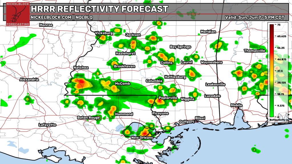
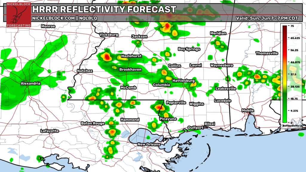
The humidity is not letting up today, with heat index values approaching the triple digits. Scattered showers and thunderstorms are visible on radar, but overall storm coverage is fairly low. If you catch one, expect a quick burst of heavy rain and some lightning. Otherwise, most areas will see mostly cloudy skies and another warm, muggy afternoon.
For the rest of the day, guidance shows scattered passing showers and storms through the evening. Locally heavy rainfall may lead to flooding, especially near the Mississippi coast, which already saw flooding yesterday in Hancock, Pearl River, Harrison, and Stone counties.
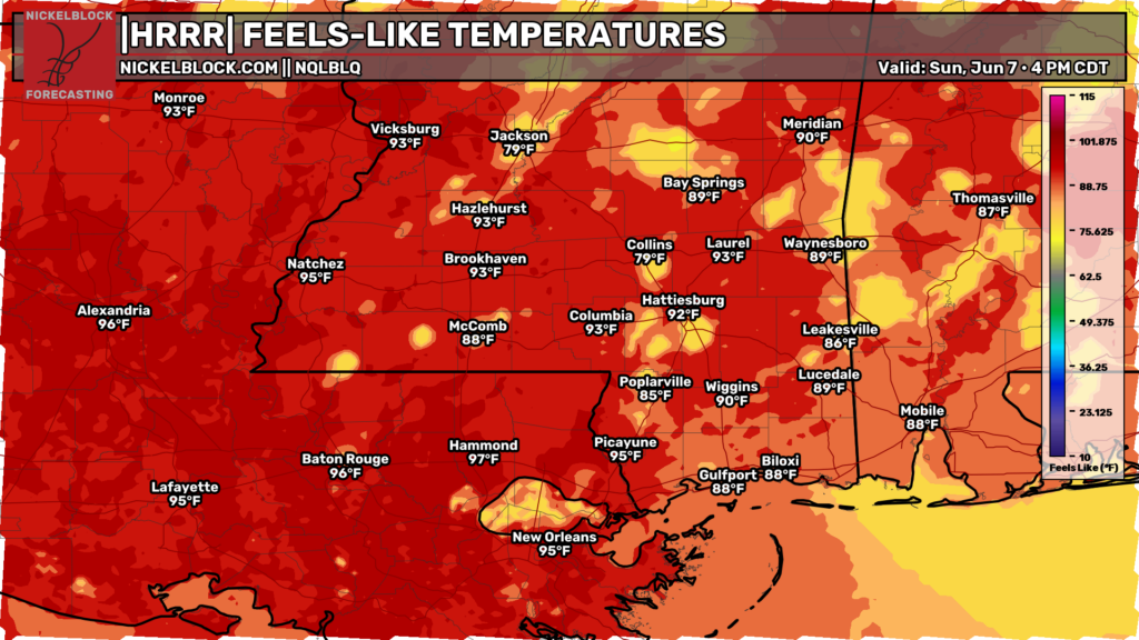
Dew points in the upper 70s are making it feel closer to 100 degrees in Baton Rouge and Hammond. Heat index values are running into the 90s across western Mississippi and holding in the 80s farther east. The heat index will continue to creep upward as we head through the week so stay hydrated!