Howdy and happy Sunday!
Hurricane season is in full swing! Looking out the window in the Atlantic, we can see that there is nothing significant going on. There is easterly flow coming from Africa creating some tropical waves (nothing that will impact us here in the U.S. currently), and upper-level westerly flow creating wind shear that suppresses development of hurricanes.
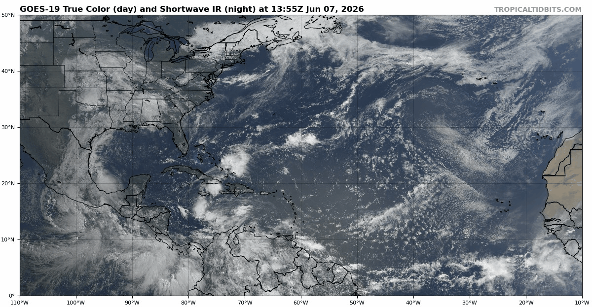
There is a line of thunderstorms coming off Africa to South America near the equator called the Intertropical Convergence Zone (or the ITCZ). This is where the northeast and southeast trade winds meet and converge, which forces air to ascent and form thunderstorms. Based off the satellite image, it is not north enough yet to form any tropical systems.
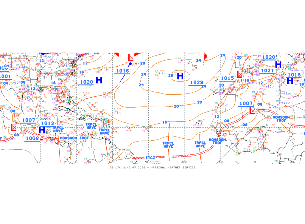
Below, we can see the tropical waves better and the monsoon trough coming off the coast of Africa. It is clearer here that the ITCZ is too close to the equator for any tropical development.
The Atlantic as we know is predicted to have a below-average hurricane season. This can be attributed to El Nino. But how exactly does it make the Atlantic below-average?
Well, during periods of El Nino, the water in the Pacific is warmer than normal. Trade winds become weaker, which pushes warm water more east towards the west coast of the U.S. This is indicated below by the long band of red in the Pacific that is circled.
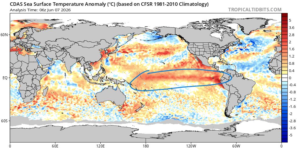
So, very warm waters in eastern and central Pacific. We can see that in the tropical Atlantic the ocean is actually colder than average. This line of cooler water reduces any tropical development (but that does not mean it still can’t happen).
Also the difference between these two regions creates wind shear, which is another factor playing into the lack of development. All of these factors together play into the below-average season we will see. Even so, we still have a chance to see activity and some hurricanes to develop, even 1-3 major hurricanes.
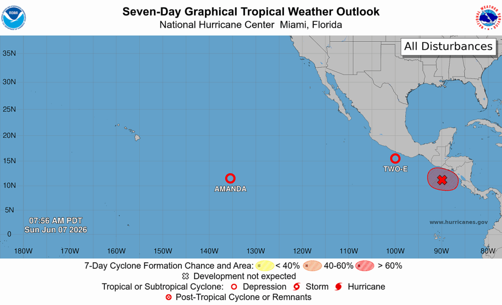
With the warmer waters in the Pacific, it can be expected that the central and eastern Pacific hurricane season will be above average. We already see some activity currently with Tropical Storm Amanda, which is now a tropical depression, and tropical depression Two-E off the coast of southern Mexico. It is also expected in the next 7 days for another tropical depression to form toward the coast of Central America.
As of now, the Pacific has all the activity and the Atlantic does not. Something to look out for in the next month, though, are any gyres or environmental cyclonic flow that could lead to a tropical cyclone developing.
Below, we can see that red represents anomalous westerly flow, and purple represents anomalous easterly flow. This difference in flow directions has the potential to create an area of cyclonic flow (or cyclonic vorticity). This can lead to clustered thunderstorms that have the potential to become organized and develop into something. It is always important to pay attention to patterns like this, especially near/in the gulf.
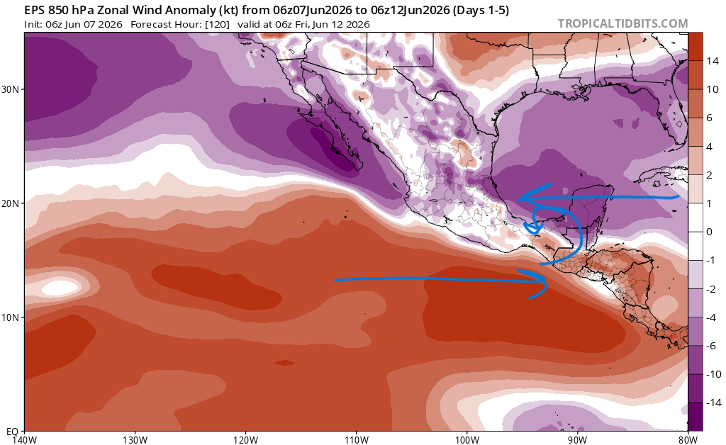
Of course, the area I marked with the cyclonic flow is not exactly where it could form, it is just to give an idea of the concept. The video that pops up right when you open Tropical Tidbits explains these concepts very well, so I encourage you to go check it out!
Either way, the tropics are getting more interesting as time goes on. Make sure to keep checking on these tropical forecasts and create a plan just in case a hurricane is predicted to impact your area. Enjoy the rest of your Sunday!


