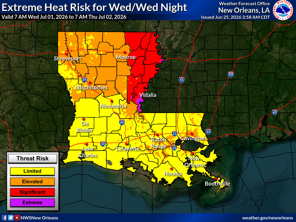
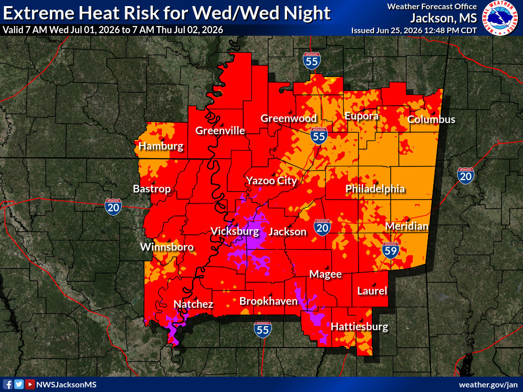
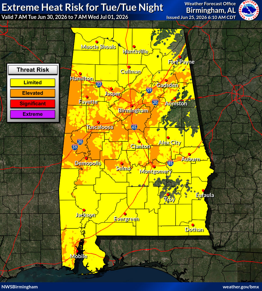
The heat is going to be brutal for the next few days. The heat index will be above 100 with extreme heat risks in most of our area. While most of the threats are limited to elevated, a lot of MS are at a significant or extreme risk.
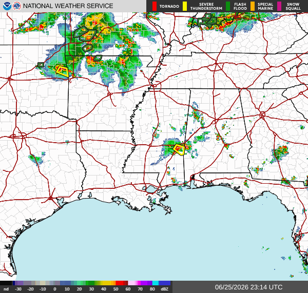
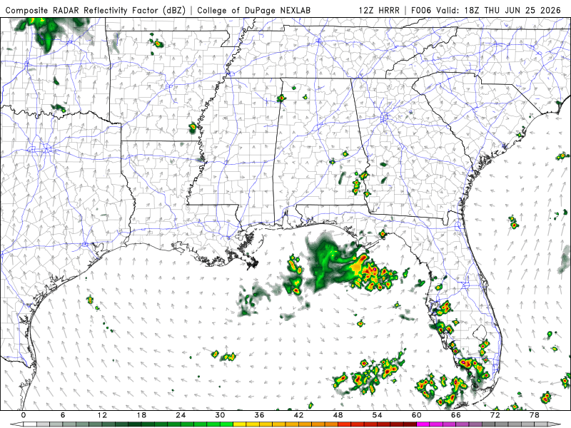
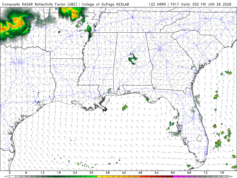
Currently, there is a thunderstorm near central MS and the MS/AL border moving southeast. There is an active severe thunderstorm warning along with this storm.

Today
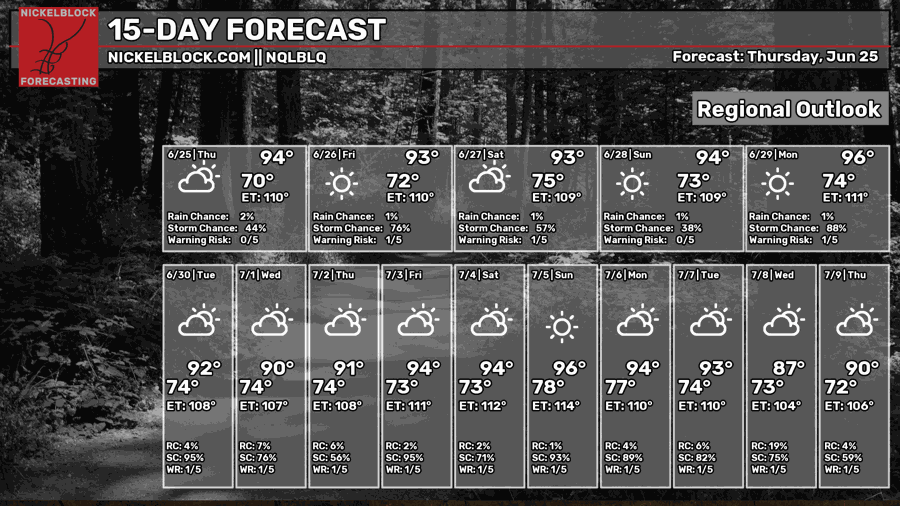
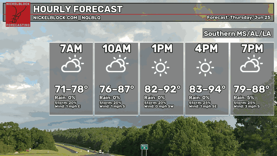
It’s going to be hot and feel muggy outside today. Highs will be in the mid-90s around the late afternoon. There is a possibility of thunderstorms and a slight chance of showers in the evening. Very calm winds today, mostly out of the south.
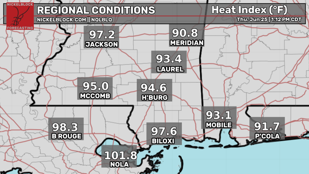
The heat index is rising rapidly as the day progresses. The LA coast is already in the 100s with MS following just short at 97! Make sure to hydrate and protect yourself from the sun. It is best to avoid the peak sun hours.
Most of LA and AL will remain dry today. Southeast LA will see isolated storms around 2 pm, mostly ending around 5 pm. In MS and the edge of the MS/AL border, a scattered thunderstorm will be moving southeast, starting around 5 pm. Around 10 pm, the storm will mostly weaken into just showers. Should clear out just before the early morning hours.
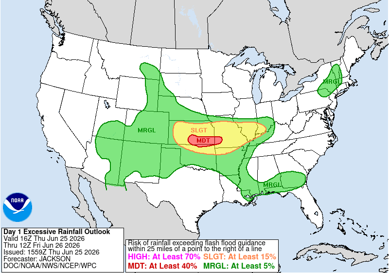
We are under a marginal risk for excessive rainfall with these storms passing through, meaning isolated flash flooding is possible. While there doesn’t seem to be a lot of precipitation passing through, excessive rainfall actually means how much the ground can absorb or handle. With how much rain we’ve been experiencing over the past month, the ground can’t handle the rain as well.
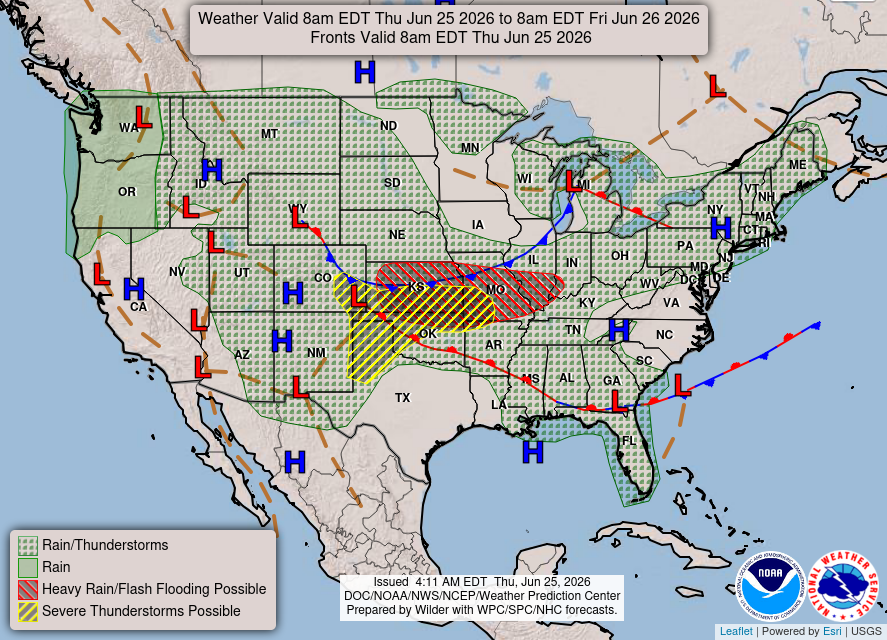
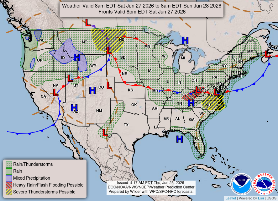
Taking a look at the national forecast chart, we see the lingering from going across the Southern region. We also have a high-pressure system feeding the region with warm, moist air. This fuels thunderstorms and showers in our area.
Tomorrow
Another hot and humid day with highs in the mid-90s around late afternoon. A slight chance of thunderstorms throughout the day. The wind will be relatively calm, mostly coming from the south.
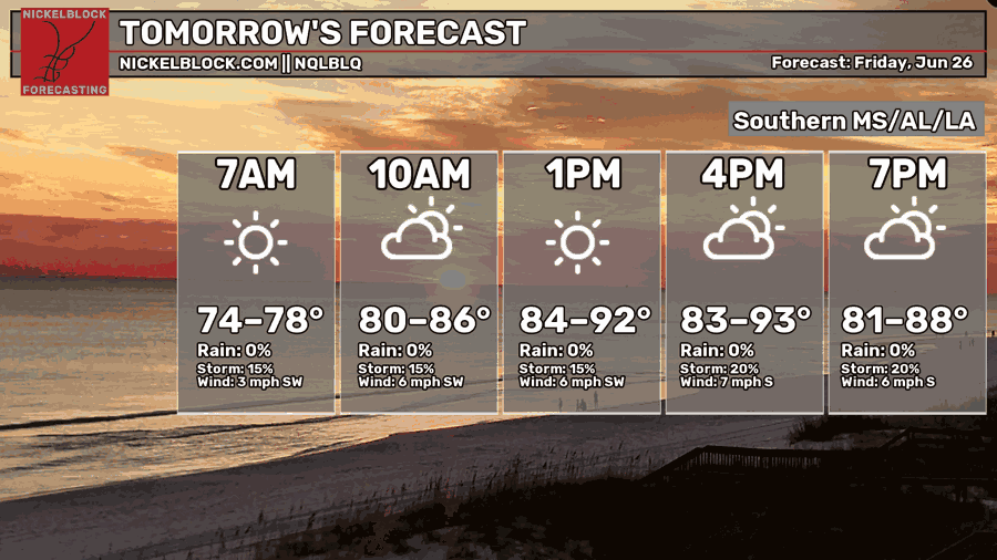
Our area will be mostly dry, with isolated thunderstorms in Southern AL in the early morning and Southern MS in the late afternoon. Parts of LA and AL might also see small pop-ups around the late afternoon. The night will be clear.
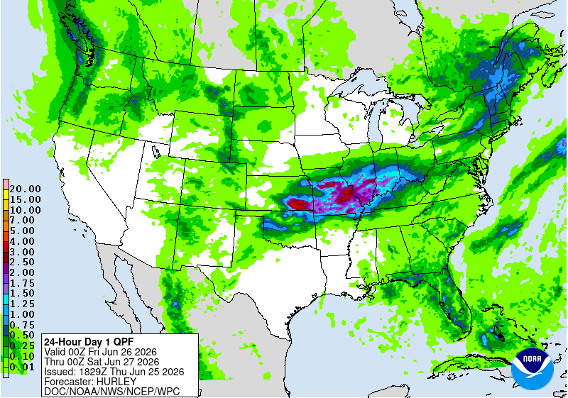
Rainfall for tomorrow will be <0.25 inches.

Saturday
Still going to be hot and humid with high temperatures in the mid-90s around the late afternoon. Chance for storms increasing during the afternoon into the evening. Wind will be relatively calm coming out of the southwest.
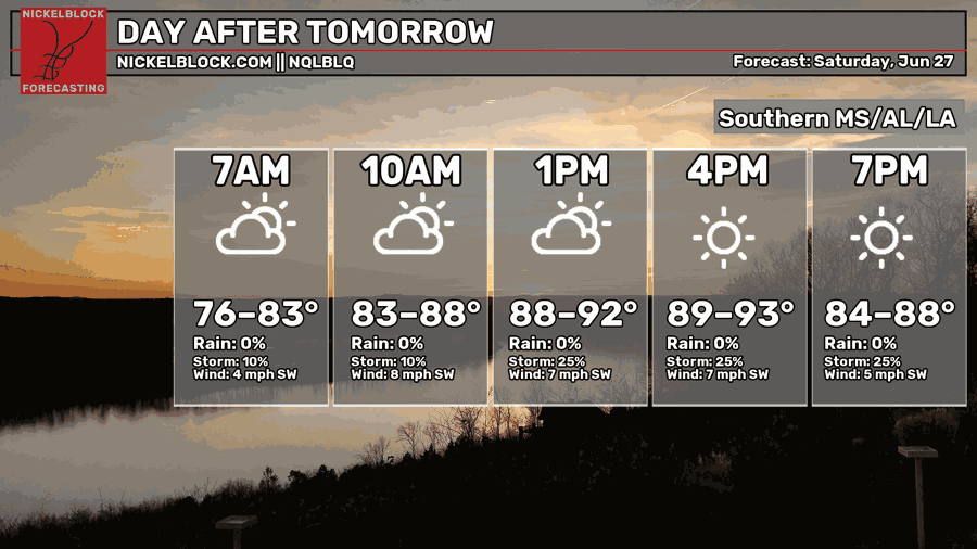
Around the afternoon, Southern MS and AL may experience possible showers and/or thunderstorms till around the late afternoon/early evening.
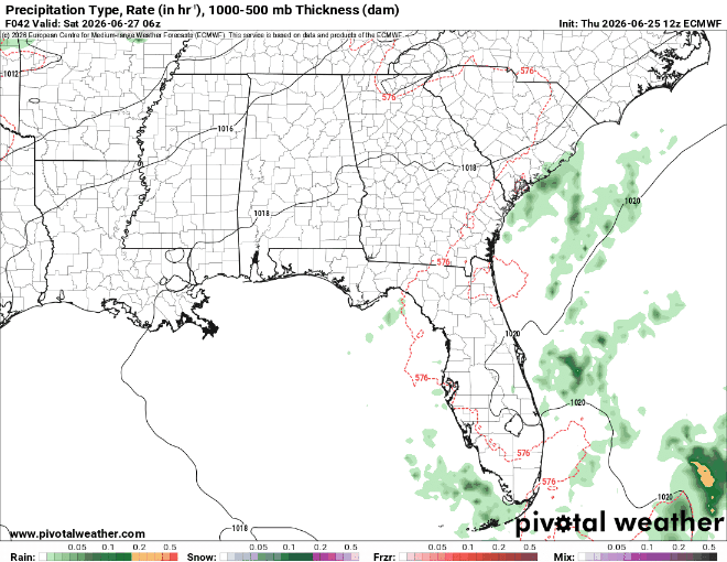
The national forecast chart has these areas under a mix of rain and thunderstorms. With the high-pressure system in the Gulf, this makes sense. The system will feed warm and moist air into the atmosphere, so afternoon showers and thunderstorms are a common setup for this area.

Extended Forecast
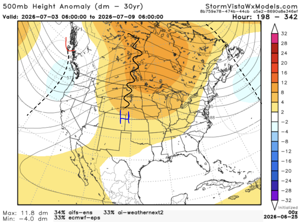
The CPC has our area with above normal temperatures and precipitation.


This 500mb height anomaly model has a blend of the 3 most accurate models over the past 7 days. The model runs from July 3, 1 am to July 9, 1 am. Based on the blend, I would agree with the CPC, especially with the temperatures. The high-pressure system will bring in warm but not dry air. There will still be moisture being brought in from the Gulf, allowing for the sea breeze, afternoon thunderstorms.