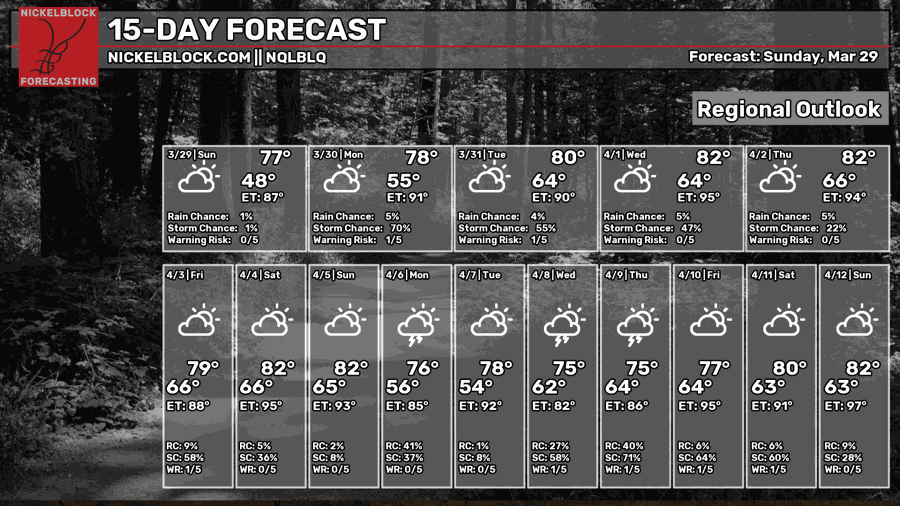
Sitting underneath this ridge of high pressure continues to keep the weather mostly calm. We ahve enjoyed a good number of days of calmer weather and even some cooler temps the last few days. Honestly, looking ahead, there is not much to talk about with the weather… except for the shot for a handful of showers here and in there in the coming days. It isn’t a great shot, but it is certainly “there” for most everyone.
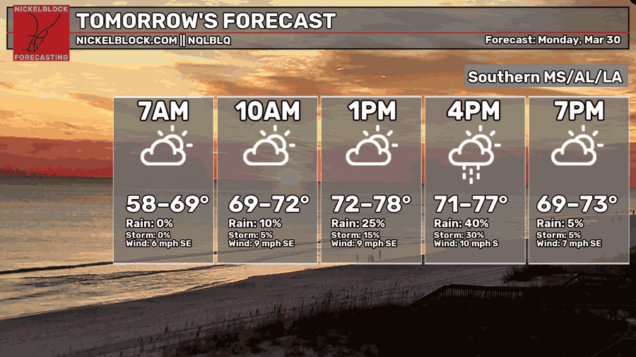
I’d call it a 20% to 40% chance each of the next three days: Tomorrow, Tuesday and Wednesday.

A BRIEF NOTE ABOUT THE SETUP
During the next few days we will have shots for rain every afternoon and evening. It may end up feeling a bit like “Summer” around here with the pattern. Not because of the temperatures (those will be int eh 70s and 80s) but due to the added bit of humidity and the every day shot for rain.
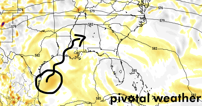
Part of the reason for the afternoon showers is crinkles in teh ridging that will allow for the instability to actually break through the lower-levels and intot he mid and upper-levels. The other part is this little area of vorticity that will be drifting north from the Gulf. This is a little pocket in the atmosphere with some extra ‘umph’ in it. And that added ‘umph’ may be enough to help spark an extra few showers and storms by Tuesday and Wednesday.

THIS WEEK
Beyond tomorrow, it looks like a weak front will push through on Thursday to give us another shot for storms. This one would be a bit more typical for this time of year. An actual cold front, not just afternoon storms.
Even that one looks questionable on some of the modeling.
That means, instead we would have to wait until Sunday for the next front to actually push through.
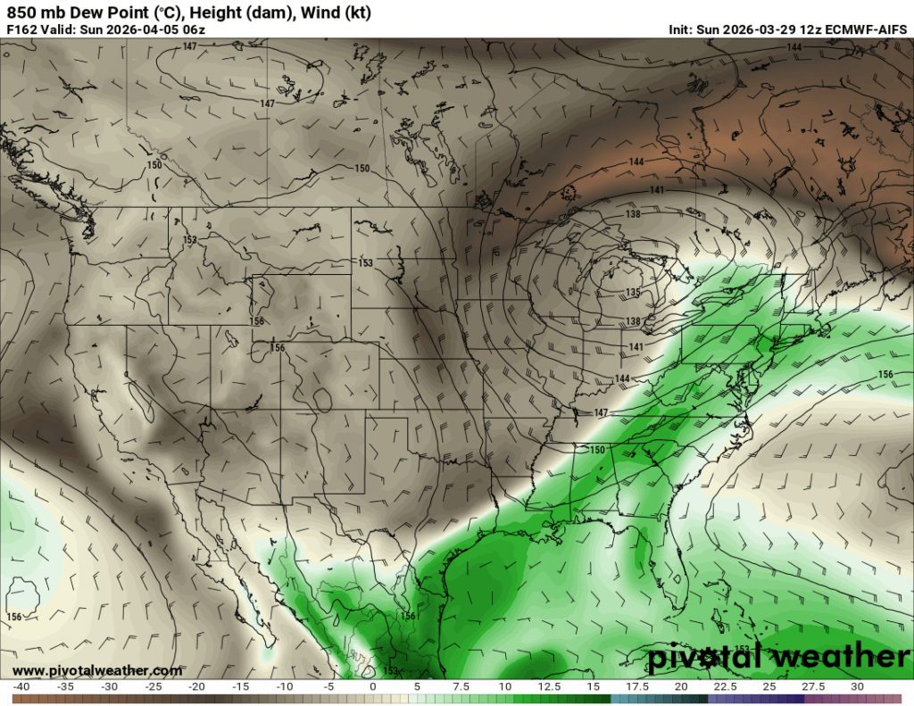
The AIFS model, the “AI” version of the ECMWF model, shows the cold fornt (above) pushing through Sunday morning around sunrise. If this happened we would likely see a round of storms through the area on Saturday night and into Sunday morning. The risk for severe weather would be “non-zero” but there isn’t anything that stands out (as of yet) to say severe weather will be “likely”
And as much as we don’t want severe weather, we sure could use some rain.
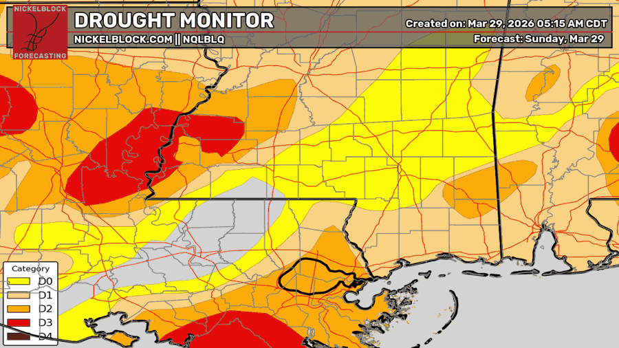
Right now, the latest Drought Monitor shows the area in D0 – D3 Drought, depending on location.

EXTENDED OUTLOOK
This do look a bit more active as we move through the middle of the month. Actually, once we get past this Thursday – regardless of if this first system makes it or not – we may see a new system through the area every 3-6 days through early May.