Current Setup
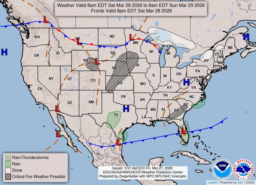
I hope everyone is enjoying their Friday night! I’ll be giving you the last forecast before the weekend, and while there isn’t much weather happening, it’s important to be cautious on Saturday, as fires will be able to spread very easily given the weather conditions. As for the setup, that cold front that I’ve mentioned the past few days will push through in a few hours and bring a wall of wind with it. It’s still possible to see a quick sprinkle, but that risk is reducing and more than likely will just be a dry front.

Tonight’s Forecast
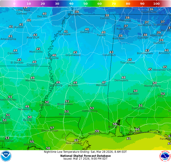
Tonight, we will see some chillier low temperatures in the low-to-mid 50s, thanks to the cold front bringing in some cooler air. We’ll see some increasing clouds as the night progresses as we wait for the front, but after it comes through, expect a clear night and start of tomorrow morning. Don’t be shocked to see some of those gusty winds come through around midnight or so!

Tomorrow’s Forecast: Saturday, March 28
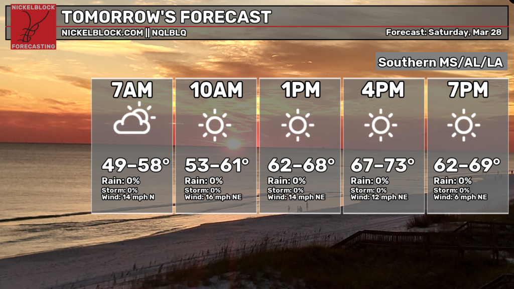
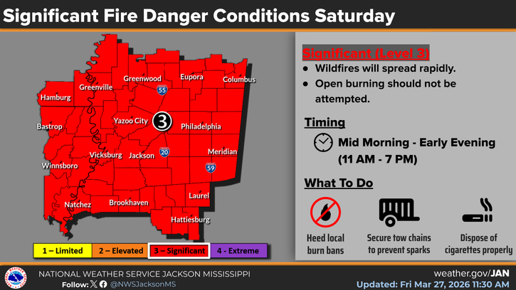
A beautiful sunny day is in store for Saturday! Aside from the gusty northerly winds coming in up to 35 mph, temperatures will sit near-average in the low-to-mid 70s, and the humidity will be very low. While that is comfortable for us, please ensure that you do not do any sort of burning since fires can spread extremely well with the gusty wind and low humidity. The NWS has upgraded our risk to a level 3 out of 4, to Significant status, highlighting just how favorable the conditions are for fire spread.
Taking a look at the HRRR, winds will gust through the morning and afternoon and will die down in the late afternoon and evening.
Sunday’s Forecast: March 29
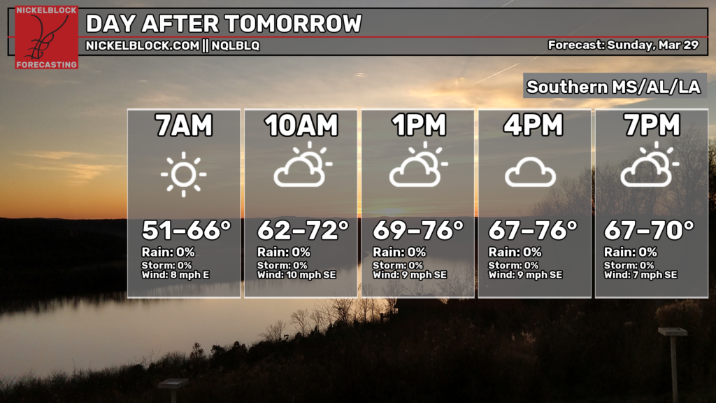
For Sunday, it’ll also be a nice day with temperatures near-average again in the mid-70s. Not as windy, which is a plus, but the humidity will make its slight return to us. As you can see by the wind direction, it will turn easterly and then southerly, which will stick around for the entire upcoming week.

Extended Local Outlook
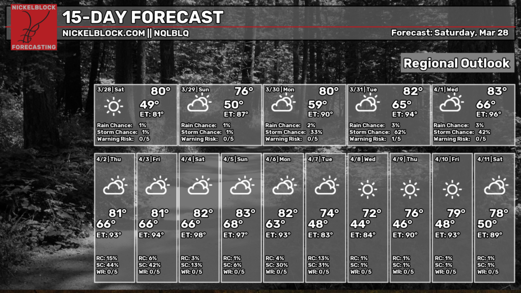
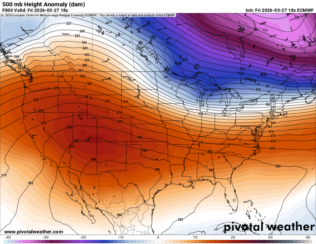
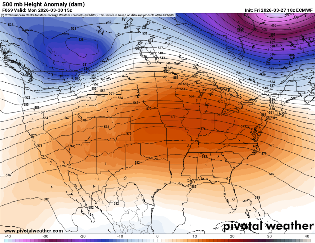
Get used to the warm and humid weather, because each day next week will be just that. No huge rainmakers it doesn’t look like, but there certainly be more rain and systems coming through than we saw this week. The huge ridge that’s been over the west will move east by next week, really driving those warm temperatures for our region.
Have a great weekend!


