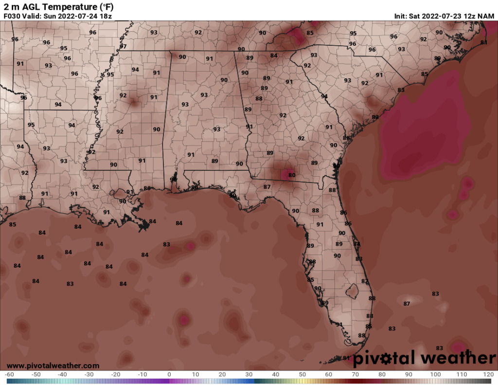
For much of the upcoming forecast period, the conditions will be hot and dry with only marginal chances for precipitation each day. The high temperatures are forecasted to be in the lower to mid 90s for the next few days.
Towards the middle of the work week, things start getting hotter again, with highs in the mid 90s on Wednesday and in the upper 90s on Thursday. The heat index may even get above 100 on Friday.
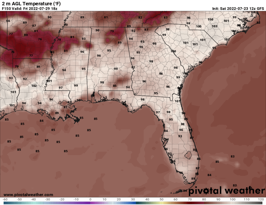
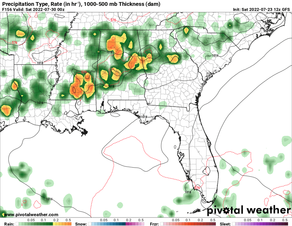
There is thankfully some good news on Friday. The GFS forecasts a small cold front to move through on Friday. The cold front is visible on the map above (keep in mind the GFS tends to overestimate temperatures by a couple degrees, so just mentally subtract 2 or 3 degrees on the map). Not only will this lower the temperatures temporarily, it will also bring rain to the area. Thunderstorms are forecast on Friday and Friday night.
Day to Day Forecast
Sunday
Partly cloudy. Highs in the lower 90s. Heat index around 100. Chance of rain 20 percent.
Sunday Night
Mostly clear. Lows in the mid 70s. Chance of rain 20 percent.
Monday
Partly cloudy. Highs in the lower 90s. Heat index around 100. Winds S at 5-10 mph. Chance of rain 20 percent.
Monday Night
Mostly clear. Lows in the mid 70s. Chance of rain 20 percent.
Tuesday
Partly cloudy. Highs in the lower 90s. Heat index in the upper 90s. Chance of rain 20 percent.
Tuesday Night
Mostly clear. Lows in the mid 70s. Chance of rain 10 percent.
Wednesday
Sunny. Highs in the mid 90s. Heat index in the upper 90s. Winds S at 5-10 mph. Chance of rain 10 percent.
Wednesday Night
Clear. Lows in the mid 70s. Chance of rain 10 percent.
Thursday
Mostly sunny. Highs in the upper 90s. Heat index around 100. Chance of rain 10 percent.
Thursday Night
Mostly clear. Lows in the mid 70s. Chance of rain 10 percent.
Friday
Mostly sunny skies in the morning will give way to mostly cloudy skies and thunderstorms later in the day. Highs in the mid 90s. Heat index between 100 and 105. Chance of rain 80 percent.
Friday Night
Chance of thunderstorms early, then cloudy overnight. Lows in the lower 70s. Chance of rain 60 percent.
Saturday
Cloudy with thunderstorms. Highs in the upper 80s. Heat index in the mid 90s. Chance of rain 80 percent.
Saturday Night
Cloudy. Lows in the low 70s. Chance of rain 20 percent.


