Hot and humid weather will stick around for another few days before we transition into a wetter pattern toward the end of this week. Then, flash flooding may become a concern for some spots as a weak boundary settles in and gets comfy.
Before then, though, it’ll be pretty warm. There is a Heat Advisory in effect for some parts of the region today – mainly for central and southwestern Mississippi.
Highs today and tomorrow will tag the mid 90s with Heat Index values up around 105F. You can thank a big ridge of high pressure to the west for this. It’ll slowly erode as we move through the week, but for the next two or three days, it’ll keep it rather warm and the Gulf will keep us plenty muggy. Both days will feature the usual chance for afternoon storms.


Wednesday will be our ‘tweener’ day as the ridge erodes, but the boundary isn’t fully in place. That means it’ll be slightly cooler, but we will also have some slightly better shots for afternoon storms.
Then Thursday the boundary moves in and we start to see much better chances for rain. On the maps above, the move may look pretty subtle, but it is enough to allow for more rain to move into the area.

Estimates from the model guidance shows a, generally, 1″-to-3″ swath of rain across the region. But embedded within that may be some spots of up to 6″ of rain by the time it is all said and done. And, if storms train over the same areas, higher totals may also be possible.
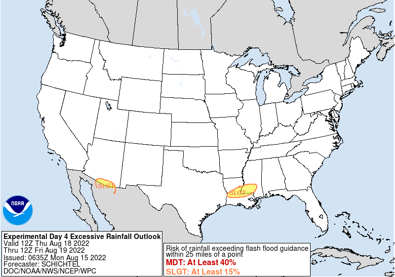
In fact, the WPC is already watching parts of the area for flash flooding, issuing a “Slight Risk” for flash flooding.
Once we get into the weekend, the pattern should moderate a bit and things will remain slightly cooler (upper 80s to low 90s) and a bit drier.
Day to Day Forecast
Today
Mostly sunny with afternoon storms possible. Some may be strong. Chance of rain 40 percent. Heat Index values around 108F
Tonight
Partly cloudy. Lows in the mid 70s.
Tuesday
Mostly sunny with afternoon storms possible. Chance of rain 30 percent. Heat index values up to 108F.
Tuesday Night
Partly cloudy with a few storms possible. Chance of rain 20 percent.
Wednesday
Mostly sunny. Afternoon storms possible. Highs in the mid 90s. Chance of rain 40 percent. Heat index values up to 103F.
Wednesday Night
Partly cloudy with a chance of showers and thunderstorms. Lows in the lower 70s. Chance of rain 40 percent.
Thursday
Partly sunny with storms likely in the afternoon and evening. Not an “all day” rain. Highs in the upper 80s. Chance of rain 80 percent.
Thursday Night
Showers and thunderstorms likely overnight. Lows in the lower 70s. Chance of rain 60 percent.
Friday
Partly sunny with storms possible throughout the day. Highs in the mid 80s. Chance of rain 60 percent.
Friday Night
Mostly cloudy with a chance of showers and thunderstorms. Lows in the lower 70s. Chance of rain 40 percent.
Saturday
Mostly sunny with storms possible. Highs in the upper 80s. Chance of rain 40 percent.
Saturday Night
Mostly cloudy. Lows in the lower 70s.
Sunday
Mostly sunny with an afternoon storm possible. Highs in the upper 80s. Chance of rain 30 percent.


