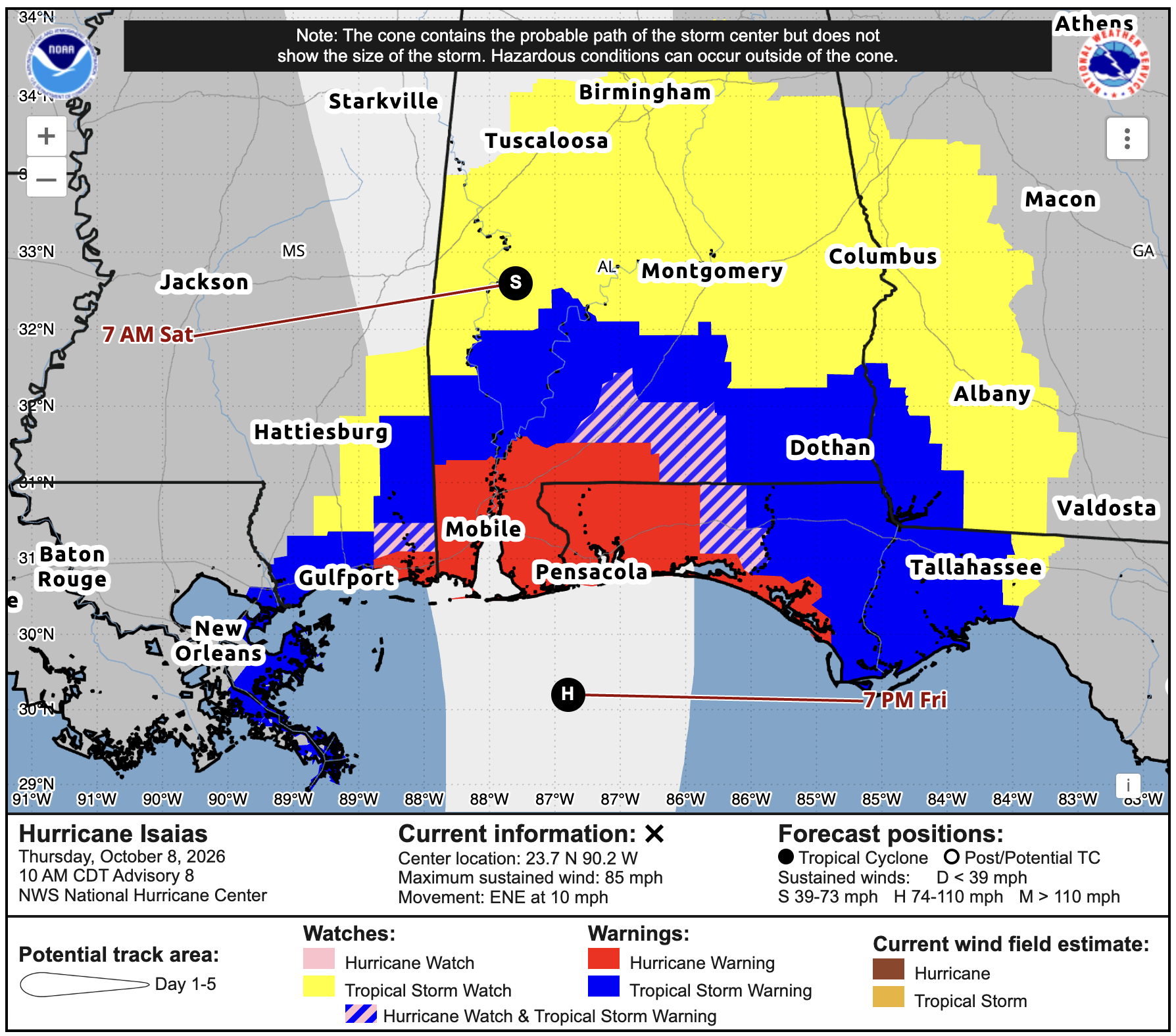
Current Watches and Warnings
We now have hurricane warnings in place around Mobile, Pensacola and parts of the western Florida Panhandle, with tropical storm warnings stretching west along the Mississippi coast and east toward Tallahassee. Isaias is up to 85 mph as of the 10 AM CDT update, and landfall is still expected late Friday or early Saturday. Watches also extend farther inland into parts of Mississippi, Alabama and Georgia. There’s still some room for the track to shift a few miles east or west, so don’t focus only on the center line. Impacts will extend outside the cone, and I’ll go through those again for you all below!
HURRICANE ISAIAS
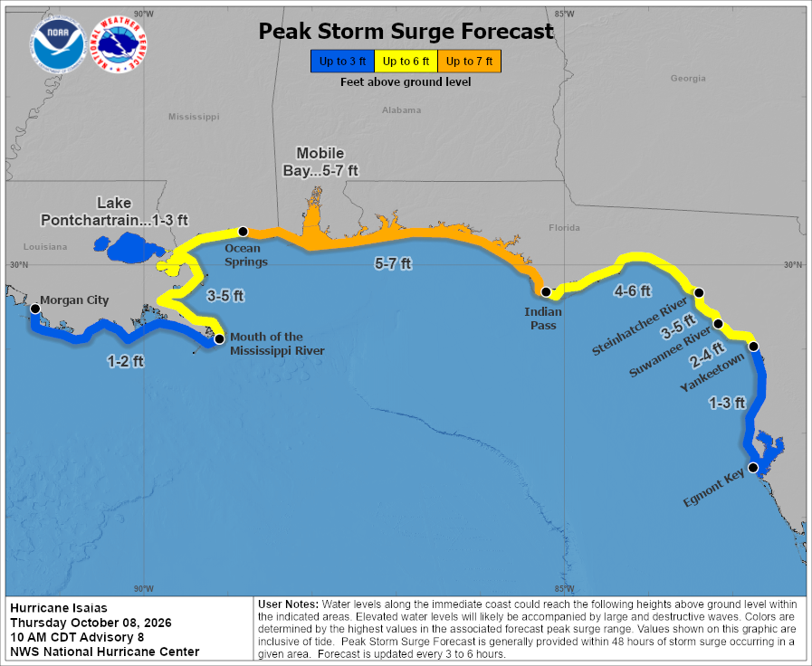
Storm surge is a big concern along the coast. Water could reach 5-7 feet above ground from Ocean Springs east to Indian Pass, including Mobile Bay, with 3-5 feet possible from the mouth of the Mississippi River to Ocean Springs. Farther east, parts of the Florida coast could see 4-6 feet from Indian Pass to the Steinhatchee River. These numbers are above ground level, so that’s potentially several feet of water in areas that are normally dry. The exact track will matter here too, so follow any evacuation instructions from local officials. Generally, the more east your location is from the location of landfall… the more onshore flow and storm surge you could see.
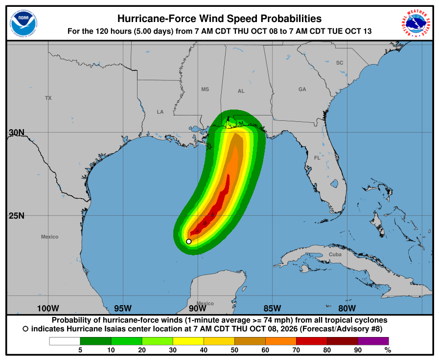
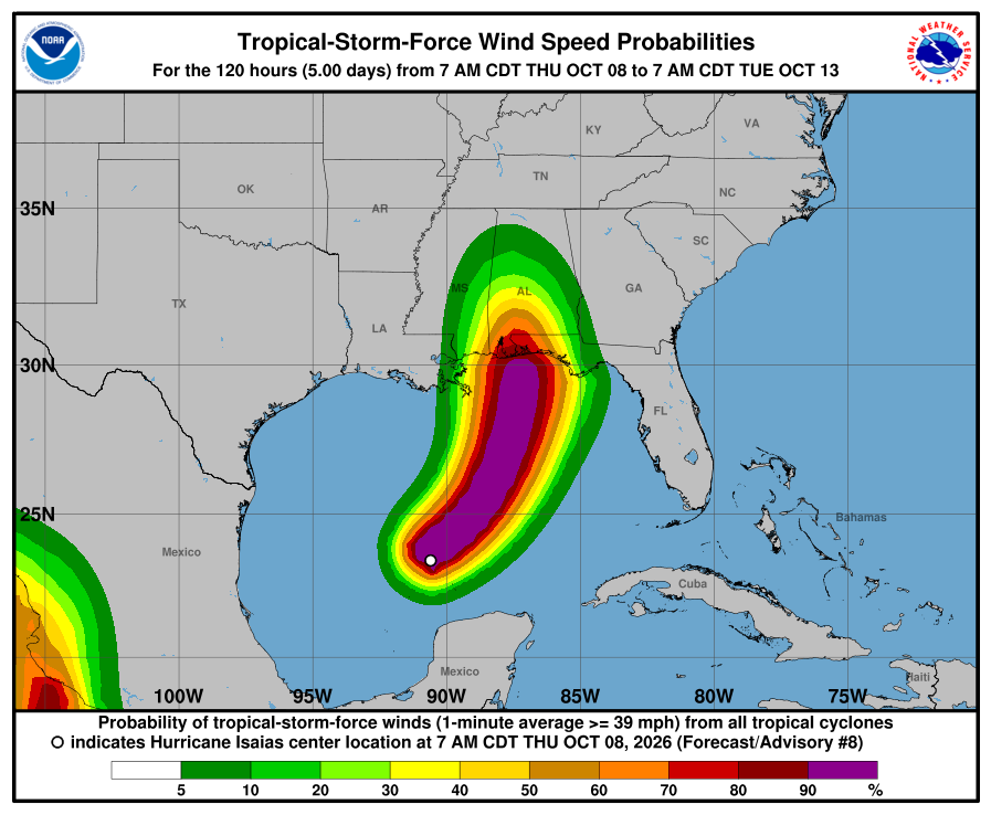
It’ll be windy in the Pine Belt and New Orleans, but nothing like what Mobile and Pensacola could see, with hurricane-force winds possible as Isaias makes landfall. Tropical-storm-force winds will also spread inland Friday evening and overnight into Saturday morning.
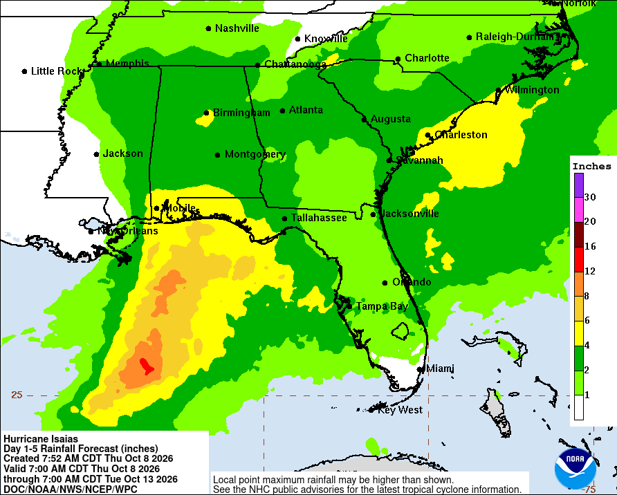
Is it possible that much of our area farther west sees little to no rain from this? Yes, because upper-level winds are expected to push most of the rain and storms to the east side of Isaias. That keeps the heavier rain closer to Alabama and the Florida Panhandle, with amounts dropping off quickly farther west across Mississippi and Louisiana. But the track still matters, and a shift west could bring more rain into our area.
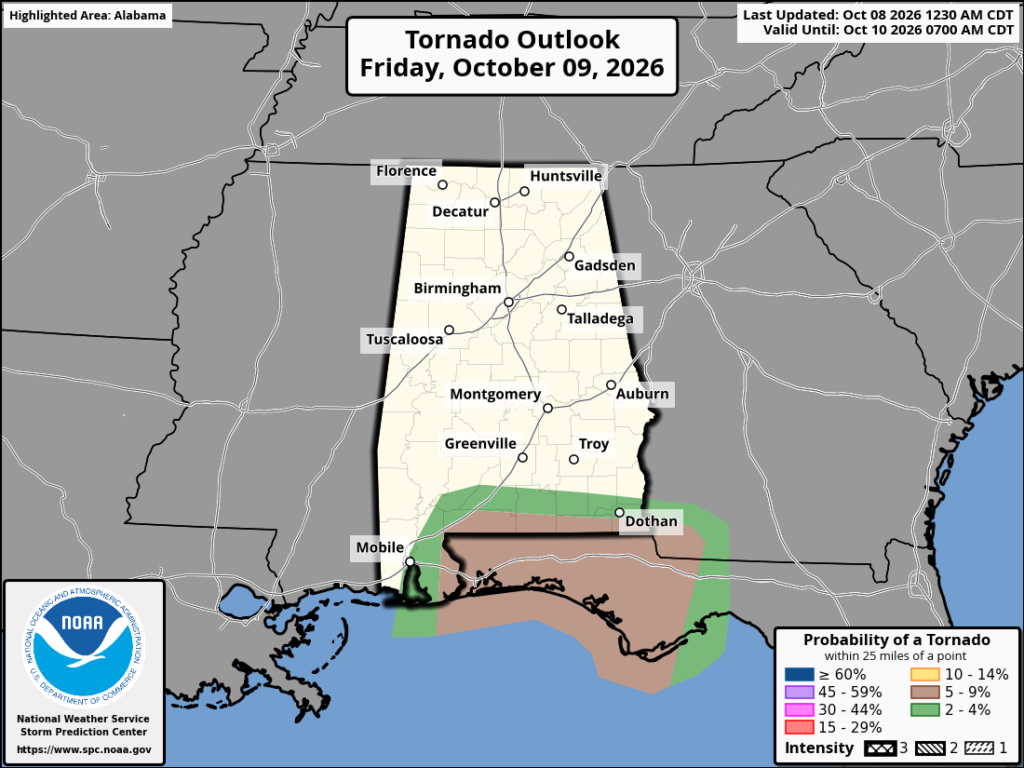
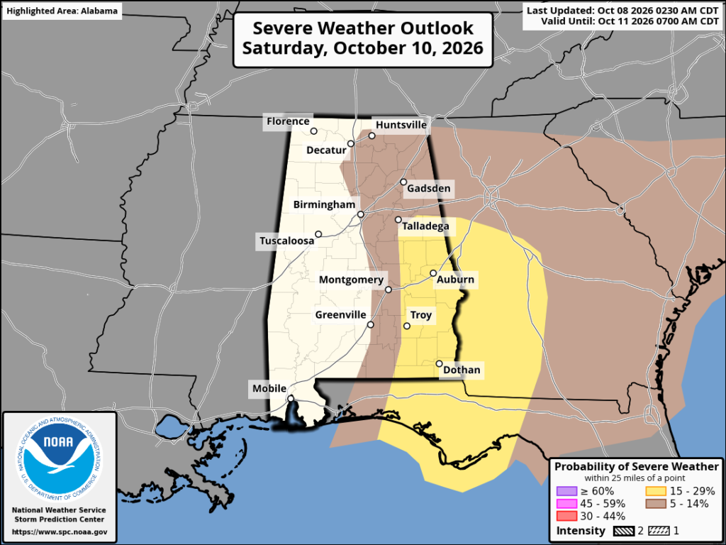
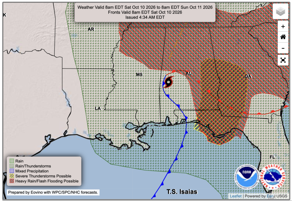
We’ll also need to watch for a few tornadoes in Isaias’ rainbands, mainly on the east side of the storm. Friday’s tornado risk is focused near coastal Alabama and the Florida Panhandle, then the severe weather threat shifts farther inland into eastern Alabama and Georgia Saturday. Some of this could happen overnight Friday, so make sure you have a way to get warnings that’ll wake you up if you live there!

Today’s Forecast: Thursday, October 8th
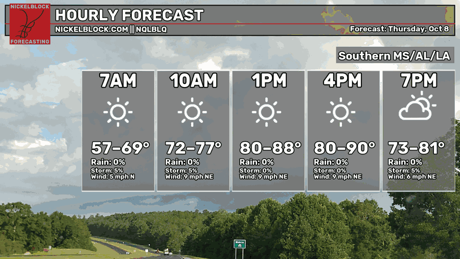
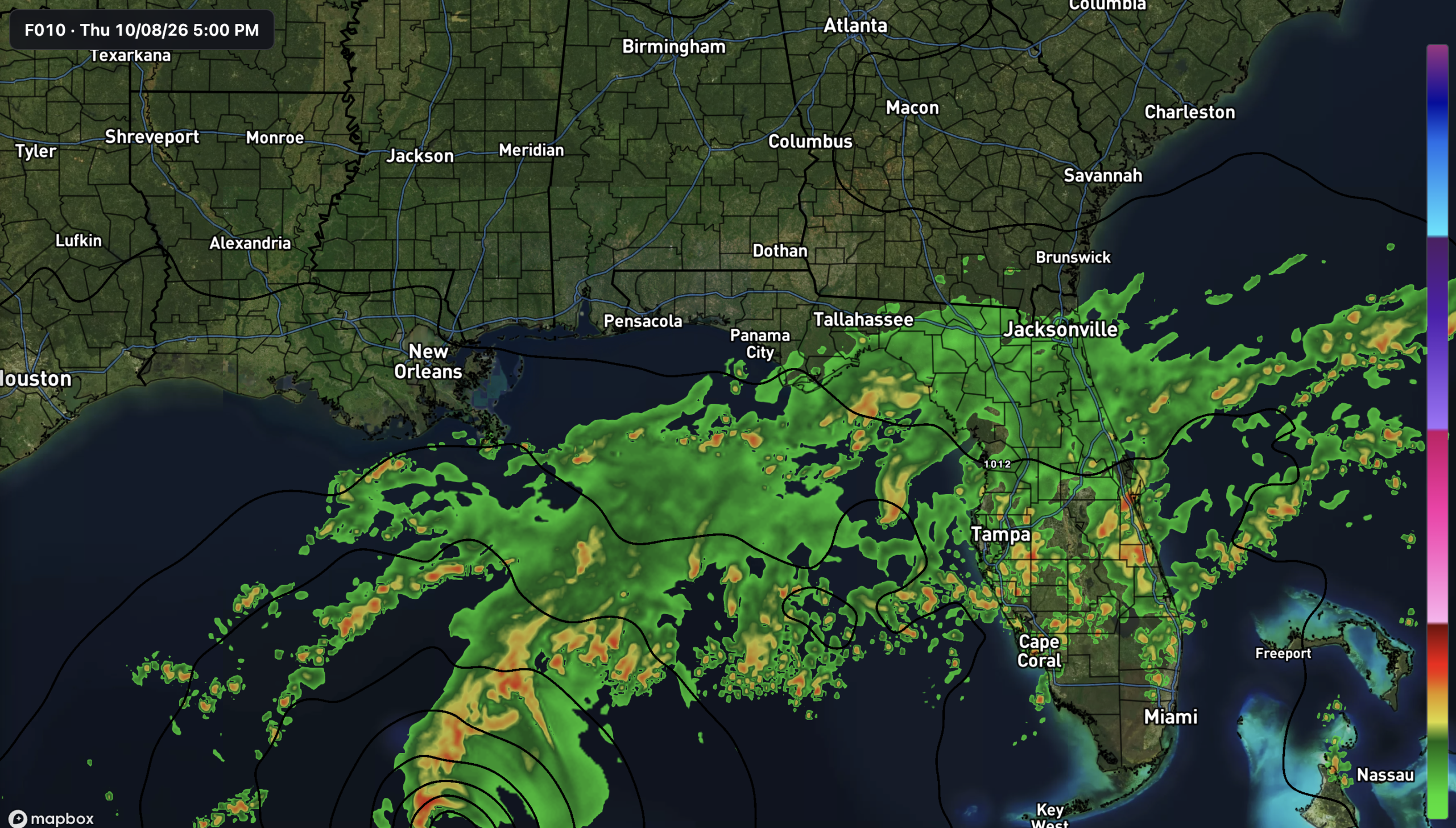
For today, though, most of us across southern Mississippi, Alabama and Louisiana will stay dry with plenty of sunshine. Temperatures climb into the 80s to near 90 this afternoon, with a northeast breeze around 5-10 mph. Most of the rain associated with Isaias stays offshore and across Florida for now, so we still have some time today to get things ready before conditions change Friday.

Tomorrow’s Forecast: Friday, October 9th
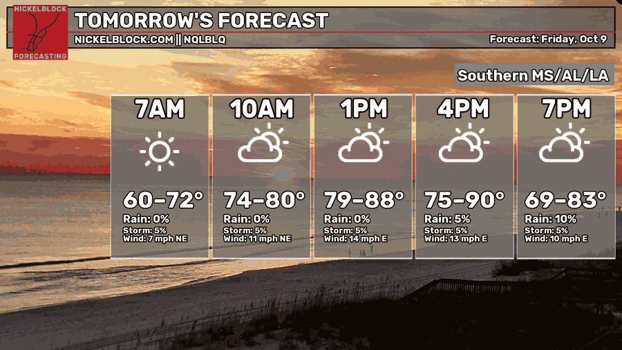
Friday starts off mostly dry for the Pine Belt and New Orleans, with highs in the 80s to near 90 and winds picking up through the day. The timing is still a little uncertain, with some models bringing rain in Friday evening and others holding it off until after midnight. Rain chances will be much higher toward Mobile and Pensacola, while areas farther west could stay mostly dry if the current track holds. Our in-house model brings the rain into eastern and central MS after midnight tomorrow night.
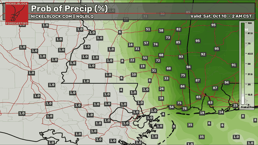
Saturday’s Forecast: October 10th
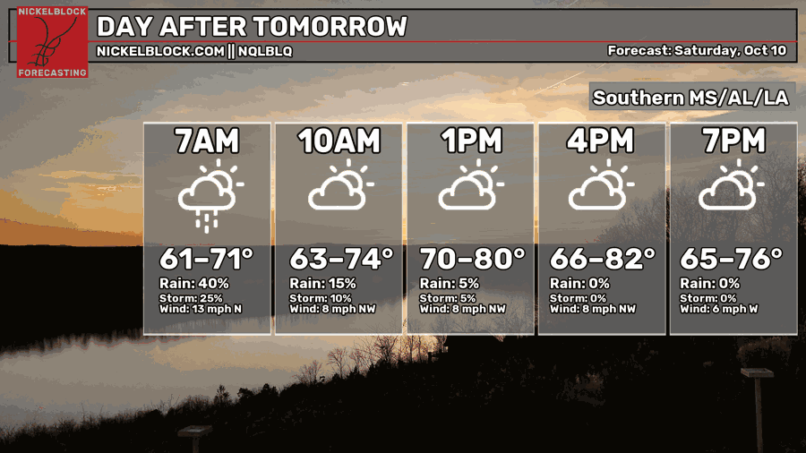
Saturday could start with some lingering rain and gusty winds, mainly across eastern parts of our area, but conditions should improve as Isaias moves north and away from us. Rain chances drop through the morning, though clouds may take a little longer to clear, with highs in the 70s to low 80s. Farther east across Alabama and Georgia, heavy rain and a few tornadoes will remain a concern.
Extended Local Outlook
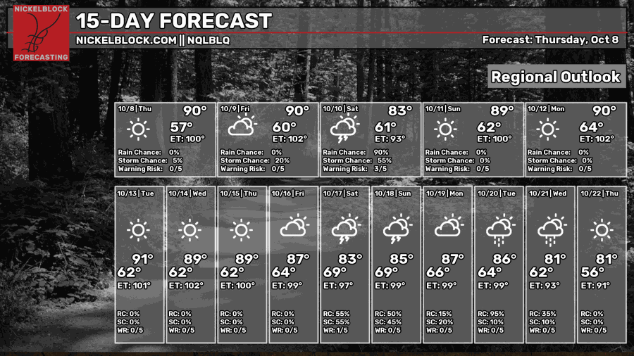
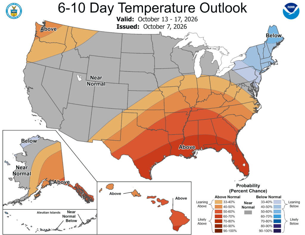
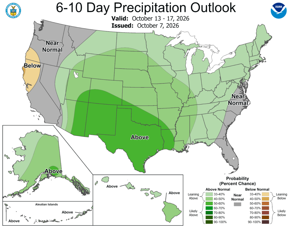
Sunday looks dry and warmer, with that mostly dry pattern continuing into early next week. The 6-10 day oulook from the CPC brings warmer-than-average temperatures towards the middle of October, as well as above average rainfall. Though, I’m not sure what the CPC is seeing, because I see high pressure and sun for the week ahead!