
Good afternoon y’all! I’m your meteorologist Noah with the weekly forecast for the Pinebelt. I can without a doubt say this summer has had much more active weather than we had last year. We switched patterns into more of an El Nino during the Spring and it helped with the formation of more shortwave troughs which led to a lot of our severe weather. Does that have anything to do with the weather that’s coming? Well, kind of!
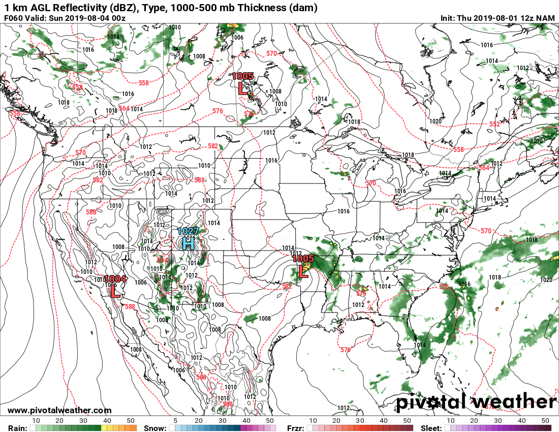
We have another shortwave low-level low pressure system that’s heading our way which is going to give us a little more rain during the weekend. Rain chances are going to be spotty since this system is going to be kind of disorganized, but it’s definitely going to be making its way down here. The mid and upper levels are going to help drive this shortwave southeast into our neck of the woods if you need some reassurance. I don’t really see a chance of severe weather associated with this either since there’s not a lot of rain associated with the event anyways.
Friday morning we’ll start off the morning with overcast skies and a low of 71. Temperatures will rise into the low to mid 80’s by 10 with clouds starting to break up and hardly any wind coming from the north. By 1 temperatures will reach the high 80’s with some low and mid-level clouds. If we do happen to see rain, it will most likely be associated with those north winds and come in from the north. We’ll reach a high of 92 by the mid-afternoon and fall back into the mid-80’s by sunset.
Saturday starts our chances of rain especially in the afternoon. These chances will be scattered across the Pinebelt and the winds shift to the southwest indicating the upcoming trough. High of 91, low of 72 and winds SW at 5 mph.
Sunday we continue these scattered rain chances with winds shifting towards the west and rain chances more likely in the afternoon and into the evening. High of 91, low of 70 and winds W at 5 mph.
Monday we could see a chance of rain in the early morning, otherwise partly cloudy skies throughout the day and the heat starts to come back. High of 92, low of 70 and winds WNW at 5 mph.
Tuesday the warm-up continues as we begin to ridge over. A possible chance of an isolated pop-up thunderstorm, but otherwise just hot. High of 93, low of 71 and winds W at 5 mph.
Wednesday the ridge over brings us drier, yet hotter temperatures across the region. High of 94, low of 72 and winds WNW at 5 mph.
Thursday we’ll see the heat remain with another chance of isolated thunderstorms. High of 93, low of 72 and winds WSW at 5 mph.
Have a great week! Be careful driving in the rain this weekend and stay hydrated next week.


