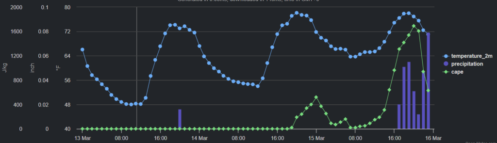
Today should be generally nice with a few showers possible as we move through the afternoon, but I wouldn’t cancel any outdoor plans. Just have a place to duck inside for a short time if you end up underneath one of these.
It is a bit of a similar forecast for tomorrow. I tend to think the rain will be a bit more widespread, but still not widespread enough to bother everyone. We will see hit and miss showers and storms mainly between 1p and 6p.
But notice, some of the higher resolution guidance keeps things pretty dry through the next two days. So, again, I wouldn’t cancel any outdoor plans.
Things start to get a bit more active as we move through the weekend, though, where a change of outdoor plans may be necessary – including, ahem, and USM baseball games.
We will have multiple rounds of storms possible, with the potential for severe weather mixed in, too. But I don’t think this will be a knock-down-drag-out fight with Mother Nature. It looks like a low-end risk for severe storms each day, with heavy rain, lightning, wind and hail as the main concerns. Then, one of the days (that we can’t nail down quite yet) may offer a slightly higher chance for tornadoes.
March is, historically, “hail season” for our area, so I would be on the lookout for hail more than tornadoes in the coming days.
Then things dry out and calm down as we head into next week.
REGIONAL DAY TO DAY FORECAST
Today: Mostly sunny. A slight chance of showers this afternoon. Highs in the upper 70s. Southeast winds 5 to 10 mph. Chance of rain 20 percent.
Tonight: Mostly clear in the evening, then becoming partly cloudy. Lows in the upper 50s. Southeast winds 5 to 10 mph.
Thursday: Partly sunny in the morning, then becoming mostly cloudy. A slight chance of thunderstorms. A slight chance of showers in the morning, then a chance of showers in the afternoon. Highs around 80. Southeast winds 10 to 15 mph. Chance of rain 40 percent.
Thursday Night: Mostly cloudy with a slight chance of showers and thunderstorms. Lows in the mid 60s. Southeast winds 5 to 10 mph with gusts up to 20 mph. Chance of rain 20 percent.
Friday: Mostly cloudy with a slight chance of thunderstorms. A chance of showers in the morning, then showers likely in the afternoon. Highs in the upper 70s. South winds 5 to 10 mph. Chance of rain 70 percent.
Friday Night: Mostly cloudy with a chance of showers with a slight chance of thunderstorms. Lows in the lower 60s. Chance of rain 50 percent.
Saturday: Mostly cloudy. A chance of showers with a slight chance of thunderstorms in the afternoon. Highs in the upper 70s. Chance of rain 50 percent.
Saturday Night: Mostly cloudy with a slight chance of thunderstorms. A slight chance of showers in the evening, then a chance of showers after midnight. Lows in the lower 60s. Chance of rain 50 percent.
Sunday: Showers likely with a slight chance of thunderstorms. Highs in the lower 70s. Chance of rain 70 percent.
Sunday Night: Mostly cloudy with a slight chance of showers and thunderstorms. Cooler with lows in the lower 50s. Chance of rain 20 percent.
Monday: Mostly sunny. Highs in the upper 60s.
Monday Night: Partly cloudy. Cooler with lows around 40.
Tuesday: Mostly sunny. Highs in the lower 60s.


