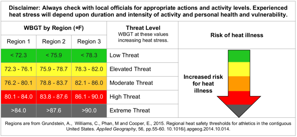
As this is being written, the current wet-bulb temperature along the coast is above 85 degrees, a high threat for heat illness. What is wet-bulb temperature? According to the NWS, Wet Bulb Globe Temperature (WBGT) is an indicator of heat-related stress on the human body at work (or play) in direct sunlight. We are a part of Region 3.
It is extremely important to limit the amount of time outside, have somewhere to cool down with air conditioning, and drink plenty of water. Hydrate, stay cool, and don’t be a fool!

Today
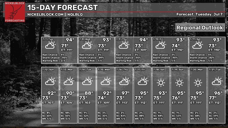
It’s going to be hot and feel muggy outside today. Highs will be in the mid-90s around the late afternoon. There is a possibility of thunderstorms. Calm winds today, mostly out of the west.
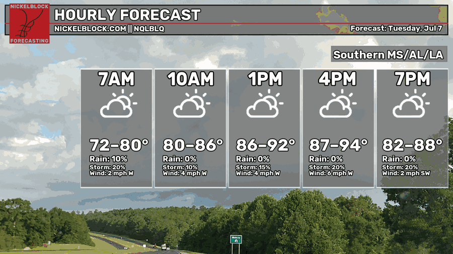
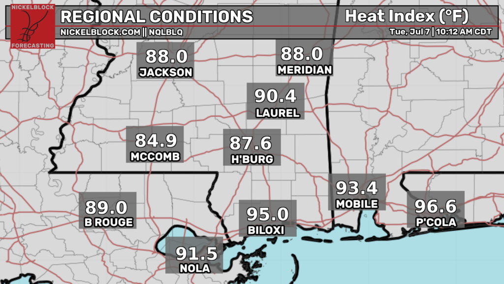
The heat index will continue to rise with the coast already in the 90s! Protect yourself from the sun. It’s also best to avoid the peak sun hours.
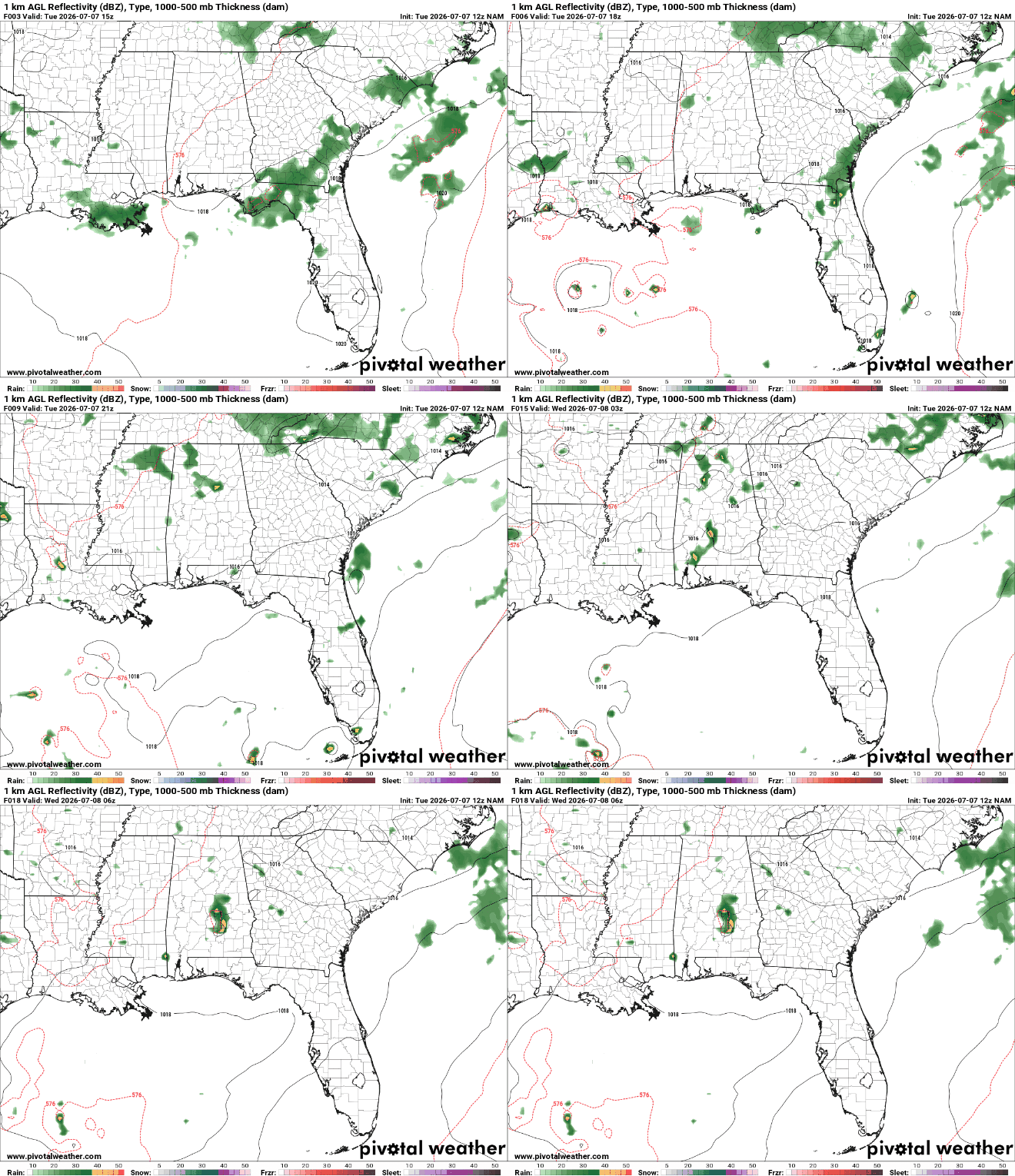
This afternoon, LA will experience rain and possible thunderstorms in the Southeast. In the late afternoon, Southwest LA will see isolated showers and thunderstorms. South MS will be relatively dry today with some isolated showers and thunderstorms near the MS/AL border later tonight into the morning. Most of the showers and thunderstorms in Southern AL will occur later tonight into the morning.
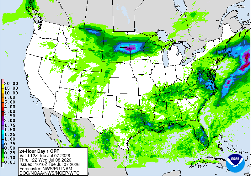
Most of our area will receive under 0.50 inches of rain through tomorrow at 7 am. The western portions of LA and MS are under a marginal risk for excessive rainfall, meaning localized flooding is possible.
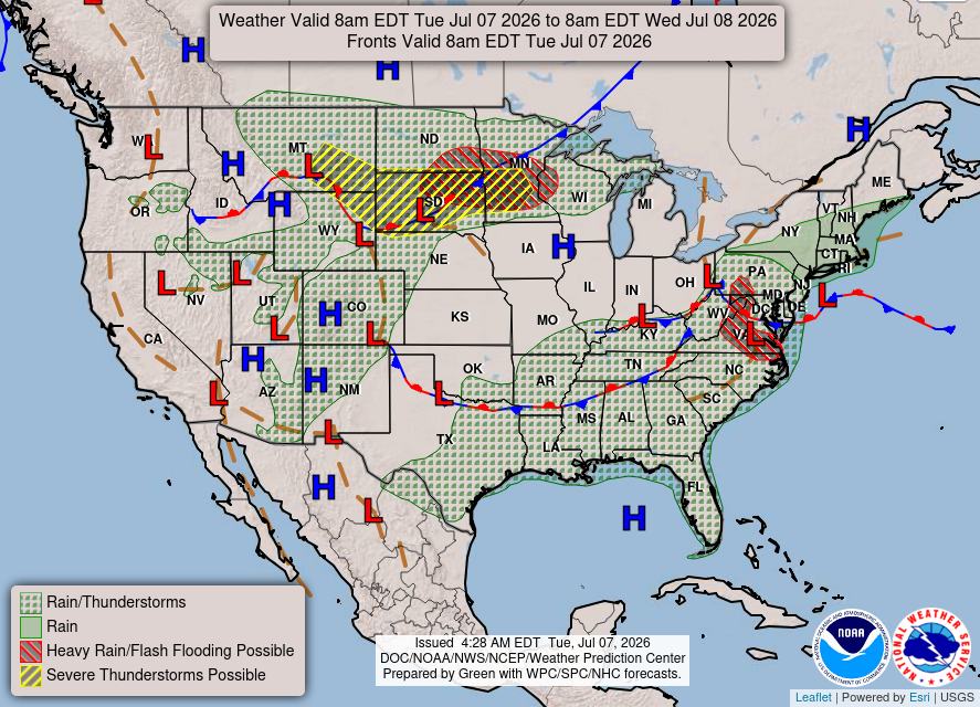
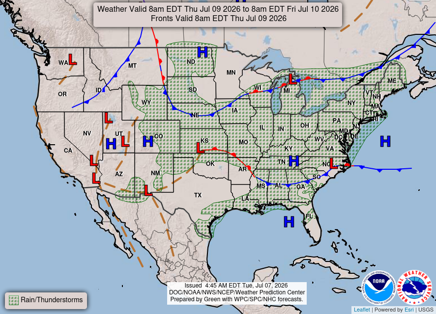
The National Forecast Chart has our area experiencing showers and thunders. The area of high pressure in the Gulf will be feeding moisture into the atmosphere, and the lingering boundary mix will bring showers and thunderstorms to our area.
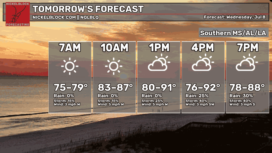
Tomorrow
More hot, muggy conditions for tomorrow. The high will be in the lower 90s in the late afternoon. The chances for rain and storms will increase around late afternoon into the evening. Calm winds are coming out of the west-southwest.
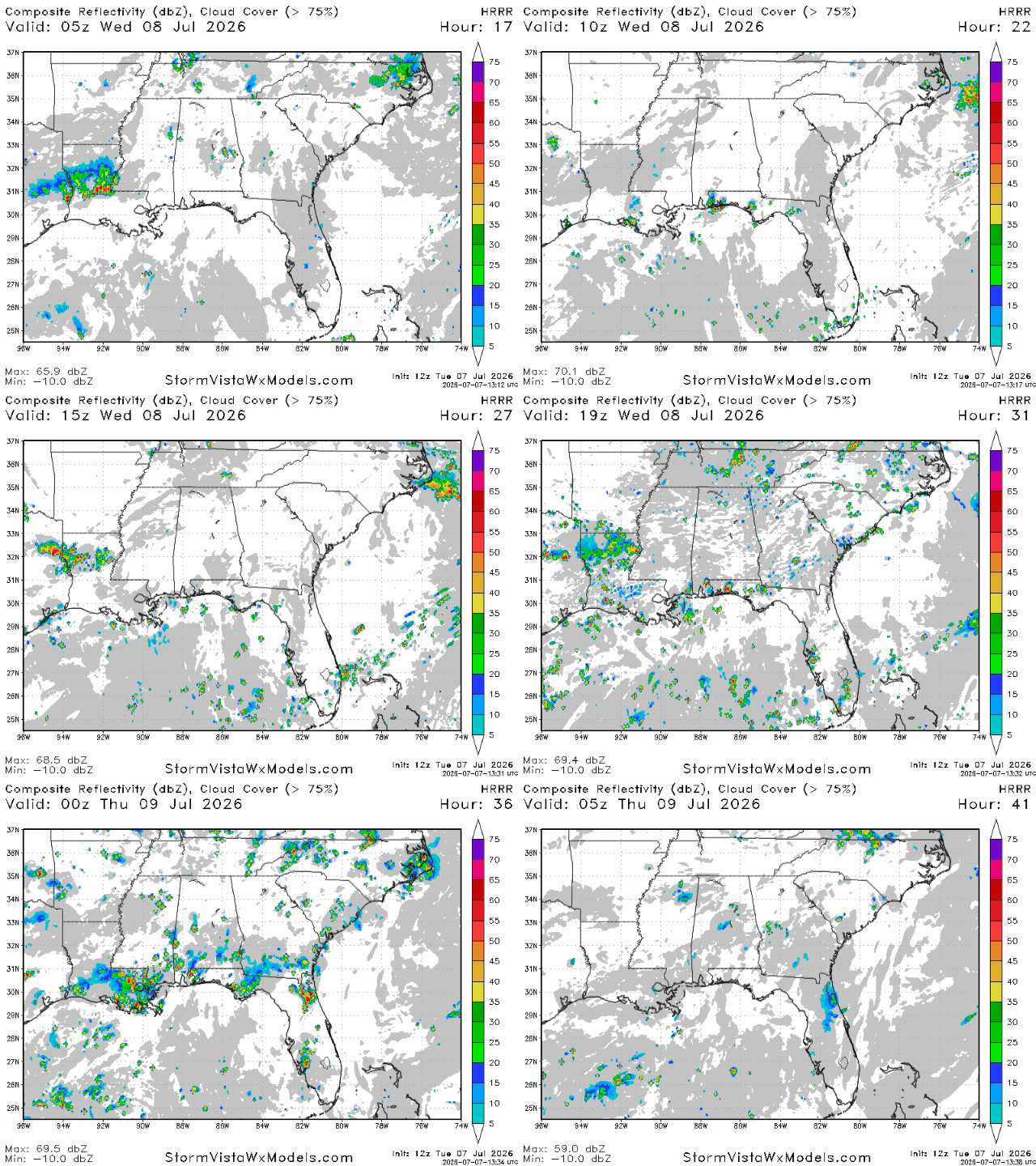
Most of the showers and thunderstorms will occur in the late afternoon in our area, lasting until around 11 pm.
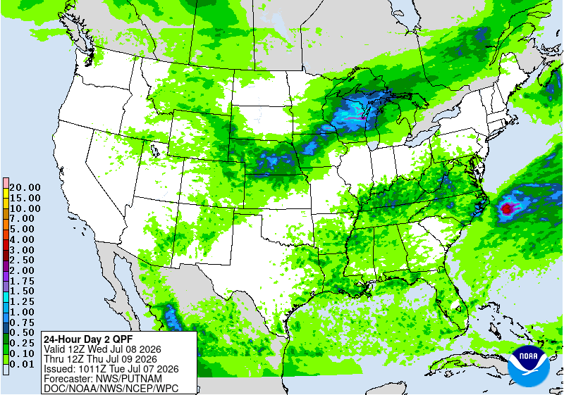
Most of the precipitation will be in Southern LA, receiving around 0.50 inches.

Thursday
More hot and muggy weather. Who would have guessed! Highs in the mid-90s around the late afternoon. The chance of storms will increase in the afternoon. Calm winds are coming out of the south-southwest.
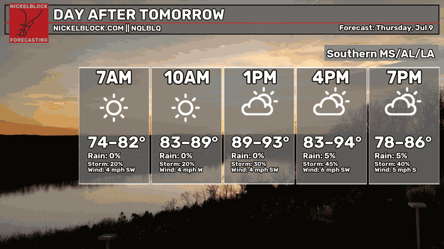
With the high-pressure system in the Gulf and the lingering boundary stretching across MS to GA, afternoon showers and thunderstorms would be a possibility.

Extended Forecast
The CPC outlook had our area experiencing above average temperatures and near normal precipitation.


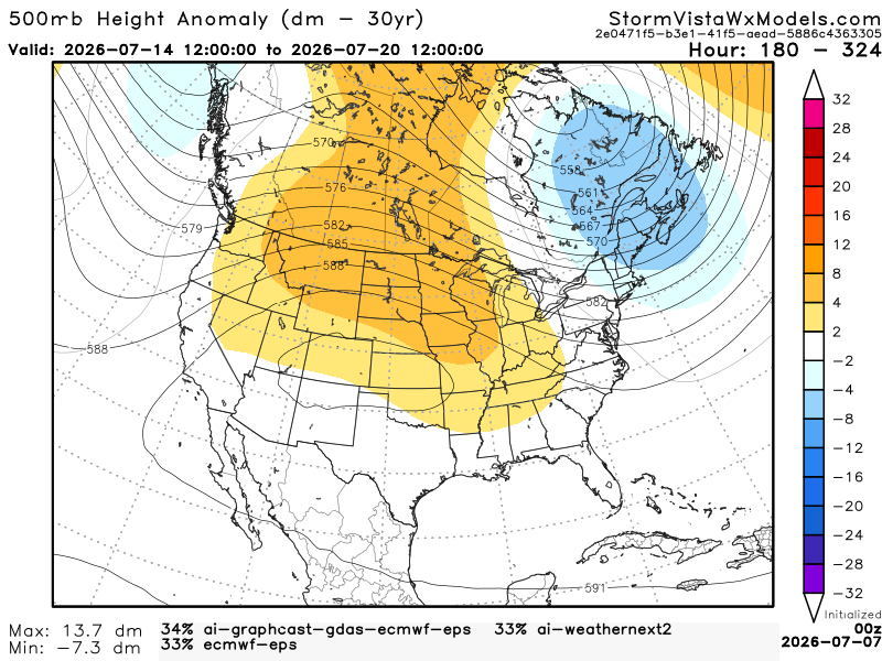
This 500mb height anomaly model has a blend of the 3 most accurate models over the past 7 days. The model runs from July 14, 7 am to July 20, 7 am. Based on the blend, I would agree with the CPC. With the ridge across the Great Plains, the south will feel warmer than usual. For Southern LA/MS/AL, we will still have moisture in the air from the Gulf. We should expect the normal summertime afternoon showers and thunderstorms from the sea breeze.