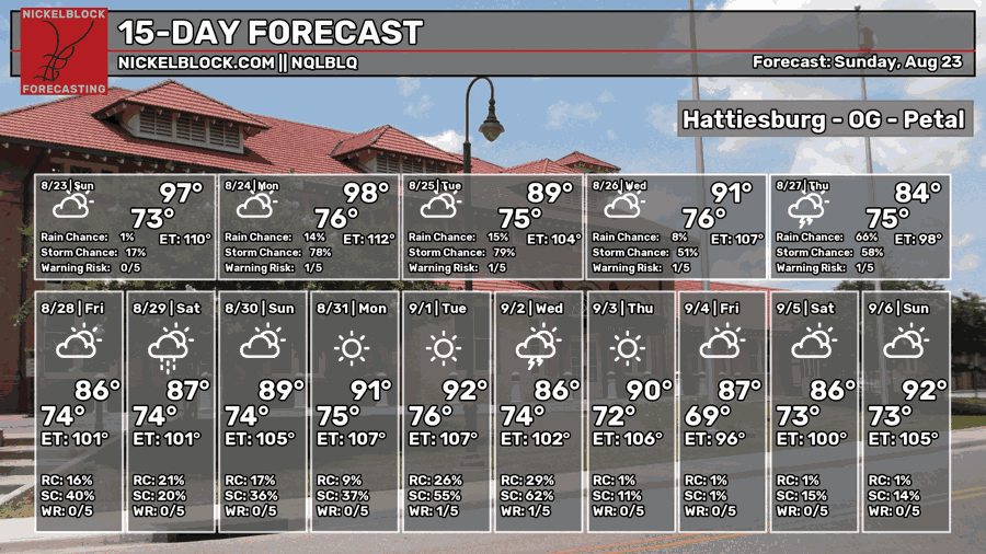
Despite a drought and constant heat waves this August, we’re still recycling some of that water vapor in the air and bringing in a few storms during the week. A slightly different style of storm will move in today and tomorrow following a mid-upper level pattern. For most of us, the good news is more rain! The question is whether it will be enough to cut down on the heat index afterwards since it moves in so early.

Today
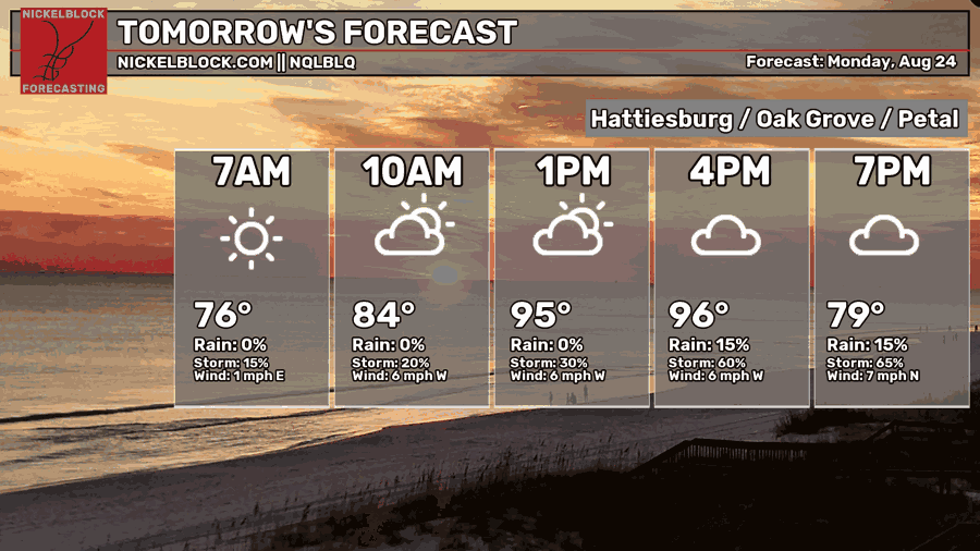
The NQLBLQ model is a bit behind, but I’ll explain what’s happening today. A Mesoscale Convective System (MCS, a more organized line of storms) is moving in this afternoon from the northern Delta region. We’ll see some rain this afternoon from that system. There’s just enough of a push from the southwestern high in the mid-levels to push along some air to bring an MCS towards the central Delta and eventually the Gulf Coast.
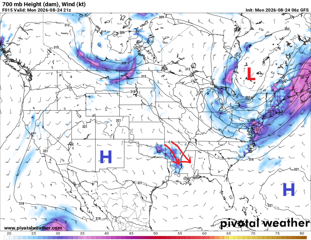
Looking at the composite reflectivity model above, we can see that this MCS is going to move in fairly quickly. It already is near I-20 and will be moving southeast towards southwestern and southern MS by the early afternoon. The SPC has already placed a mesoscale discussion over much of the Pine Belt and coastal areas for high winds, flash flooding, and severe thunderstorms. Be careful outside this afternoon and don’t be reckless!
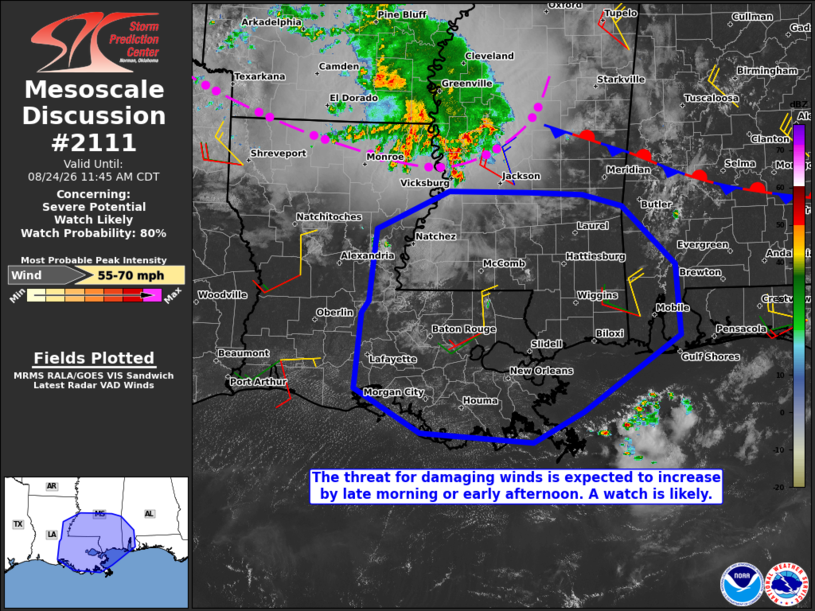
Mesoscale Discussion 2111 NWS Storm Prediction Center Norman OK 0912 AM CDT Mon Aug 24 2026

Areas affected...southern Mississippi...east-central and southeast Louisiana...and far southwest Alabama

Concerning...Severe potential...Watch likely

Valid 241412Z - 241645Z

Probability of Watch Issuance...80 percent

SUMMARY...The threat for damaging winds with gusts up to 60-65 mph is expected to increase by late morning into early afternoon. A severe thunderstorm watch will be required by 16Z or 17z.

DISCUSSION...Recent trends in volumetric radar and IR satellite data indicate at least a temporary deepening of convective updrafts from west through north of Yazoo City, along the leading edge of an elongated MCS that extends into central AR. The 12Z Jackson, MS and Slidell, LA soundings sampled the presence of a very moist inflow air mass, characterized by boundary-layer dewpoints in the mid to upper 70s, yielding MUCAPE of 3000-4000 J/kg. That instability will fuel a gradual increase in storm coverage and intensity through the remainder of the morning along and slightly ahead of the system cold pool as temperatures warm and low-level lapse rates steepen. The instability in conjunction with some enhancement of northwest winds above 3 km AGL per the current Little Rock, AR and Memphis, TN VWPs will support the development of a potentially intense cold pool with some explicit CAM wind gust data indicating wind gusts up to 60-65 mph.

..Mead/Smith.. 08/24/2026

...Please see www.spc.noaa.gov for graphic product...

ATTN...WFO...MOB...JAN...LIX...LCH...

MOST PROBABLE PEAK WIND GUST...55-70 MPH

NNNN
Otherwise, it’s going to start off hot today with a high in the mid 90s before the rain cuts that down pretty significantly. Overnight lows will be in the mid 70s.

Tomorrow
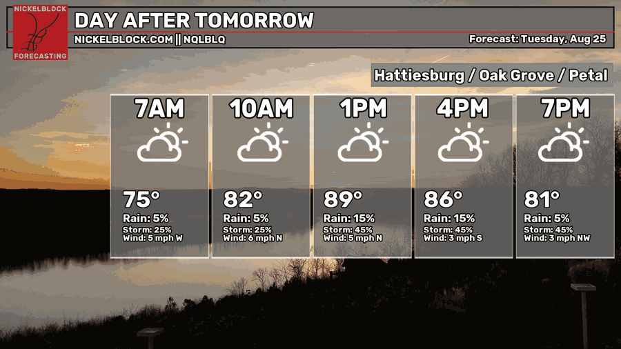
It might be a bit of a shock that we’re not breaking out of the 90s tomorrow, but I still think there’s a good chance that we will in some areas. Despite that, our main reason for the dip in temperatures is another MCS moving in tomorrow. The models are pushing some similar severe weather potential for tomorrow compared to today. CAPE values (Convective Available Potential Energy) are similar to today, but the potential is pushed later into the day due to the incoming cloud cover in the morning. A few small storms are possible in the morning, however there is a small window between morning and afternoon development that could lead to a few severe storms later in the afternoon tomorrow.
We’ll get an overall warm and humid day with clouds and early morning rain. More thunderstorms will arrive moving north/south by the mid-afternoon. Highs in the upper 80s/low 90s and a low in the mid 70s.
Wednesday
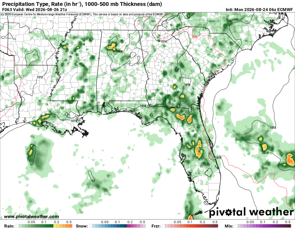
After two days of MCS storms, we’ll likely go back to our normal afternoon thunderstorm cycle. The mid-level push will weaken after Tuesday, leading to a lull in mid-level forcing. Even so, we’ll still likely see a few storms develop from the northwest and have a general northwesterly movement when it combines with the Gulf airmass. Afternoon thunderstorms are possible on Wednesday, but it’ll be another hot one with highs in the low to mid 90s and lows in the mid 70s. Expect the heat index to reach above 100.
Rest of the Week
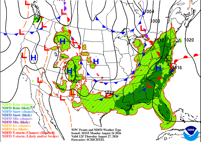
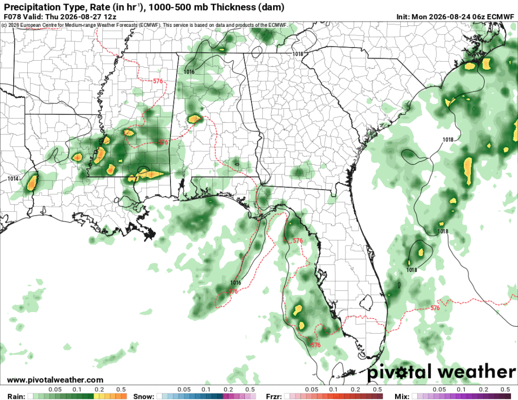
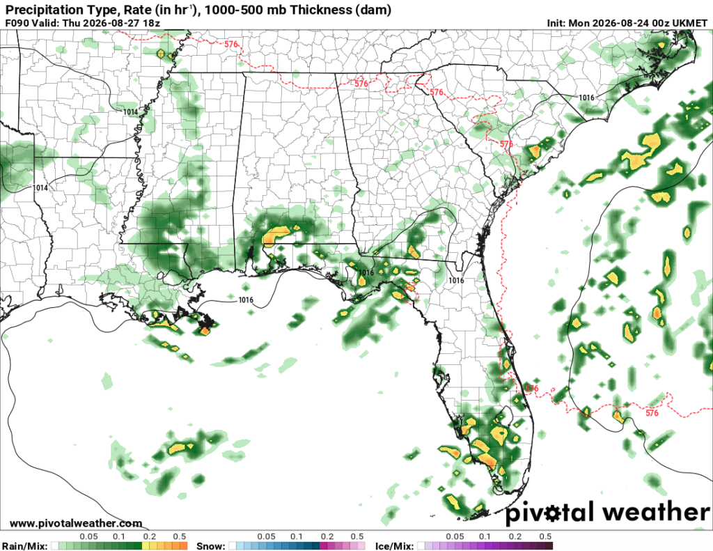
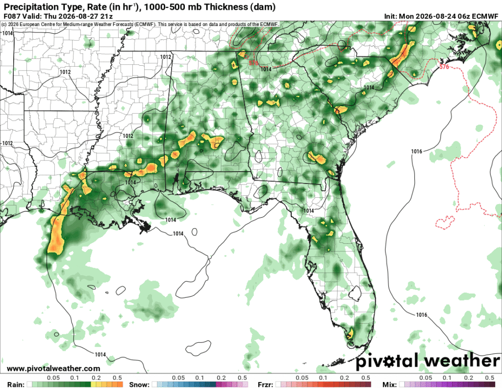
Models are showing another MCS possible overnight from Wednesday into Thursday. Afterwards, another round of storms is possible in the mid-afternoon with the collision of airmasses. Overall, temperatures will be down a bit due to the incoming rain.
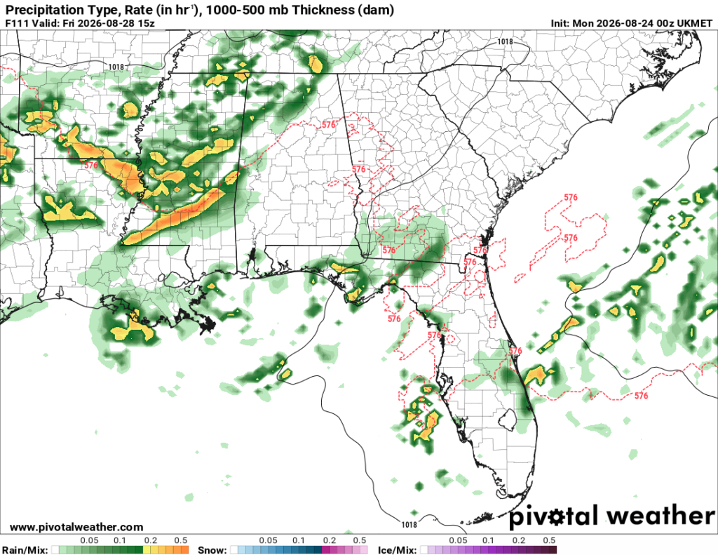
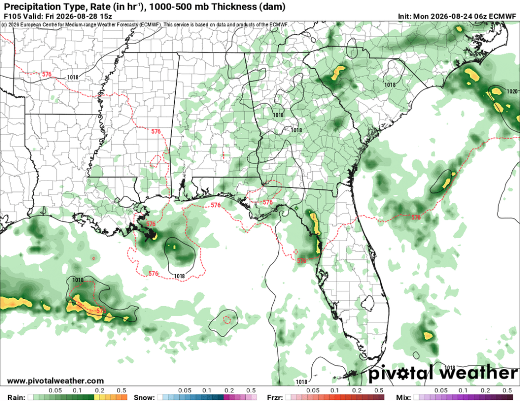
It’s a toss-up for Friday’s weather so far. The UKMET has been pretty aggressive on another front moving in on Friday, while the Euro and GFS models are more quiet. The GFS model suggests more of a coastal storm expansion while the Euro model has cut down on rain chances altogether. Overall, I do think there will be some thunderstorms possible, but until model guidance is more in agreement, it will be hard to tell what the dynamics of the system will be.