As you woke up this morning, you probably noticed the coastal warmth and humidity as the air temperature fluctuated between the mid-to-upper 70s and the dewpoint temperature hovered around 75F. Many are probably wondering, “Will we see any end to this brutal summertime pattern?” Well, courtesy of a northward building ridge of high pressure, these conditions will only intensify. Today’s high temperatures are expected to reach the low-to-mid 90s with 100F-to-105F heat indices; these conditions triggered an Heat Advisory from 11:00am to 7:00pm CDT for Alabama’s coastal counties.

In an unusual pattern, however, there is a cold front in the region moving towards the west that may offer some temporary relief. This lifting mechanism will trigger the development of evening storms, delivering rain and locally severe winds (gusts greater than 37mph) to coastal communities.
Heat indices reach 100F on Wednesday along the Northern Gulf Coast // Courtesy: Pivotal Weather High pressure system pushes storms westward in late evening // Courtesy: Tropical Tidbits


After the passage of the evening storms, coastal residents can still expect to see hot and muggy weather in the week to follow as the southeastern ridge stays steadfast. Like today, high temperatures for the next several days will reach the low 90s while dew points steadily remain in the low-to-mid 70s. Heat indices will peak between 100F-to-105F for coastal communities and chances for afternoon showers will increase as the weekend approaches. Generally, there is no indication that this pattern will let up, and according to the Climate Prediction Center, the temperatures for the next couple of weeks are almost guaranteed to be above normal. Barring a tropical cyclone with wide reaching cloud cover, we will wrap up an intensely hot June with more hot and steamy weather.

Day-to-Day Forecast
Wednesday
Mostly sunny with a 30-percent chance of evening and nighttime thunderstorms that are locally severe. Expect high temperatures in the low-to-mid-90s with heat index values around 100F.
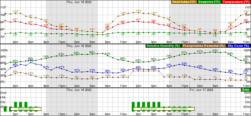
Thursday
Mostly sunny with a 40-percent chance of evening thunderstorms. Expect high temperatures in the low-to-mid 90s with heat index values around 100F.
Friday
Sunny and hot with a 20-percent chance of evening thunderstorms. Expect high temperatures in the low-to-mid 90s with heat index values around 100F.
Saturday
Sunny and hot with a 20-percent chance of evening thunderstorms. Expect high temperatures in the mid 90s with heat index values ranging from 100F-to-105F.
Sunday
Sunny and hot with a 10-percent chance of evening thunderstorms. Expect high temperatures in the mid 90s with heat index values ranging from 100f-to-105F.
Monday
Sunny and hot with a 10-percent chance of evening thunderstorms. Expect high temperatures in the low-to-mid 90s with heat index values ranging from 100F-to-105F.
Tuesday
Sunny and hot with a 10-percent chance of evening thunderstorms. Expect high temperatures in the low-to-mid 90s with heat index values ranging from 100F-to-105F.


