Another day, another chance for some rain.
Storms today will be a bit more ‘hit and miss’ but the buffett of storms may be so widespread that there will be plenty of ‘hits’ this afternoon. And PWAT values will be between 1.5 and 1.75 across much of the area which means storms will be pretty efficient rain producers.
Looking at the model data this morning, it looks like the images from last night will still be applicable.

Some drier air aloft still means a chance for some small hail and gusty wind, too.
On Wednesday, the coverage will be a bit more blanketed while storms move through during the day. As I mentioned last night, the rain may struggle to push through the entire area because the unidirectional wind through the column will be parallel to the storm motion. So, unless a good cold pool can form on the backside of the storms, this line may struggle to progress quickly.

Then a third round of rain may push through overnight Wednesday and into Thursday morning. This round is a little more questionable and will rely on a few things to happen, back in east Texas and down into the Gulf, first in order to spark off the line of storms.
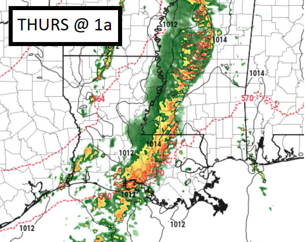
If that does happen, then Round 3 of storms is a go early Thursday morning, if it doesn’t then storms will be less likely to develop and we may end up dry slotted. So this next one isn’t a slam dunk quite yet.
Day to Day Forecast
Today
Mostly cloudy with passing showers and storms likely. Highs in the mid 80s. Southeast wind will be breezy – between 10 to 15mph with gusts up to 25 mph. Chance of rain 60-percent.
Tonight
Mostly cloudy with a few storms possible. Lows around 70. Chance of rain 20-percent.
Wednesday
Mostly cloudy with storms likely – between 10a and 6p – with strong storms possible, but heavy rain and localized flooding is the main concern. Breezy. Highs in the lower 80s. Chance of rain 80-percent.
Wednesday Night
Mostly cloudy. Another round of showers and storms possible. Lows in the upper 60s. Chance of rain 70-percent.
Thursday
Mostly cloudy with a 60-percent chance for showers and storms in the morning. Highs in the lower 80s.
Thursday Night
Partly cloudy. Lows around 60.
Friday
Sunny. Highs in the mid 80s.
Friday Night
Clear. Lows around 60.
Saturday
Sunny. Highs in the upper 80s.
Saturday Night
Mostly clear. Lows in the lower 60s.
Sunday
Sunny. Highs in the lower 90s.
Sunday Night
Mostly clear. Lows in the mid 60s.
Memorial Day
Mostly sunny. A slight chance of showers and thunderstorms in the afternoon. Highs in the lower 90s. Chance of rain 20 percent.


