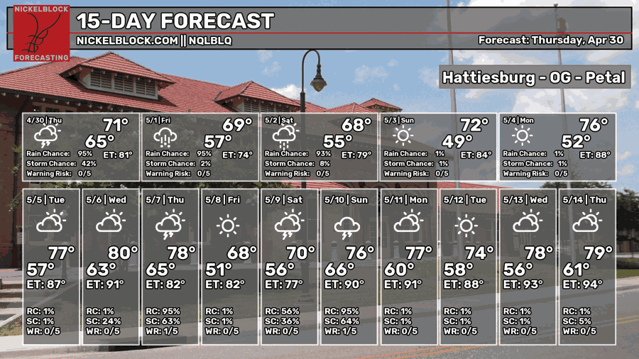
The Setup
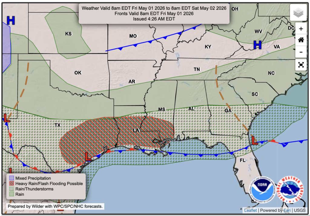
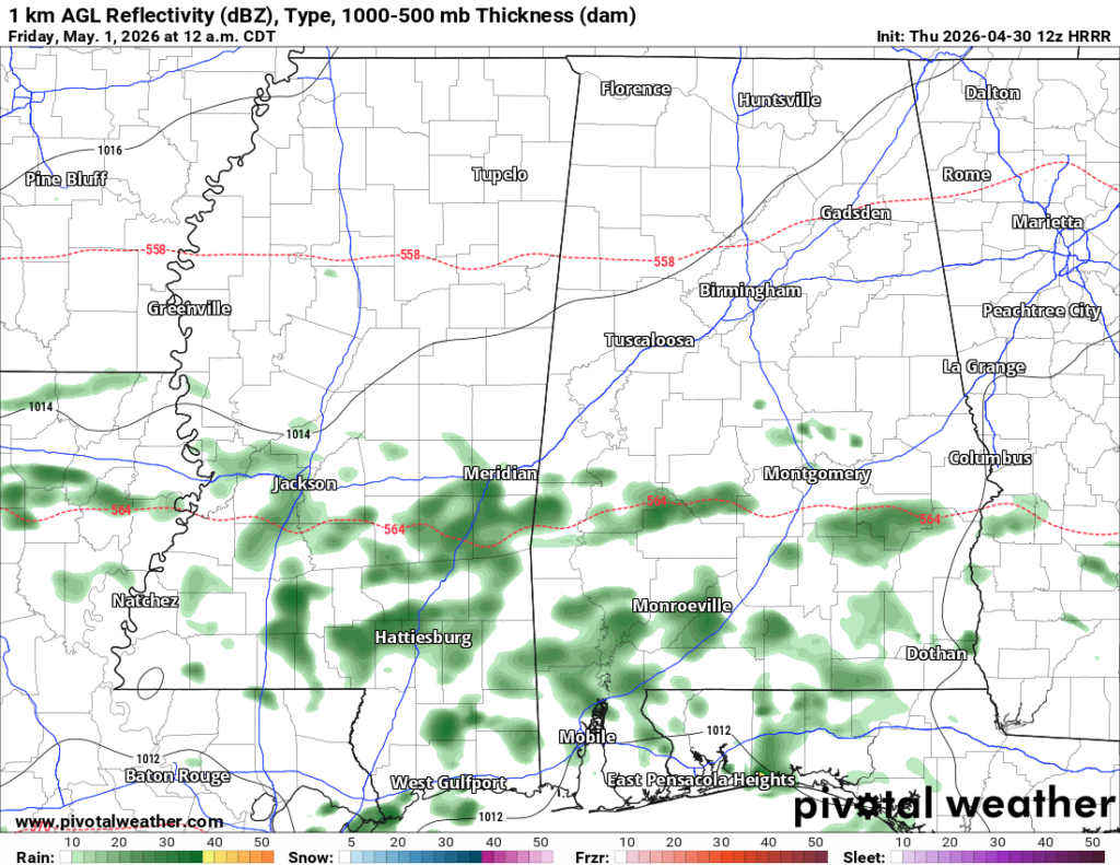
After more rain and thunderstorms today, we’ll see yet again another day of unsettled weather tomorrow thanks to a stationary front drapped over the northern Gulf. Since we’ve had a lot of rain in such a short period of time, and since we are in a drought, the ground likely has not been able to soak it all up yet. Because of this, flash flooding is possible tomorrow anywhere in our forecast region, since we will see another full day and a half of rain to come.
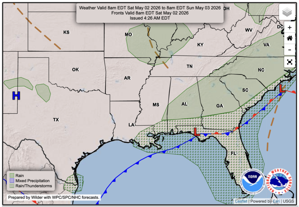
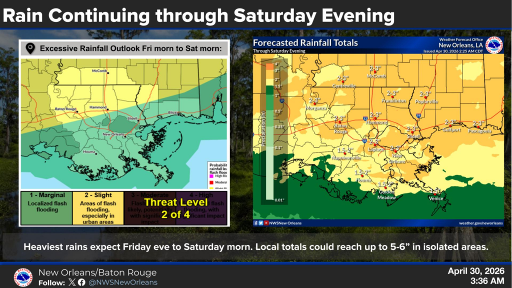
The graphic below from the NWS shows a total rainfall of 2-3 inches from today through Saturday, with locally higher amounts possible. By Saturday afternoon, the low pressure system and cold front will move eastward out of our area, leaving a clear night. A much cooler weekend than usual is in the forecast, thanks to the northerly flow behind the front and the overall 500 mb pattern showing a trough moving in over the eastern half of the country.

Tonight’s Forecast
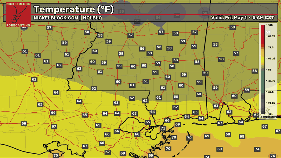
We’ll see some leftover shower activity tonight with lows in the upper 50s further north and mid 60s down south. Any severe threat that exists should be done by then, with just some showers through the night into the morning.

Tomorrow’s Forecast: Friday, May 1st
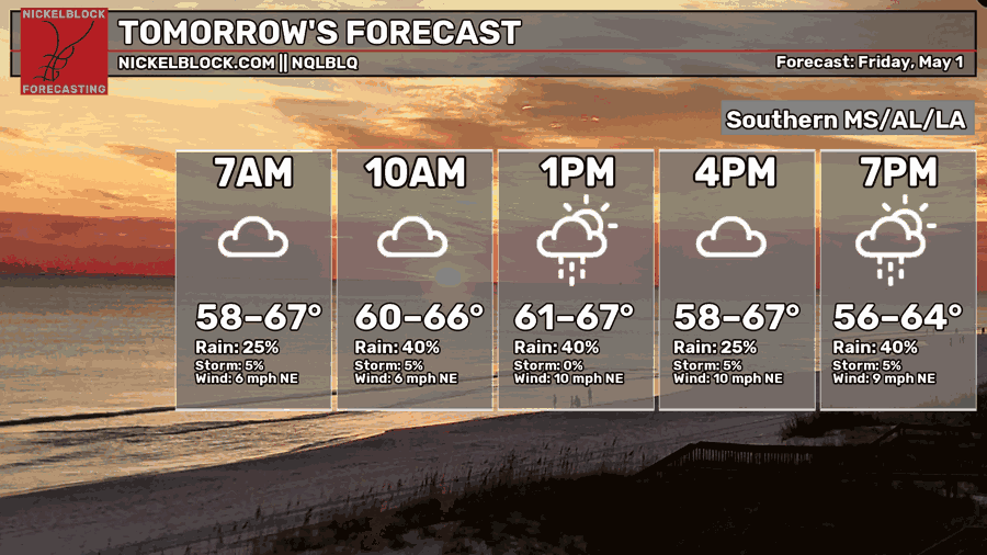
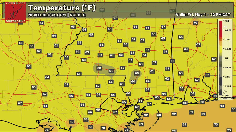
To start the weekend, Friday will be another washout, with showers and possibly some thunderstorms throughout the day. Expect generally more coverage as the day goes on and into Friday night and into Saturday morning. As I mentioned before, 2-3 inches of rain is possible before all is set and done, so ensure you are prepared in cause of any flash flooding if your location tends to flood with heavy rain. The only severe threat for Friday is over the immediate MS coast as well as southeastern LA, for a marginal chance of severe wind or hail. The tornado threat is minimal. Temperatures will be even cooler with highs only reaching the low-to-mid 60s, which is 15-20 degrees below average!
Weekend Forecast
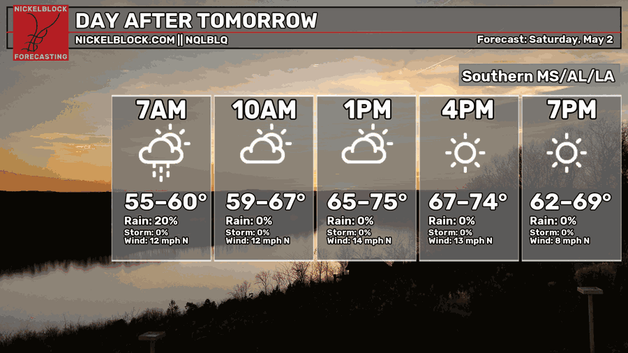
Showers will stick around for Saturday morning but will move out by the afternoon, leaving some clouds and sun and then eventual clear skies to end the day. Temperatures will warm to the low-to-mid 70s with very little humidity. A great second half of the day for sure!
Sunday is a full day of sun and low humidity with temperatures reaching the lower 70s. Definetly a great day to be outside after the rainy mess this week!

Extended Local Outlook
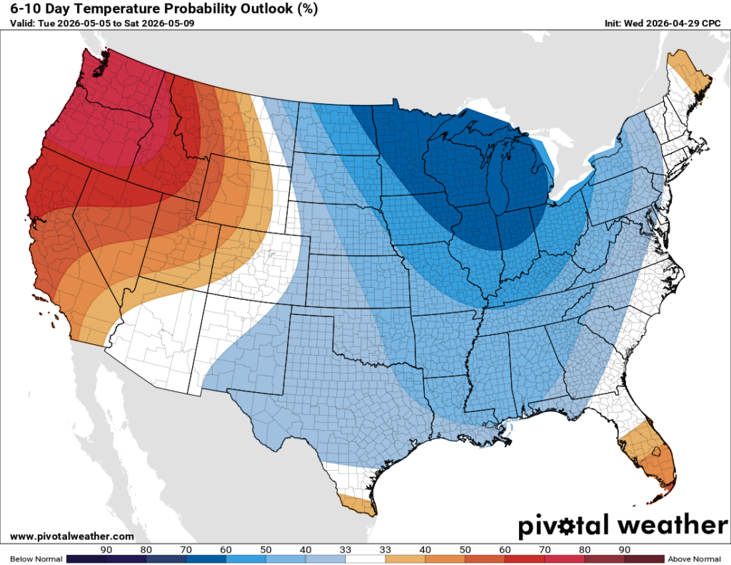
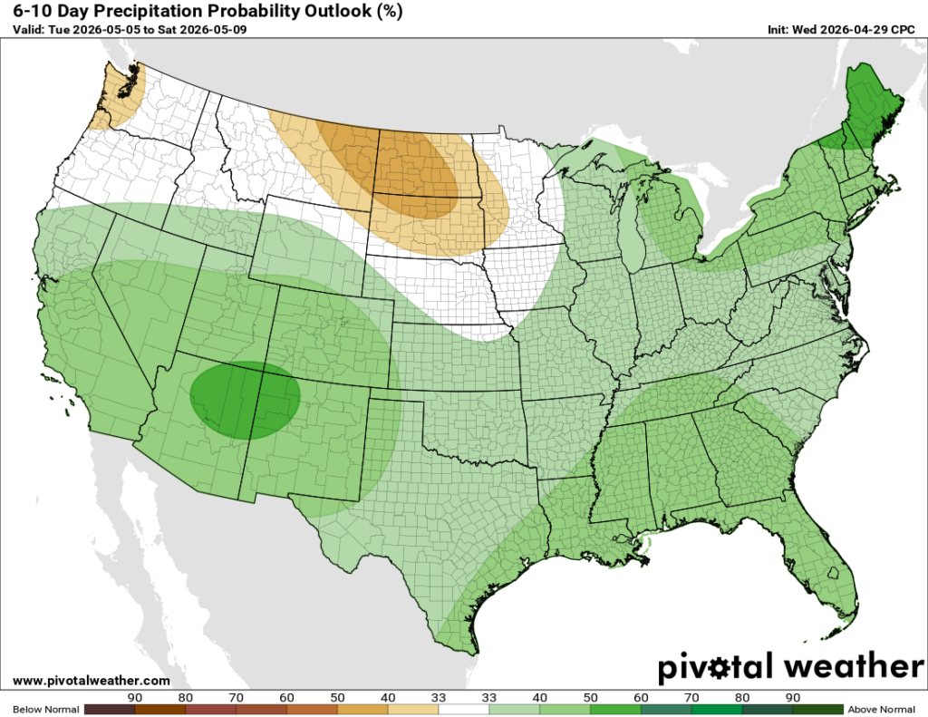
It’s been a while since we’ve had cooler than average temperatures in our forecast, but we do! Troughing will take over the pattern for the 6-10 day outlook as well as the 8-14 day outlook, meaning the below average temperatures are here to stay for a little while, giving us some relief from the crazy hot temperatures we’ve seen recently. With that comes increased rain, which we do need, so we will take it.


