We got really close to the 50s this morning, but (as of this writing) we haven’t hit the 50s yet. And today was our best chance to do it before we rebound back into warmth the next few days.
In fact, it looks reasonably warm and pretty dry during the next two weeks. Some good news is that there will be a few days in there where we may get a ‘Taste of Late Summer / Early Autumn’ in the morning, with lows in the mid 60s. But it will still be pushing 90 (or higher) in the afternoons.
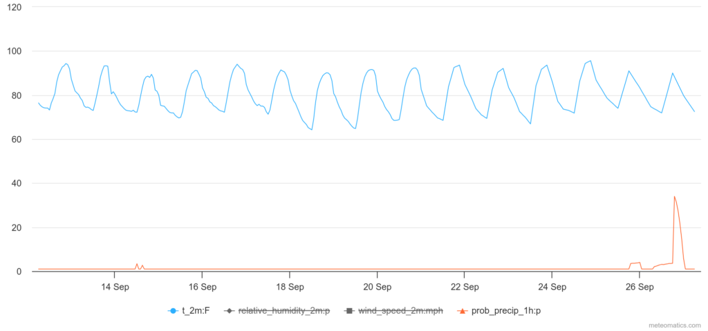
The bad news is that last year, by this time, we had already seen a night with lows in the mid 50s! And the year before that? The first night of 50s was on the 20th. In 2020, the first night of 50s was at the very end of the month. Though, in 2019, it never happened. So this isn’t completely unheard-of.
Moving forward, I couldn’t find a chance for a night with overnight lows in the 50s during the next 15 days in the data from this morning.
It looks like our first “Summer Buster” front will likely wait until October.
It also looks like the rain will hold off for a while, too. Because of that – and the lower humidity – we have elevated wildfire danger.
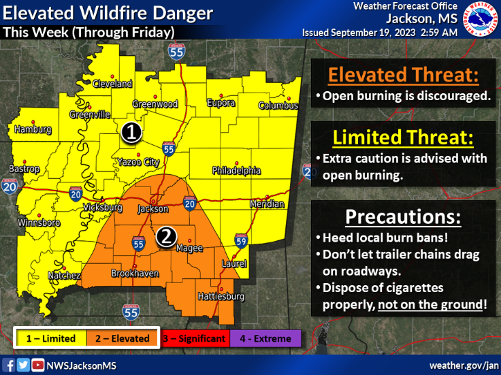
And also keep in mind that we have active burn bans in effect across much of the region, including the entire state of Louisiana and all of southern Mississippi.
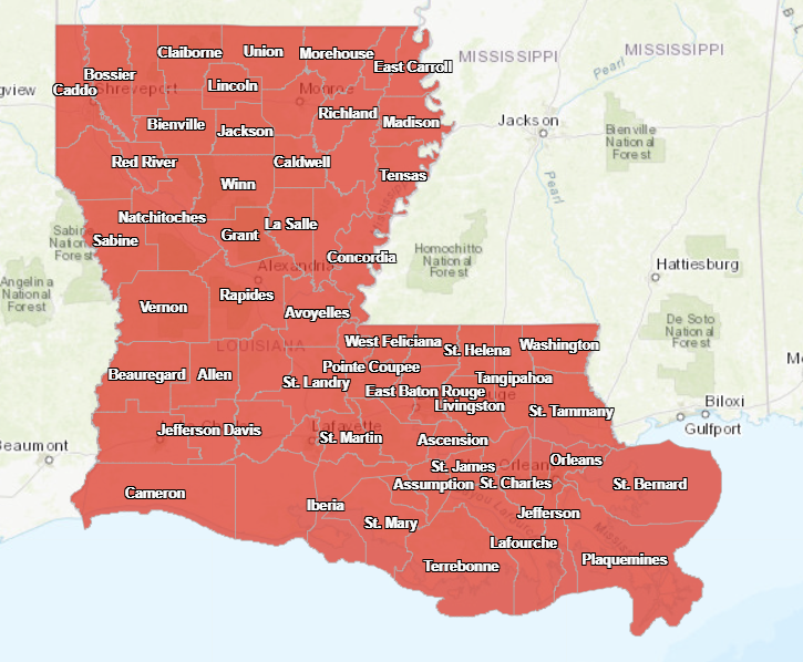
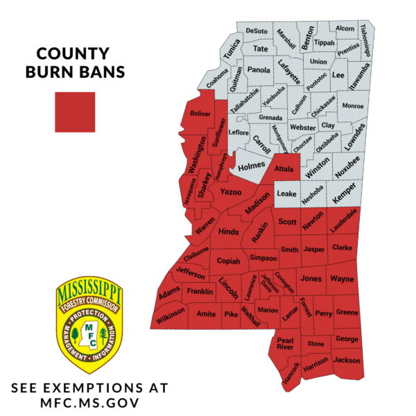
So, please avoid any outdoor burning until we get some meaningful rainfall.
[wpcode id=”41149″]
REGIONAL DAY TO DAY FORECAST
Tuesday: Sunny. Highs in the lower 90s. East winds around 5 mph.
Tuesday Night: Mostly clear. Lows in the mid 60s. Southeast winds around 5 mph, becoming east after midnight.
Wednesday: Sunny. Highs around 90. East winds around 5 mph, increasing to around 10 mph in the afternoon.
Wednesday Night: Mostly clear in the evening, then becoming partly cloudy. Lows in the upper 60s.
Thursday: Sunny. A slight chance of showers and thunderstorms in the afternoon. Highs in the lower 90s. Chance of rain 20 percent.
Thursday Night: Mostly clear. Lows in the mid 60s.
Friday: Sunny. Highs around 90.
Friday Night: Mostly clear. Lows in the mid 60s.
Saturday: Sunny. Highs in the lower 90s.
Saturday Night: Partly cloudy in the evening, then becoming mostly clear. Lows in the mid 60s.
Sunday: Sunny. A slight chance of showers and thunderstorms in the afternoon. Highs in the lower 90s. Chance of rain 20 percent.


Where in U.S. in summer has the lowest humidity but has flora? Want to buy a summer place.