Things continue to look good during the next 48 hours. Then the rain starts to move into the area on Saturday evening.
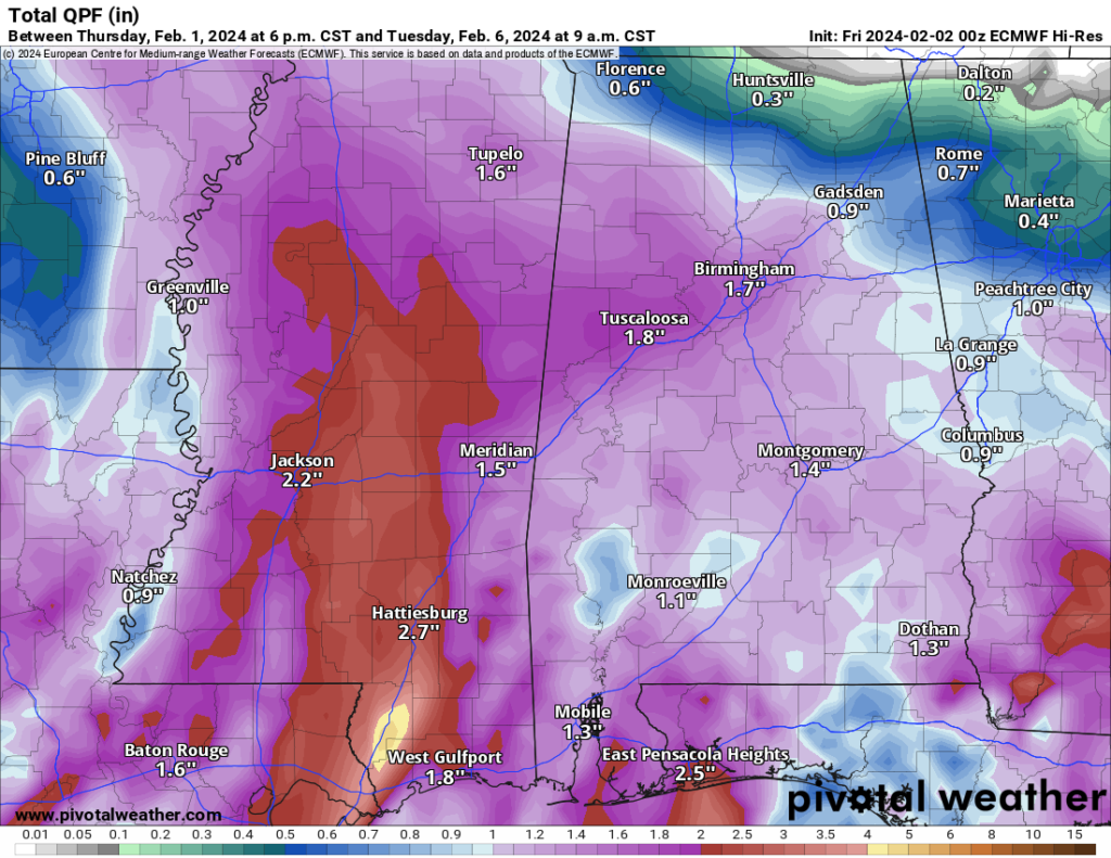
It looks like we will still be looking at a soggy Sunday with 1″ to 3″ of rain between Saturday evening and Monday morning. Flooding is looking less likely, but some spots may see some brief localized flooding for short bursts underneath some of the heaviest rainfall.
It will also be pretty breezy. So if you have any plans to be outside or tow anything, keep that in mind. I think wind gusts up to 30mph will be common on Sunday. With the wind possibly continuing into Monday, too.
Then things calm down and dry out for most of next week. The next system arrives as we move into next weekend. Thsi will bring another shot for some rain. Originally, some of the model guidance that can look out more than a week was suggesting a chance for severe weather, but I’m starting to get a bit more skeptical of that.
Speaking of longer-range model guidance, I went and grabbed the EC-VAREPS model that can look out about 40 days just to see what it was showing. And it continues to hint at a cooler Feb 13-20 for the area and then a quick shot of some colder air around the 25th.
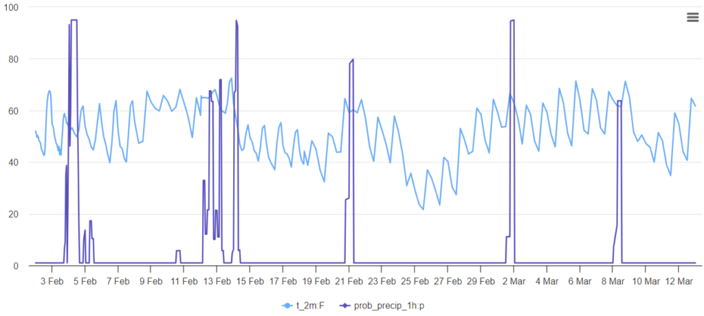
Neither of these look like any kind of “Deep freeze” or “Arctic Blast” at this point, but it may cool us back to below freezing for a few night and maybe even hold us around 40 for an afternoon high here and there.
I know there has been a lot of buzz about a big nasty cold February for the area, but there isn’t a lot of support for that in the model guidance right now. A few colder days? Sure, I think that is reasonable. But a full month that is really cold seems unlikely.
And, sorry kids, no snow in the forecast right now.
REGIONAL DAY TO DAY FORECAST
Thursday: Mostly sunny in the morning, then becoming mostly cloudy. Highs in the lower 60s. East winds around 5 mph, becoming south in the afternoon.
Thursday Night: Mostly cloudy. Lows around 40. South winds around 5 mph in the evening, becoming light and variable.
Friday: Sunny. Highs in the upper 60s. Southeast winds around 5 mph.
Friday Night: Mostly clear. Lows in the lower 40s. Southeast winds around 5 mph.
Saturday: Partly sunny. A slight chance of showers in the afternoon. Highs in the upper 60s. Chance of rain 20 percent.
Saturday Night: A slight chance of thunderstorms. Showers. Lows in the lower 50s. Chance of rain 90 percent.
Sunday: Mostly sunny with a slight chance of thunderstorms. Showers likely, mainly in the morning. Highs in the mid 60s. Chance of rain 70 percent.
Sunday Night: Mostly clear with a chance of showers with a slight chance of thunderstorms in the evening, then partly cloudy with a slight chance of showers after midnight. Lows in the mid 40s. Chance of rain 30 percent.
Monday: Mostly sunny. A slight chance for drizzle in the morning. Highs in the lower 60s. Chance of rain 30 percent.
Monday Night: Partly cloudy. Lows in the mid 40s.
Tuesday: Mostly sunny. Highs in the lower 60s.
Tuesday Night: Mostly clear. Lows in the lower 40s.
Wednesday: Sunny. Highs in the mid 60s.


