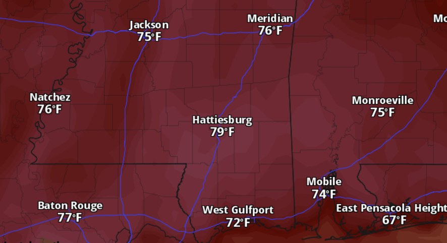
Get out and enjoy the weather during the next few days because it looks fantastic with highs in the upper 70s and low 80s. Humidity shouldn’t be too bad, either.
Next week will start out great, too. With highs will around 80. But we will see the clouds invade the area just about he time we want to look up and enjoy the eclipse. The raw data suggest there will be two layers of clouds that we will have to look through to see the eclipse – a layer up above 20,000ft and then another down around 3,000ft.
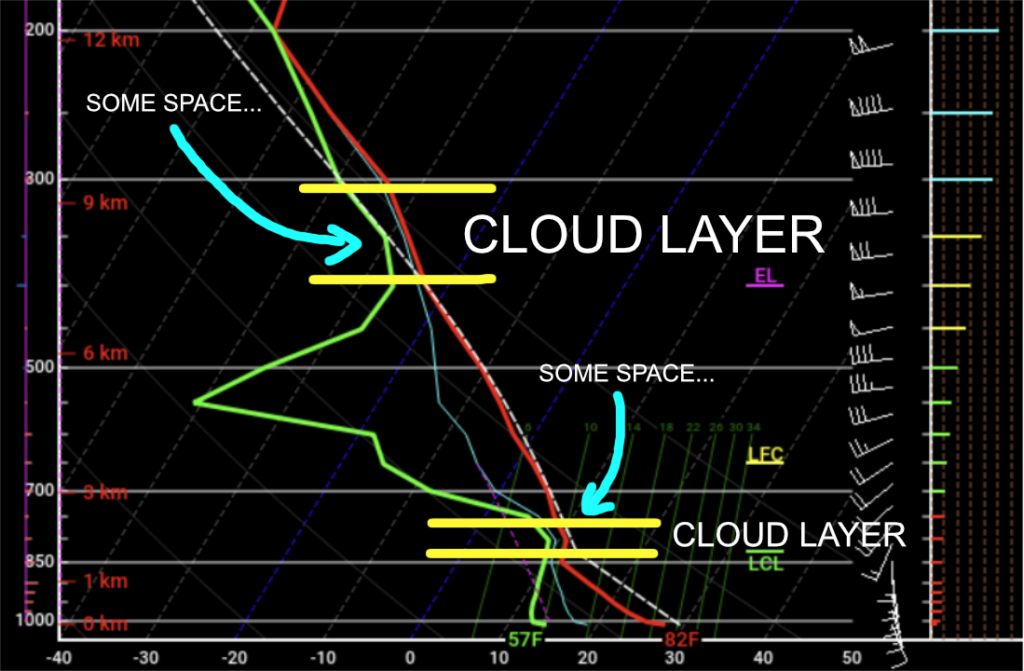
The good news is that both layers don’t look completely saturated. That means we could have some breaks in the clouds in some spots. So, we may get lucky enough to have a few spots across the region clear out at juuust the right time for juuuust long enough to see the eclipse.
But for the rest of us, it’ll be cloudy.
Then as we move through Tuesday and into Wednesday of next week we will have a shot for some storms – and the potential for severe weather.
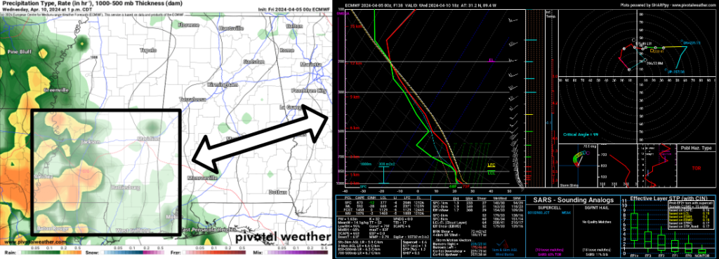
The Skew-T data show a pretty primed atmosphere for storms with heavy rain, lightning, gusty wind, hail and the potential to produce a few tornadoes.
Still a ways out, but model guidance – both the American and European – has been showing this now for four consecutive days, so I’m start to get a bit more confident in the potential.
Int he meantime, though, enjoy the nice weather! And lets all hope the clouds break up enough for us to enjoy the eclipse!
REGIONAL DAY TO DAY FORECAST
Today: Sunny. Highs in the upper 70s. North winds around 5 mph, becoming northwest with gusts up to 20 mph this afternoon.
Tonight: Mostly clear. Lows in the mid 40s. North winds around 5 mph.
Saturday: Mostly sunny. Highs in the upper 70s. East winds around 5 mph, becoming southeast in the afternoon.
Saturday Night: Partly cloudy. Lows in the lower 50s. South winds around 5 mph.
Sunday: Mostly sunny. Highs in the upper 70s. South winds 10 to 15 mph.
Sunday Night: Mostly cloudy. Lows around 60.
Monday: Partly sunny. A slight chance of showers and thunderstorms in the afternoon. Highs in the upper 70s. Chance of rain 20 percent.
Monday Night: Mostly cloudy. A slight chance of showers and thunderstorms after midnight. Lows in the mid 60s. Chance of rain 20 percent.
Tuesday: Mostly cloudy with a slight chance of showers and thunderstorms. Highs around 80. Chance of rain 20 percent.
Tuesday Night: Mostly cloudy. A slight chance of showers after midnight. Lows in the mid 60s. Chance of rain 20 percent.
Wednesday: Mostly cloudy with a chance of thunderstorms. A chance of showers in the morning, then showers likely in the afternoon. Highs in the upper 70s. Chance of rain 60 percent.
Wednesday Night: Showers likely with a chance of thunderstorms. Locally heavy rainfall possible. Lows in the lower 60s. Chance of rain 40 percent.
Thursday: Partly sunny with a chance of showers and thunderstorms. Highs in the upper 70s. Chance of rain 20 percent.


