Things are still looking pretty good into and through the weekend. Nice weather continues into the beginning of next week, too.
By the middle of next week, though, things will change as the next system swings into the area.


Both the SPC and the CIPS Analogs show a potential for severe weather with the next system. Though there is some question about much of a tornado threat will develop. This may end up being more of a wind threat closer to the Gulf Coast – leaving the tornado risk north of I-20 again.
Honestly, this next system isn’t anything to lose sleep over yet. Get out and enjoy the weekend and check back in with the forecast next week. There is still a fair bit to hammer out.
As of now, model guidance is showing a more linear setup with a squall line instead of individual supercells. It also shows an uncapped pre-frontal warm sector.
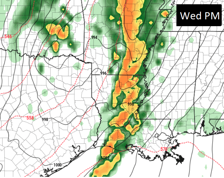
In English? Big, bad tornadoes less likely farther south and straight-line wind up to 70mph possible in the strongest storms. But knowing where those strongest storms would be and how many would develop is a big unknown.
Today
Sunny. Highs in the lower 70s.
Tonight
Clear. Lows in the mid 40s.
Saturday
Sunny. Highs in the mid 70s.
Saturday Night
Clear. Lows in the mid 40s.
Sunday
Sunny. Highs in the upper 70s.
Sunday Night
Mostly clear. Lows around 50.
Monday
Sunny. Highs in the lower 80s.
Monday Night
Clear. Lows in the upper 50s.
Tuesday
Sunny. Highs in the mid 80s.
Tuesday Night
Partly cloudy in the evening, then becoming mostly cloudy. Lows in the mid 60s.
Wednesday
Mostly cloudy in the morning, then partly sunny with a chance of showers and thunderstorms in the afternoon. Breezy with highs in the mid 80s. Sustained wind between 10 and 20mph, gusts to 30mph. Chance of rain 40-percent.
Wednesday Night
Showers and thunderstorms likely. Some storms may be severe. Lows around 65. Chance of rain 70-percent.
Thursday
Mostly cloudy in the morning with some lingering rain, clearing in the afternoon. Highs in the mid 70s. Chance of rain 30-percent.


