The next front is set to move through later this afternoon with a quick shot for some brief showers and storms, then we dry things back out overnight.
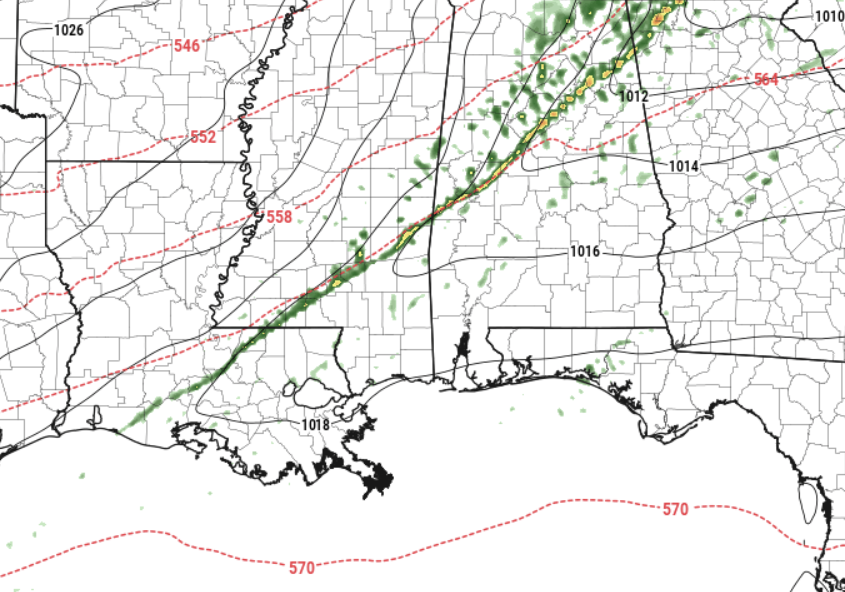
The rain today will not be very meaningful. In fact, if you aren’t looking out the window, you may miss it completely. The HRRR model, I think, has the best handle on things today with a thing line of rain passing from NW to SE across the area around midday.
Severe weather? Nope. But it may be a bit breezy during the rain and you may hear a few rumbles of thunder.
While things will be drier overnight, the rest of the week, weekend, and into next week looks a bit soggy. We will have an active weather pattern with multiple system zipping through the region offering a few rounds of rain as well as some spotty showers between the more organized rain.
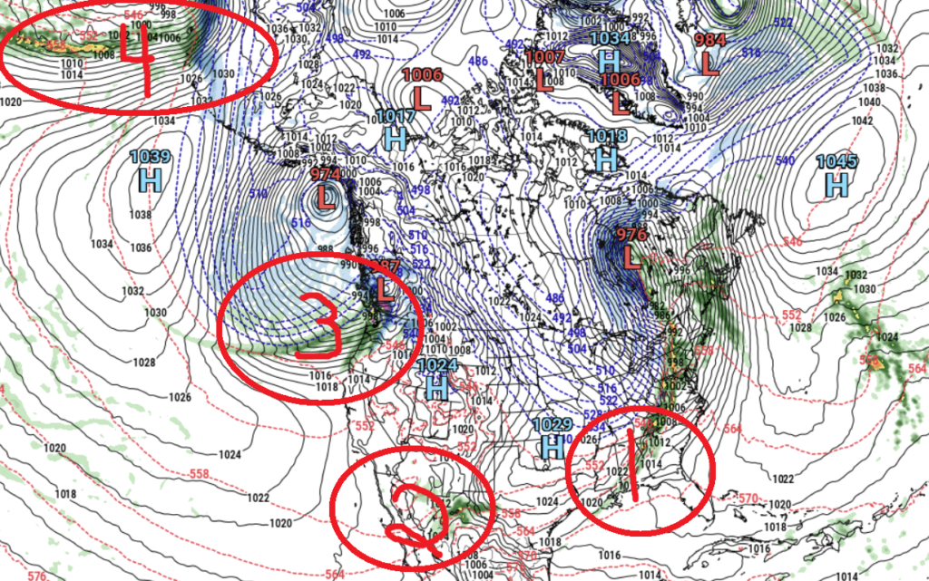
In fact, looking at the GFS model, we have four systems that will impact our local weather during the next seven days. So things are pretty active above us.
So far, it looks like the only one set to offer any meaningful chance for severe weather will be “System 4” but given how far away it is, I’m not ready to put too much stock in the eventual impacts. The current model guidance suggests it wouldn’t arrive until next Monday night and into Tuesday.
REGIONAL DAY TO DAY FORECAST
Wednesday: Mostly cloudy with a quick line of showers and storms cruising through this afternoo.. Highs around 80. Temperature falling into the upper 60s in the afternoon. Southwest winds around 15 mph, becoming northwest in the afternoon. Gusts up to 30 mph. Chance of rain 40 percent.
Wednesday Night: Mostly cloudy. Much cooler. Less humid with lows in the mid 40s. Northeast winds 15 to 20 mph with gusts up to 35 mph.
Thursday: Mostly cloudy. Much cooler with highs in the lower 60s. Northeast winds around 15 mph, diminishing to 5 to 10 mph in the afternoon.
Thursday Night: Mostly cloudy. A chance of showers after midnight. Lows in the lower 50s. East winds 5 to 10 mph. Chance of rain 30 percent.
Friday: A slight chance of thunderstorms. Showers. Highs in the upper 60s. Chance of rain 90 percent.
Friday Night: Cloudy with a few showers possible Lows in the upper 50s. Chance of rain 30 percent.
Saturday: Passing clouds. Can’t rule out a chance for rain. Highs in the mid 70s. Chance of rain 20 percent.
Saturday Night: Mostly cloudy. Lows in the upper 50s.
Sunday: Mostly cloudy with a few showers and storms possible. Highs in the mid 70s. Chance of rain 30 percent.
Sunday Night: Mostly cloudy. Lows in the lower 60s.
Monday: Mostly cloudy with a few showers and storms possible. Highs in the mid 70s. Chance of rain 30 percent.
Monday Night: Mostly cloudy with storms possible. Lows in the upper 50s. Chance of rain 30 percent.
Tuesday: Storms possible. Some severe.. Highs in the lower 70s. Chance of rain 40 percent.


