Happy Leap Day! Back in 2020, the last LEap Day, we hit 71F in the afternoon after waking up at the freezing mark! Not quite as cold this morning, nor will it be as warm this afternoon.
In fact, you have to go all the way back to Leap Day 2004 to find a day where we didn’t get into the 70s. And even then, we managed 67 degrees. We won’t likely get out of the low 60s today. And the last time we failed to reach 65F on Leap day was all the way back in 1996!
It will be a breezy, dry, and markedly cooler day today. As mentioned, highs will only top out in the low 60s. Yesterday we were in the 70s briefly and the day before some folks got near 80!
With the breezy conditions and lower humidity, the NWS continues to caution against any outdoor burning.
While the likelihood that something happens in our area like happened in the TExas panhandle two days ago is unlikely, but when it comes to fire on a day like today, I wouldn’t push my luck
The good news is that rain is back in the forecast as we move through the next few days, through the weekend and through next week. So if you lawn is looking parched, it’ll get some help from Mother Nature soon.
And we need the rain as the plants are all starting to wake up.
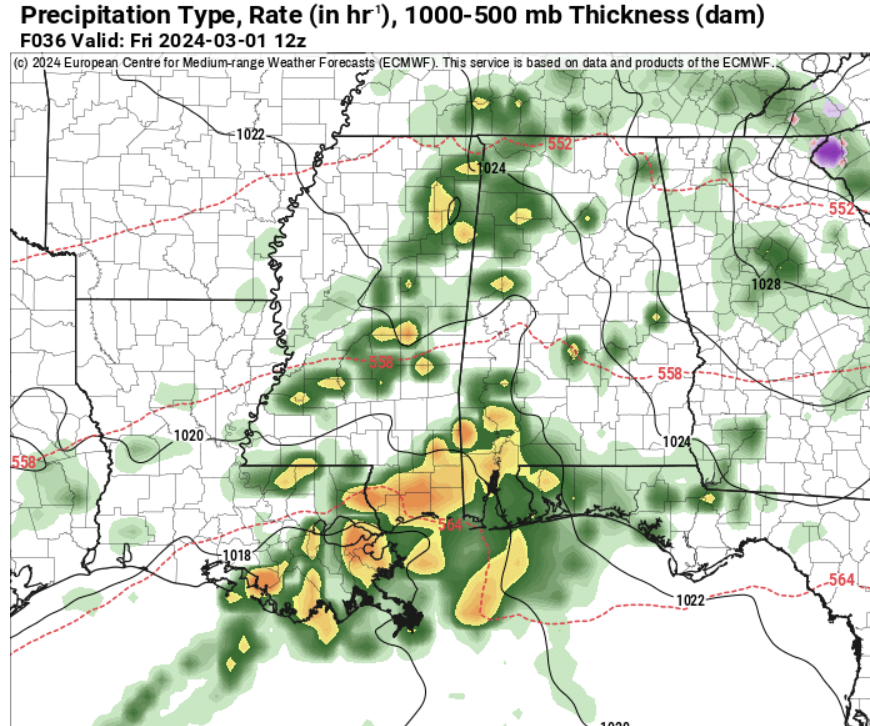
tomorrow morning the Euro model shows a fair bit of rainfall across the area. Teh good news is that there isn’t going to be any severe weather with this go-around – except right along the coast and out into the Gulf.
Instead, most of us will have a chilly rain with a few rumbles of thunder possible.
Then we get a weekend that should be mostly dry. We will have some hit-and-miss showers around, but I wouldn’t cancel any outdoor plans. Just make sure you have a place to duck inside if you are one of the unlucky ones that ends up underneath some light rain and drizzle.
Then, the next system arrives early next week – likely on Tuesday.
Model guidance shows that we warm back into the 70s as we march toward out next shot for rain. But it doesn;t look to have an big impact on temperatures.
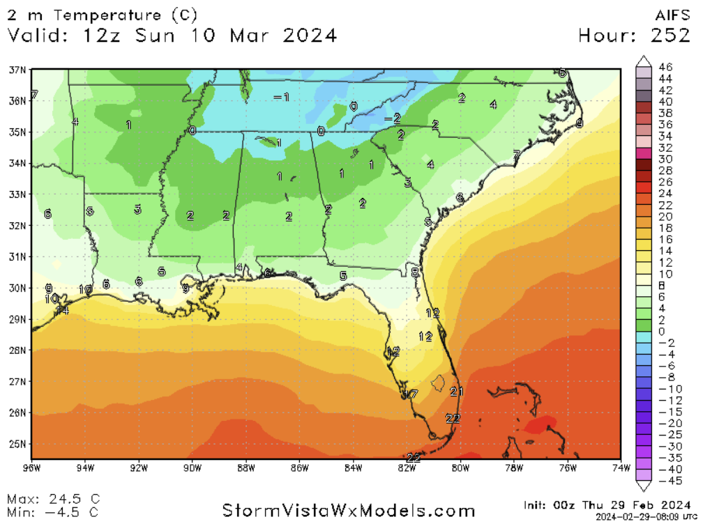
Teh next “shot” for cooler air may arrive around March 10th. The newest comptuer model out there, the AI-powered Euro model, the AIFS, shows temperatures in the 30s and 40s on the morning of the 10th.
That said, that is still quite a few days out.
For now, enjoy the rain and cooler temperatures. We will be begging for temperatures like this in a few short months!
REGIONAL DAY TO DAY FORECAST
Thursday: Mostly cloudy. Much cooler with highs in the lower 60s. Northeast winds 10 to 15 mph with gusts up to 25 mph.
Thursday Night: Cloudy. Showers likely with a slight chance of thunderstorms after midnight. Lows in the lower 50s. East winds 5 to 10 mph. Chance of rain 40 percent.
Friday: Showers with a slight chance of thunderstorms. More humid with highs in the upper 60s. Southeast winds 10 to 15 mph. Chance of rain 60 percent.
Friday Night: Mostly cloudy with a chance of showers with a slight chance of thunderstorms. Lows in the upper 50s. Southeast winds 5 to 10 mph, becoming west after midnight. Chance of rain 40 percent.
Saturday: Mostly cloudy in the morning, then becoming partly sunny. A chance of showers with a slight chance of thunderstorms. Highs in the mid 70s. Chance of rain 20 percent.
Saturday Night: Partly cloudy in the evening, then becoming mostly cloudy. Lows in the upper 50s.
Sunday: Mostly cloudy in the morning, then becoming partly sunny. A slight chance of thunderstorms. A slight chance of showers in the morning, then a chance of showers in the afternoon. Highs in the mid 70s. Chance of rain 20 percent.
Sunday Night: Mostly cloudy with a slight chance of thunderstorms. A slight chance of showers in the evening, then a chance of showers after midnight. Lows around 60. Chance of rain 20 percent.
Monday: Mostly cloudy in the morning, then becoming partly sunny. A slight chance of thunderstorms. A chance of showers in the morning, then showers likely in the afternoon. Highs in the mid 70s. Chance of rain 40 percent.
Monday Night: Mostly cloudy with a chance of showers with a slight chance of thunderstorms. Lows in the upper 50s. Chance of rain 40 percent.
Tuesday: Mostly cloudy in the morning, then becoming partly sunny. A slight chance of thunderstorms. A chance of showers in the morning, then showers likely in the afternoon. Highs in the lower 70s. Chance of rain 60 percent.
Tuesday Night: Mostly cloudy with a chance of showers with a slight chance of thunderstorms. Lows in the mid 50s. Chance of rain 30 percent.
Wednesday: Mostly cloudy in the morning, then becoming partly sunny. A chance of showers with a slight chance of thunderstorms. Highs in the lower 70s. Chance of rain 10 percent.


