We have some added visibility to the outcome on Tuesday as the higher resolution model guidnace can now “see” what may shake out on Tuesday afternoon and evening. The Storm Prediction Center has bumped up the risk for severe weather across parts of the area closer to I-20, but otherwise, there hasn’t been any big changes to the forecast.
The HRRR model isn’t very impressed by the line of potential storms set to move through the area. Looking at the estimated radar imagery, the HRRR model suggests a thin line of gusty showers with some rumbles of thunder. Rainfall totals less than one inch and some folks may not even see rain at all.
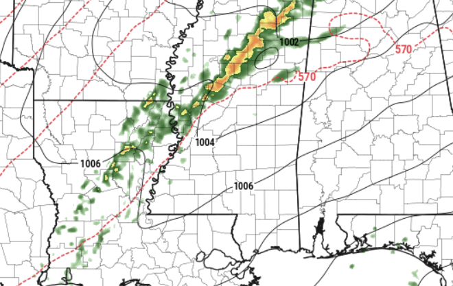
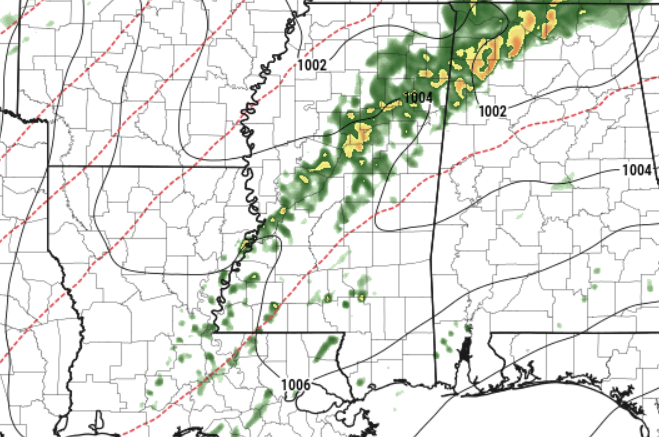
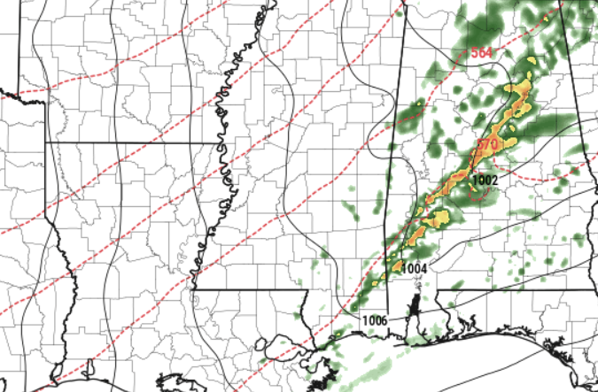
There is one asterisk I need to add to this, though: if a lone storm can get better establish, it may produce some stronger wind gusts and produce some hail. I don’t think we have to worry about damaging hail, but if you have a metal roof and end up underneath one of these stronger storms, it may be rather loud.
So far, it looks like the tornado threat is pretty low.
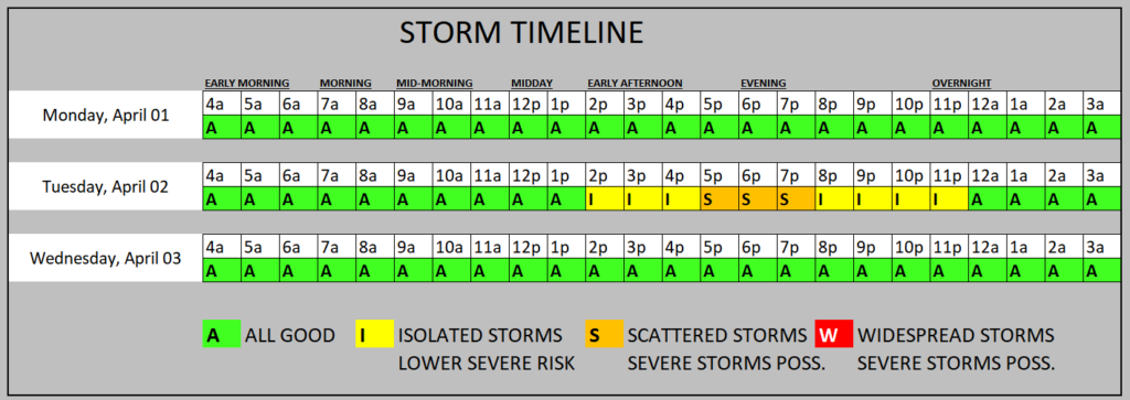
Once this little front slides through, we go back to nice weather! And after the blitzkrieg of weekly severe storms during the last five years in the Spring, it sure is nice to have a few weeks of – generally – nice weather.
REGIONAL DAY TO DAY FORECAST
Monday: Mostly cloudy in the morning, then becoming partly sunny. Patchy fog in the morning. Highs in the lower 80s. South winds 5 to 10 mph.
Monday Night: Mostly cloudy. Lows in the mid 60s. South winds 10 to 15 mph.
Tuesday: Mostly cloudy in the morning, then partly sunny with a slight chance of showers and thunderstorms in the afternoon. Better chance for rain the farther north you live. Highs in the mid 80s. South winds 15 to 20 mph with gusts up to 30 mph. Chance of rain 20 percent.
Tuesday Night: Mostly cloudy. A slight chance of showers and thunderstorms in the evening. Lows in the upper 50s. Southwest winds 10 to 15 mph, becoming west after midnight. Chance of rain 20 percent.
Wednesday: Mostly sunny. Cooler with highs in the lower 70s.
Wednesday Night: Clear, cooler with lows in the mid 40s.
Thursday: Sunny. Highs in the lower 70s.
Thursday Night: Clear. Lows in the lower 40s.
Friday: Sunny. Highs in the lower 70s.
Friday Night: Clear. Lows in the lower 40s.
Saturday: Mostly sunny. Highs in the mid 70s.
Saturday Night: Partly cloudy. Lows in the upper 40s.
Sunday: Sunny. Highs in the upper 70s.


