The potential for widespread storms and impactful severe weather next week continues to diminish. So we have some good news to report on the weather forecast today.
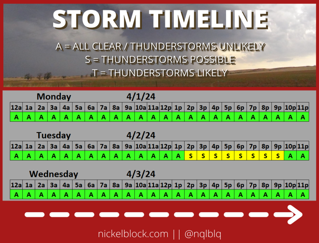
I still think there will be a few renegade storms trying to move across the area, but they should be pretty isolated and don’t look like they’ll be able to tap into much energy in the atmosphere.
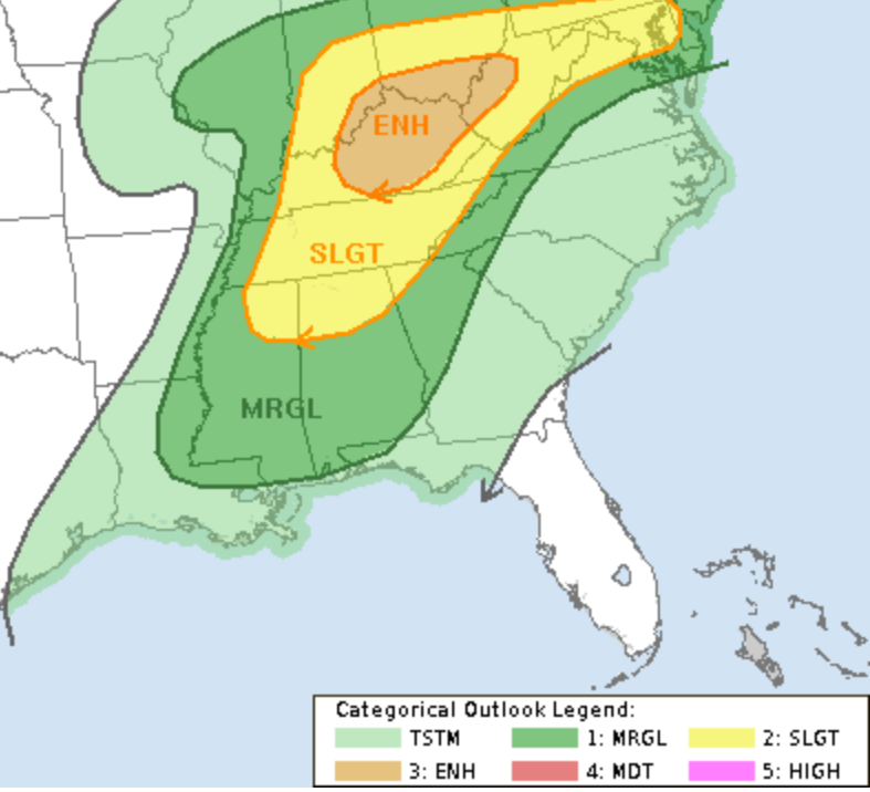
The Storm Prediction Center shows the highest risk for severe weather up along the Ohio River Valley. The CIPS Analogs continues to – stubbornly – show our area with a higher risk for storms.
It’s actually a great example of how tricky severe weather forecasting can be for the Gulf Coast if you don’t know what you are looking for (or, if you are not a human). Because this event is one of those ‘when all of the pieces are in place, but nothing is there to be the catalyst’ events. So, on paper, it looks like a slam dunk for severe weather. But once you investigate things, it really isn’t.
CURIOUS ABOUT THIS SUMMER AND HURRICANE SEASON, CHECK OUT THE MARCH OUTLOOK FOR SUMMER HERE
Again, good news for us.
More good news? Okay, it looks like the next seven days should be pretty nice weather-wise. So get out and enjoy it!
REGIONAL DAY TO DAY FORECAST
Today: Patchy fog this morning. Partly sunny. Highs in the lower 80s. South winds 10 to 15 mph.
Tonight: Mostly cloudy. Patchy fog after midnight. Lows in the mid 60s. South winds 5 to 10 mph.
Monday: Mostly cloudy. Highs in the lower 80s. South winds 10 to 15 mph.
Monday Night: Mostly cloudy. Patchy fog after midnight. Lows in the mid 60s. South winds around 10 mph.
Tuesday: Mostly cloudy in the morning, then partly sunny with a chance of showers and thunderstorms in the afternoon. Highs in the lower 80s. South winds 10 to 15 mph with gusts up to 25 mph. Chance of rain 40 percent.
Tuesday Night: Mostly cloudy. A slight chance of showers and thunderstorms in the evening. Lows in the upper 50s. Chance of rain 20 percent.
Wednesday: Sunny, cooler with highs in the lower 70s.
Wednesday Night: Clear, cooler with lows in the mid 40s.
Thursday: Sunny. Highs in the lower 70s.
Thursday Night: Clear. Lows in the lower 40s.
Friday: Sunny. Highs in the mid 70s.
Friday Night: Mostly clear. Lows in the mid 40s.
Saturday: Mostly sunny. Highs in the mid 70s.


