Howdy!
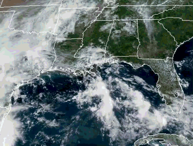
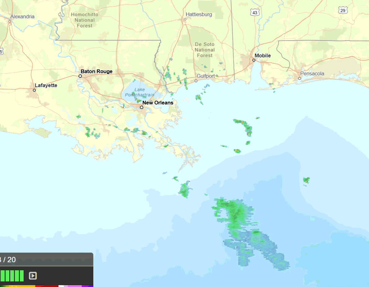
Looking out the window, we can see there are quite a few clouds over Louisiana and central/southern Mississippi, and looking at the radar we can see there are a few scattered showers going on currently in southern LA and MS. Not much going on for a lot of the region (as I am typing this).
TODAY
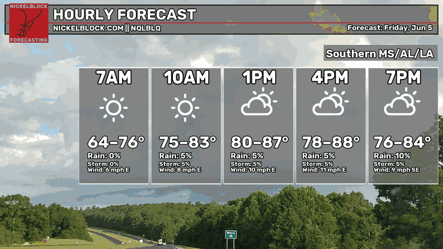
Temperatures are currently in the lower 80s and will warm up to the upper 80s throughout the day. Dewpoints are in the low 70s for much of the region, greatest in New Orleans and Baton Rouge, decreasing as you head more north towards Jackson and Meridian.
There is no change to the forecast today from yesterday, everything is playing out how I expected. The stationary front I mentioned yesterday is well out of the gulf now, but we do have a weak tropical wave propagating through the gulf into our region. This is what is giving us all the moisture and chances of rain (which I did not mention yesterday).
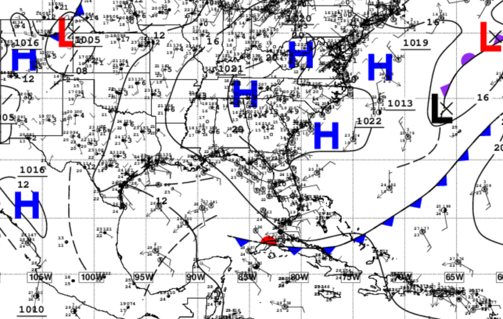
Above is a surface analysis from the National Hurricane Center. We can see that tropical wave denoted as a trough axis right in the gulf (the black dashed line), those south/southeasterly winds bringing in the tropical moisture.
Now is a good time to mention that there is a low-end chance of “minispinny” tornadoes forming. With the tropical wave boundary, weaker instability and weak wind shear in our area, there is a slight possibility of getting weak, short-lived tornadoes.
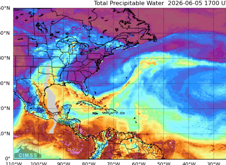
These tornadoes form differently than the typical supercell tornadoes we are all used to, these ones form along existing, intersecting boundaries or due to weak tropical influences moving onshore. Just to really get it through, we can see that tropical moisture flowing onshore in the Total Precipitable Water model below. Very moist and humid for the next few days.
TOMORROW
Slight change to the forecast for tomorrow. Temperatures are a little warmer by a few degrees than what they were forecasted yesterday, warmest in the early afternoon and decreasing into the evening once again.
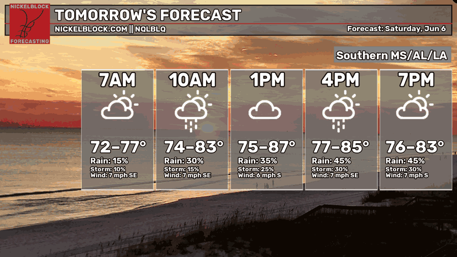
There still will be rain for much of Mississippi and Louisiana especially in the afternoon, a little of central Alabama can see some rain as well. The numerous showers and thunderstorms have the chance of producing a lot of rainfall through Saturday and Sunday, along with wind and lightning.
With all of this in mind, make sure to stay weather aware this weekend and keep dry!


