We are looking at another few days of dry weather before showers and storms return to the forecast this weekend. Severe weather is less likely for us, but can’t be completely ruled out. The highest risk for severe weather across this region during this go-around will be in Louisiana. for others, localized brief flash flooding is the only concern.
I don’t think it’ll look anything like the region in 2016 by any means, or even like Petal a few years back, but if storms line up like they are shown to in some model guidance, some folks may get ponding in their yards, water over some roads, and creeks may swell for a short period of time.
This will be mainly a concern for Louisiana and Mississippi. Lower Alabama won’t see as much rainfall. And that is shown pretty well in some of the model guidance. The GFS and Euro models both cake the area with a good 0.5″ to 2.5″ of rain.
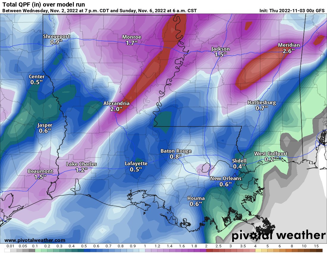
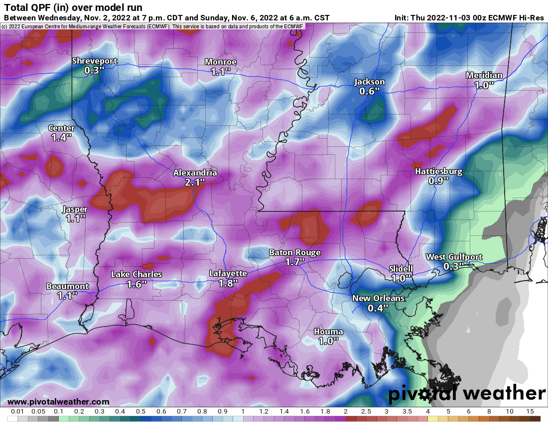
This is much-needed rainfall, but may come down just a hair too fast for the ground to soak up. That is why there is a concern for localized, brief flash flooding. Again, not a major concern, just something to be aware of as you go about your day on Saturday.
This won’t be much of a “cold” front, either, as temperatures aren’t going to cool down much (if at all) behind it.
Our next weather-maker may be more than a week away after this rain rolls through, too. So the hope is that we get enough to quench the thirst of the plants that are holding on (desptie that early season frost) at the end of the growing season.
DAY TO DAY FORECAST
Today
Sunny. Highs in the lower 80s.
Tonight
Mostly clear. Lows in the upper 50s.
Friday
Mostly sunny. Highs in the lower 80s. Breezy. Southeast winds 5 to 15 mph, gusts up to 20 mph.
Friday Night
Increasing clouds. A shower possible. Lows in the lower 60s. Breezy. Southeast winds 5 to 15 mph, gusts up to 25 mph. Chance of rain 20 percent.
Saturday
Mostly cloudy with rain and storms likely. Highs in the upper 70s. Chance of rain 70 percent.
Saturday Night
Mostly cloudy with lingering storms possible before midnight. Lows in the lower 60s. Chance of rain 20 percent.
Sunday
Mostly sunny. Highs in the lower 80s.
Sunday Night
Mostly clear. Lows in the lower 60s.
Monday
Sunny. Highs in the lower 80s.
Monday Night
Mostly clear. Lows in the lower 60s.
Tuesday
Sunny. Highs in the lower 80s.
Tuesday Night
Mostly clear. Lows in the upper 50s.
Wednesday
Sunny. Highs in the upper 70s.


