REMINDER: Check your settings on the app! Starting next week, I’m going to be sending out a ‘morning ping’ with an updated forecast. If you want to opt-out of that, I’ve made that possible. Check out this link for more info: https://www.nickelblock.com/you-control-your-pings-on-the-nickelblock-forecasting-weather-app-new-features/
For today’s forecast, I tried something a bit different. I took a look at all of the forecast discussions from the surrounding NWS offices and asked ChatGPT to summarize them all in one forecast. And here is what it gave me:
The weather conditions across the ArkLaMiss region will be affected by an upper low pressure system that is expected to persist through Thursday. This system will be responsible for increasing Precipitable Water Values (PWATs) steadily in the southeast, leading to scattered to numerous rain chances in the east and isolated to scattered ones in the west.
Thunderstorms are also possible, particularly in the east, where instability levels may range from 500 – 1000 J/kg in the afternoon. However, there are some factors that may limit the strength of these thunderstorms, including unimpressive lapse rates, dewpoints that may not exceed 60 degF, and decreased updraft production. Cloud cover will also be prevalent throughout the day, resulting in below-average highs ranging from the low 60s to near 70.
As the upper low lifts northeast by tonight, rain chances will decrease, and cloud cover will persist overnight for most of the region, except for the western areas, which will start seeing drier air filtering in. Friday is expected to be relatively clear, with isolated PoPs for the Golden Triangle as there may be convergence on the backside of the low, which could lead to a band of showers. On Saturday, the region should brace itself for a longwave upper trough advancing from the intermountain region, which is expected to provide mainly lighter isolated WAA shower activity by Saturday morning.
However, the latest guidance indicates that there could be developing coastal convection from a Southern stream upper jet streak on Saturday. It is unclear how this may impact later activities, but it will be one to watch. Although convection is expected to be limited throughout most of the day Saturday due to mid-level caps and a lack of larger scale forcing, there may be some severe thunderstorms by late afternoon as initially marginal deep layer shear increases, forcing development in the unstable regime ahead of the front from the ArkLaTex into the Mid South.
The threat of severe thunderstorms could include potential for damaging wind gusts and large hail, with a limited tornado threat since low-level wind fields are currently forecast to be lackluster. Rain and storm chances will end by Sunday morning as the front exits the region. A brief cool down will ensue at the beginning of next week as ridging builds eastward, with dry weather conditions, followed by a warming trend toward the end of the week as the ridge shifts east of the area.
Regarding the current surface low, it has formed off the coast of Mobile and is expected to move northward through the day and exit the region early Friday. Coastal areas of MS will experience persistent light rain showers throughout the day, with pockets of moderate to heavy rainfall possible. However, most of the region will see light rainfall. Once the surface low exits the area tomorrow, brief high pressure will set in on Friday, resulting in dry and mostly clear skies.
This change in weather conditions will cause a significant jump in afternoon high temperatures, with most areas expecting upper 70s to low 80s compared to Thursday’s high temps in the upper 60s to low 70s. The upper low that is part of a Rex Block pattern and centered over southwest Louisiana will drift slowly to near the border of central Mississippi/central Alabama through Thursday, with the HRRR and 12Z GFS providing fairly accurate predictions of its track.
These models show the surface low to be located about 190 miles south of the mouth of the Mississippi River, and they deepen the surface low while taking it to coastal Mississippi by 12Z Thursday. The HRRR/GFS then continue the surface low slow.
Actually pretty impressive. It isn’t as easy to follow as it would be if a human wrote it, but it also isn’t terrible, either.

In short, there is a chance for rain today – all day – as this little area of low pressure moves through. Rain may be heavy at times and there will be a few spots that see up to 3″ to 4″ of rainfall. This may lead to some brief, localized flash flooding.

This clears out just in time for the next cold front to arrive. But the next front doesn’t look very potent. Almost has a ‘Late May’ look to it. So instead of tornadoes and hail, we may be talking about heavy rain, lightning and wind.
TODAY’S MAPS
Here is a look at the maps for today using our new in-house weather model:
Image Viewer
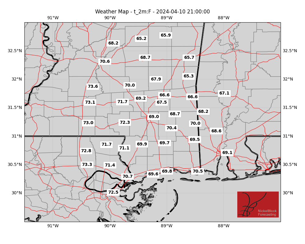
I continue to work on these, but for now, this is just a snapshot of this afternoon around 3pm. The highs, general wind, dewpoint, etc. I’m still working on a way to allow everyone to view these images for the entire day all at once.
AG FORECAST
Here is a look at the Ag Forecast for all of you farmers and gardeners out there. If there is any weather-related info you’d like added to this, don’t hesitate to reach out!

For a full-size image of this forecast, CLICK HERE
REGIONAL DAY TO DAY FORECAST
Today: Showers with a slight chance of thunderstorms this morning, then a chance of showers and thunderstorms this afternoon. Highs in the upper 60s. North winds 10 to 15 mph, becoming west this afternoon. Chance of rain 90 percent.
Tonight: Mostly cloudy. A slight chance of showers in the evening. Lows in the mid 50s. Southwest winds 5 to 10 mph with gusts up to 20 mph. Chance of rain 20 percent.
Friday: Partly sunny in the morning, then clearing. Not as cool with highs in the upper 70s. West winds 5 to 10 mph.
Friday Night: Mostly clear in the evening, then becoming mostly cloudy. Lows in the upper 50s. South winds around 5 mph.
Saturday: Mostly cloudy with a slight chance of thunderstorms. A chance of showers. Highs in the upper 70s. South winds 5 to 10 mph. Chance of rain 50 percent.
Saturday Night: Mostly cloudy with a slight chance of thunderstorms. A chance of showers. Lows in the lower 60s. Chance of rain 50 percent.
Sunday: Mostly cloudy with a slight chance of showers in the morning, then mostly sunny in the afternoon. Highs in the mid 70s. Chance of rain 20 percent.
Sunday Night: Mostly clear. Cooler with lows in the upper 40s.
Monday: Sunny. Highs in the mid 70s.
Monday Night: Clear. Lows in the upper 40s.
Tuesday: Sunny. Highs in the lower 80s.
Tuesday Night: Partly cloudy in the evening, then becoming mostly cloudy. Lows in the mid 50s.
Wednesday: Partly sunny. Highs in the lower 80s.


