It will be quite a bit calmer today with the wind easing back and the chance for rain near zero. We may have a few clouds in the area, but that is about as ‘severe’ as the weather should get for today.
Tomorrow, though, we have to deal with more storms. And it looks like they may come in two rounds and both rounds may have a chance to offer a severe storms with brief heavy rain, lightning, gusty wind, and small hail. And perhaps even the chance for a brief tornado.
The first round of storms looks to arrive in the late afternoon / early evening on Saturday. And the second round of storms shows up overnight Saturday and into Sunday morning.
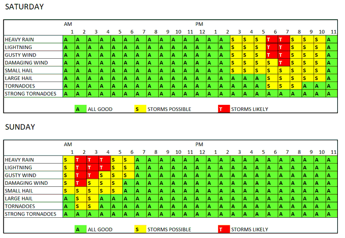
It looks like, at this time, that the first round of storms will be mainly for area along and south of HWY 98 and the second round of storms will be mainly for areas north of HWY 98, but I think there may be some crossover in there, too, so I’d prepare like it was going to impact everyone for the moment.
Once this rolls through, it looks like we stay dry to start next week.
TODAY’S MAPS
EDIT: Looks like my code hit a hiccup this AM. I’ll try to fix this tonight! But if the maps are blank ft or the ou… Don’t worry! It’s my fault, not yours.
Here is a look at the maps for today using our new in-house weather model:
Image Viewer
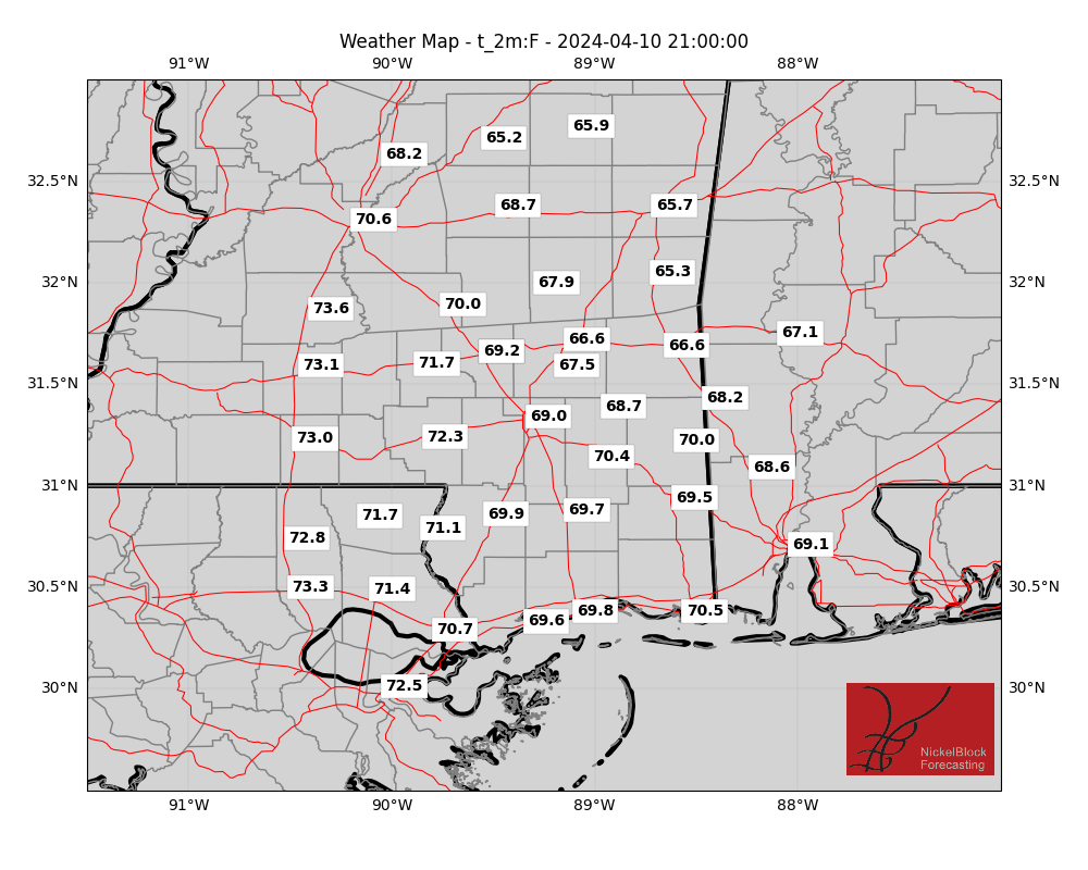
I continue to work on these, but for now, this is just a snapshot of this afternoon around 3pm. The highs, general wind, dewpoint, etc. I’m still working on a way to allow everyone to view these images for the entire day all at once.
AG FORECAST
Here is a look at the Ag Forecast for all of you farmers and gardeners out there. If there is any weather-related info you’d like added to this, don’t hesitate to reach out!

For a full-size image, CLICK HERE
REGIONAL DAY TO DAY FORECAST
Today: Mostly sunny. Not as cool with highs in the upper 70s. Southwest winds 5 to 10 mph.
Tonight: Partly cloudy. Lows in the upper 50s. South winds 5 to 10 mph.
Saturday: Partly sunny with a chance of showers with a slight chance of thunderstorms in the morning, then mostly cloudy with showers with a chance of thunderstorms in the afternoon. Highs in the upper 70s. Temperature falling into the lower 70s in the afternoon. Southeast winds 5 to 10 mph. Chance of rain 80 percent.
Saturday Night: Mostly cloudy with a chance of showers with a slight chance of thunderstorms. Lows in the mid 60s. Southeast winds around 10 mph, becoming southwest after midnight. Chance of rain 50 percent.
Sunday: Partly sunny with a slight chance of showers and thunderstorms in the morning, then sunny in the afternoon. Highs in the mid 70s. West winds 10 to 15 mph with gusts up to 25 mph. Chance of rain 20 percent.
Sunday Night: Mostly clear. Much cooler with lows in the upper 40s.
Monday: Sunny. Highs in the mid 70s.
Monday Night: Clear. Lows in the upper 40s.
Tuesday: Sunny. Highs around 80.
Tuesday Night: Partly cloudy in the evening, then becoming mostly cloudy. Lows in the mid 50s.
Wednesday: Partly sunny. Highs in the lower 80s.
Wednesday Night: Mostly clear. Lows in the upper 50s.
Thursday: Sunny. A slight chance of showers in the afternoon. Highs in the mid 80s. Chance of rain 20 percent.


