Today promises to be a fairly active weather day with two rounds of thunderstorms pushing through the Southeast, particularly Texas, Louisiana, Mississippi, and Alabama.
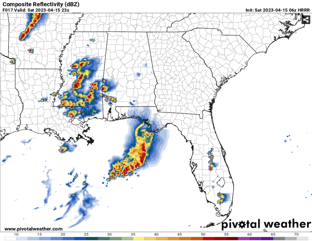

Round one and round two. Images courtesy of Pivotal Weather.
Round one is from a surface high that formed near the Texas portion of the Gulf which is moving towards the central Gulf near Louisiana and Mississippi. With it, it will push thunderstorms towards Louisiana moving northeast into Mississippi by the early afternoon. Our main threat will be heavy rain upwards of 1 inch and even some flash flooding possible depending on the cells that develop. Hail is even possible with some of these storms along with a spin-up tornado, so be on alert this afternoon into the evening if there are any NWS warnings. Our main timeline for these storms start after 1 pm and will continue until about 9 pm.
Round 1 main concerns: localized heavy rain, hail, winds, and a possible tornado

Round two is coming from a cold front way up North near Lake Superior which is finally starting to move. The SPC’s main concern is towards Arkansas into Illinois, however portions of the Mississippi Delta may see some significant severe weather as well. As for us in the Pinebelt, the line of storms will mature as they pass through the Delta and will begin to weaken in intensity overnight as they push past Jackson. Nevertheless, we still have some chance of severe weather with this. This line is fairly well put together which means that heavy rain, lightning, hail, but most importantly, straightline winds (some damaging) will be our main concern. Of course a possible tornado won’t be ruled out either. Our timeline for these storms will start around 1 am for our westernmost counties and push through the central Pinebelt around 2-4 am continuing on until around 6-7 am.
Round 2 main concerns: heavy rain, damaging winds, lightning, tornadoes
Sunday looks to be like a much better day. The cold front will push through after the line of storms overnight which will keep temperatures down to the upper 60’s and low 70’s and also keep us fairly dry! The clouds will begin to clear out throughout the day which means much nicer weather to end off the weekend.

Regional Day-to-Day Forecast
Today – A chance of showers and thunderstorms in the early afternoon and into the evening. Cloudy, with a high near 77. South southeast wind 5 to 10 mph. Chance of precipitation is 70%. New rainfall amounts between a quarter and half of an inch possible.
Tonight – A chance of showers and thunderstorms after midnight into the early morning. Cloudy, with a low around 63. South wind 5 to 10 mph shifting west after midnight. Chance of precipitation is 70%. New rainfall amounts between a quarter and half of an inch possible.
Sunday – A 30 percent chance of showers in the early morning. Mostly cloudy through mid morning, then gradual clearing, with a high near 70. West northwest wind 5 to 10 mph, with gusts as high as 20 mph.
Sunday Night – Clear, with a low around 48. Northwest wind 5 to 10 mph, with gusts as high as 20 mph.
Monday – Sunny, with a high near 74. Northwest wind 5 to 10 mph.
Monday Night – Clear, with a low around 48. Northwest wind around 5 mph becoming calm in the evening.
Tuesday – Sunny, with a high near 80. Light east wind becoming southeast 5 to 10 mph in the morning.
Tuesday Night – Mostly cloudy, with a low around 56. South wind around 5 mph becoming calm in the evening.
Wednesday – Partly sunny, with a high near 80. South southeast wind 5 to 10 mph, with gusts as high as 20 mph.
Wednesday Night – Partly cloudy, with a low around 60.
Thursday – A 20 percent chance of showers and thunderstorms. Mostly sunny, with a high near 86.
Thursday Night – A 20 percent chance of showers. Mostly cloudy, with a low around 66.
Friday – A 40 percent chance of showers and thunderstorms. Partly sunny, with a high near 85.
(adsbygoogle = window.adsbygoogle || []).push({});

