Hello everybody, there will be another rainy day for the storms to fire up in the afternoon and evening. In the morning, it will be a cloudy with the temperature low will be in the upper 70s. Throughout the day the dew point will be in the low 70s. It will be a muggy humid day with scattered thunderstorms in the afternoon and evening.
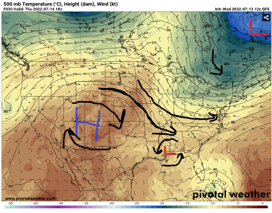
As the high pressure moving out to the west will provide a push for the cold front boundry coming down to the Southeast. This will bring slightly colder air to near the humid air from the Southeast to create these storms for today.
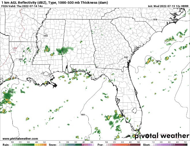
In the morning the storms will start to develop in the northern part of Mississippi and Alabama. Then the storms will start moving down south to Gulf of Mexico. While the low pressures system hovering around the coast, it seems like it is gathering the disorganize thunderstorms in the Gulf of Mexico. In the next few days, the thunderstorms in the Gulf will bring in heavy rain to the nearby areas in the coast.
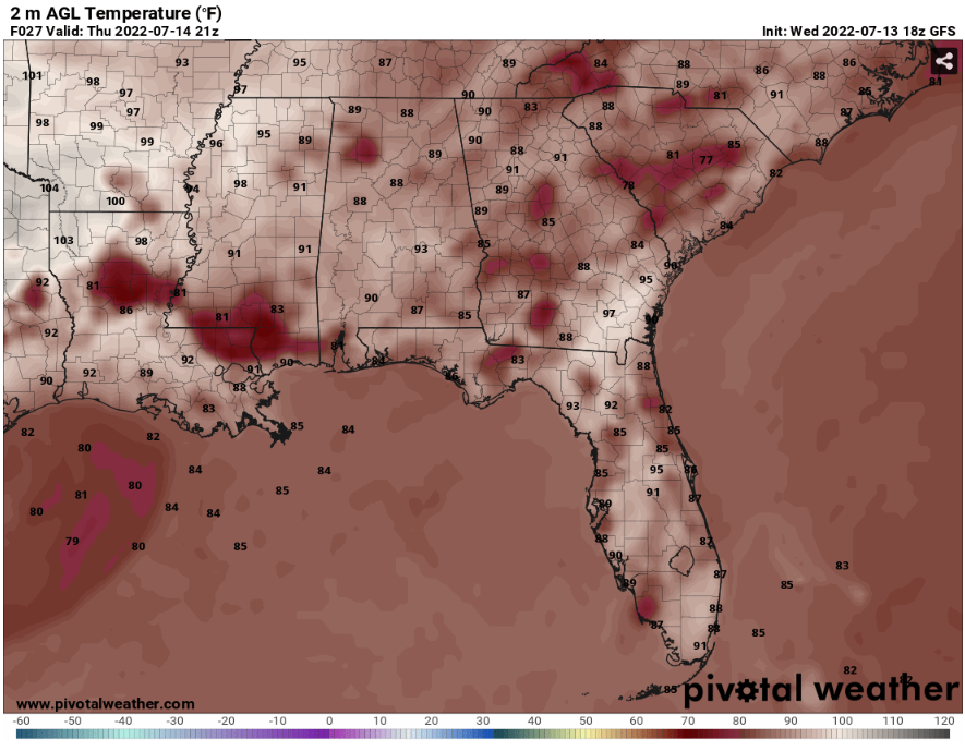
The coast will have cooler temperatures than the surrounding areas because the thunderstorms coming down south to the coast. The high temperature will be in the low 80s to mid 80s and the surrounding areas will be in the low 90s.
Day to Day Forecast
Thursday
Partly Cloudy in the morning and thunderstorms happening in the afternoon. With the temperatures high will be in mid 80s to low 90s. The heat Index values will go up to mid 90s. There will be a 70% for showers and thunderstorms.
Friday
Partly cloudy, with the temperatures high will be in upper 80s to low 90s. The heat index values will go up to upper 90s to low 100s. There will be a 60% chance for scattered showers and thunderstorms.
Saturday
Partly cloudy with afternoon showers or thunderstorms, with the temperatures high will be in low 90s. The heat index values will go up to low 100s. There will be a 40% chance for showers and thunderstorm.
Sunday
Mostly sunny skies with scattered showers or thunderstorms in the Afternoon. With the temperatures high will be in low 90s. The heat index values will go up to low 100s. There will be a 50% chance for showers and thunderstorms.
Monday
Sunny with some clouds and showers, with temperatures high in the low 90s. The heat index values will go up to mid 90s. There will be a 50% chance for showers and thunderstorms.
Tuesday
Sunny with some clouds and showers, with temperatures high in the upper 80s. The heat index values will go up to low 100s. There will be a 50% chance for showers and thunderstorms.
Wednesday
Sunny with showers and thunderstorms in the afternoon, with temperatures high in the low 90s. The heat index values will go up to low 100s. There will be a 50% or showers and thunderstorms.


