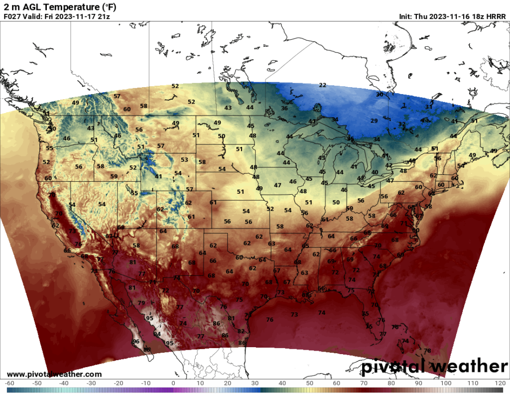

Heading into the weekend, temperatures will be, for lack of a better word, fairly normal for this time of year. It seems a bit strange to not be writing about a crazy cold spell or unseasonably warm temperatures, I must admit. The South will see pleasant temperatures, and most of the northern states will see chilly but not frigid weather. One thing I will note is a weak but fast-moving cold front that will sweep across the Midwest tonight and tomorrow and reach the Northeast by Friday evening.
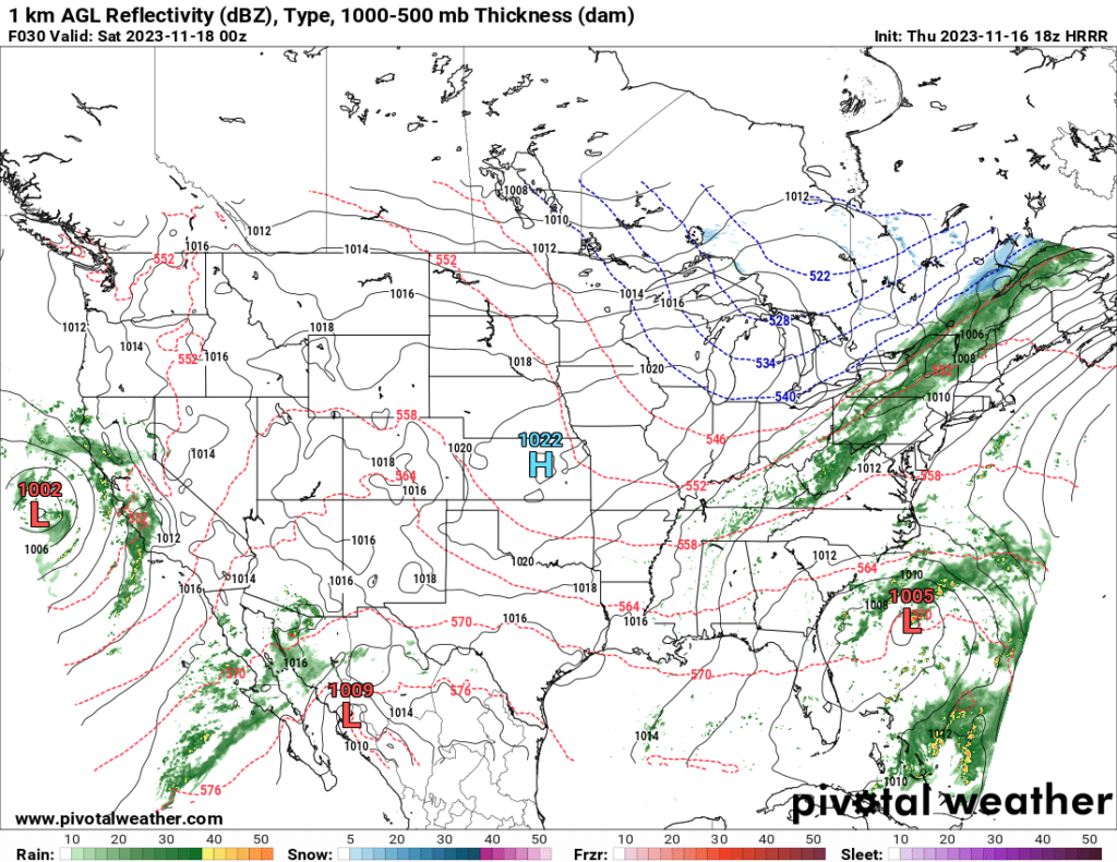
This front will bring rain to the eastern states on Friday and early Saturday, particularly the Northeast. A few thunderstorms are possible further south, though severe risk is low at this time.
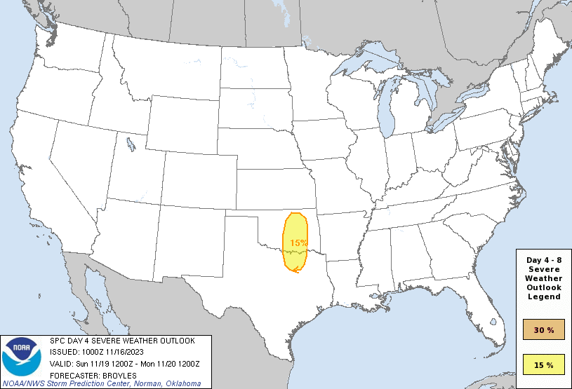
Speaking of severe weather, after a quiet few weeks, severe weather may ramp up again starting on Sunday. A shortwave trough is forecast to enter the Southern Plains on Sunday, and severe development is possible east of the trough. Strong shear combined with modest CAPE and moisture should support the potential for severe storms in parts of northeast Texas and eastern to central Oklahoma. It is possible the range of the severe outlook could be expanded in the coming days, but the SPC’s current Sunday forecast shows where the greatest potential for severe weather is based on current model runs. Anyone in central and eastern Oklahoma and northeast to north central Texas should pay attention to the forecast over the next few days. Based on my current look at the latest model run, I would say the greatest risk is wind, but a tornado threat cannot be ruled out either, owing to the strong shear.


