Dry weather has taken back over for the next few days. Outside of a shot for a rogue storm here or there, it looks like the area will be back underneath high pressure through the end of the week – at least.


It look slike the ridge should hold through the weekend and into next week. That means any rain we see will be tied to the seabreeze. And will likely be rather brief.
That same ridging though, should help stave off anything in the Tropics from bothering us – including Invest 95L.
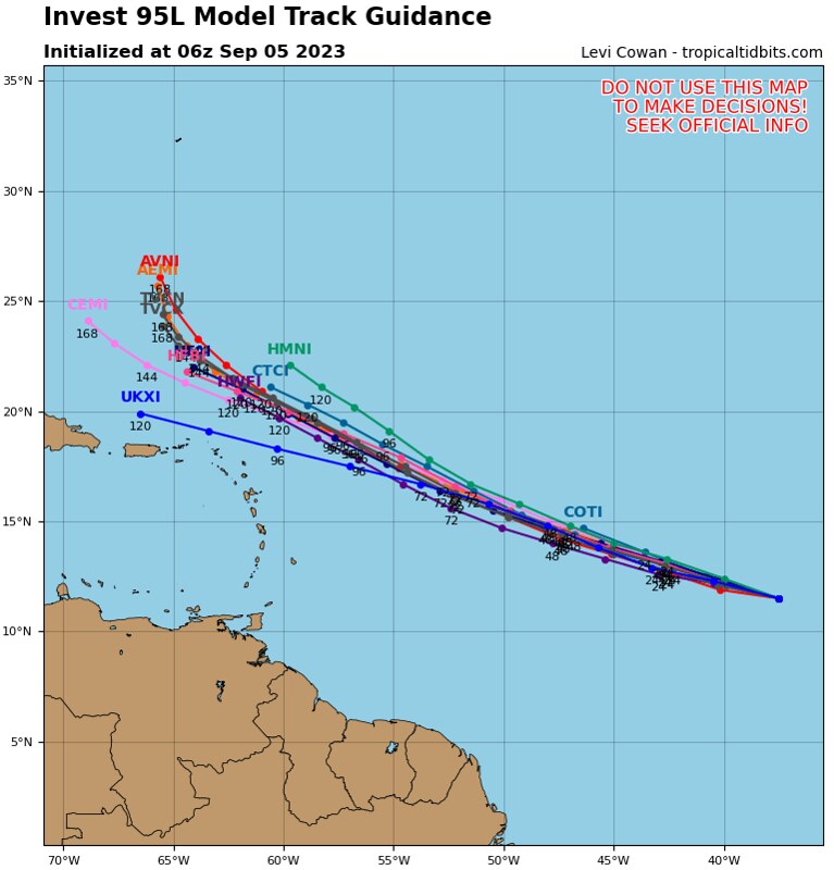

And that is a good thing because model guidance shows that Invest 95L will strengthen pretty quickly to become our next named storm, Lee. And most model guidance has it as a Major Hurricane out in the open Atlantic.
But, thankfully, given the atmospheric setup, we shouldn’t be bothered by it.
[wpcode id=”41149″]
TODAY’S WEATHER MAPS
Here is a look at today’s local weather maps!
[wpcode id=”41179″][wpcode id=”41149″]
REGIONAL DAY TO DAY FORECAST
Today: Sunny. Highs in the mid 90s. Southeast winds 5 to 10 mph.
Tonight: Mostly clear. Lows around 70. South winds 5 to 10 mph in the evening, becoming light and variable.
Wednesday: Mostly sunny with a few storms possible. Highs in the mid 90s. Northeast winds around 5 mph, becoming southeast around 5 mph in the afternoon. Chance of rain 20 percent.
Wednesday Night: Mostly clear. Lows in the lower 70s. Southwest winds around 5 mph.
Thursday: Sunny. Can’t rule out a few storms. Highs in the upper 90s. Heat index values up to 110. Chance for rain around 10 percent.
Thursday Night: Partly cloudy in the evening, then becoming mostly clear. Lows in the lower 70s.
Friday: Sunny. Highs in the upper 90s.
Friday Night: Partly cloudy in the evening, then becoming mostly clear. Lows in the lower 70s.
Saturday: Mostly sunny with a few storms possible. Highs in the mid 90s. Chance of rain 20 percent.
Saturday Night: Partly cloudy in the evening, then becoming mostly clear. Lows in the upper 60s.
Sunday: Sunny with a few storms possible. Highs in the mid 90s. Chance of rain 20 percent.
Sunday Night: Mostly clear. Lows in the upper 60s.
Monday: Sunny. Highs in the mid 90s.


