The Gulf Coast is pretty much set in the typical summertime weather pattern with chances for scattered storms and hot temperatures. An upper-level trough over the Great Lakes region is bringing a frontal boundary near the Ohio Valley with some possible severe weather. However, this front will not make it south enough to the coast. The upper-level high is stretched out across the Southern U.S. bring some easterly winds aloft over the area.

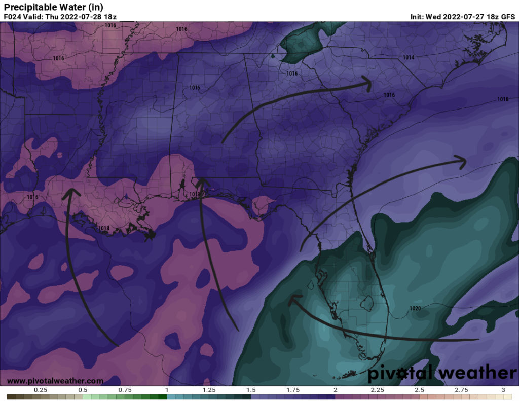
The Bermuda high over the Western Atlantic is helping to steer flow from the south near the surface. This will bring moist, tropical air from the Gulf. Storms on Thursday and Friday will use this moisture as they develop to produce some possible locally heavy rainfall. Precipitable water values increase to above 2″ to support this possibility.
Storm motion could also be slow with weaker winds aloft from the east and southerly winds near the surface. As some thunderstorms collapse, gusty winds 30+ mph could be seen with the downdraft and heavy rains. Storms will move in from the Gulf inland in the morning and move northward with the sea breeze before dissipating near sunset as daytime heating is lost. Expect widespread scattered showers and storms for the next two days before high pressure move in from the east dropping rain chances.
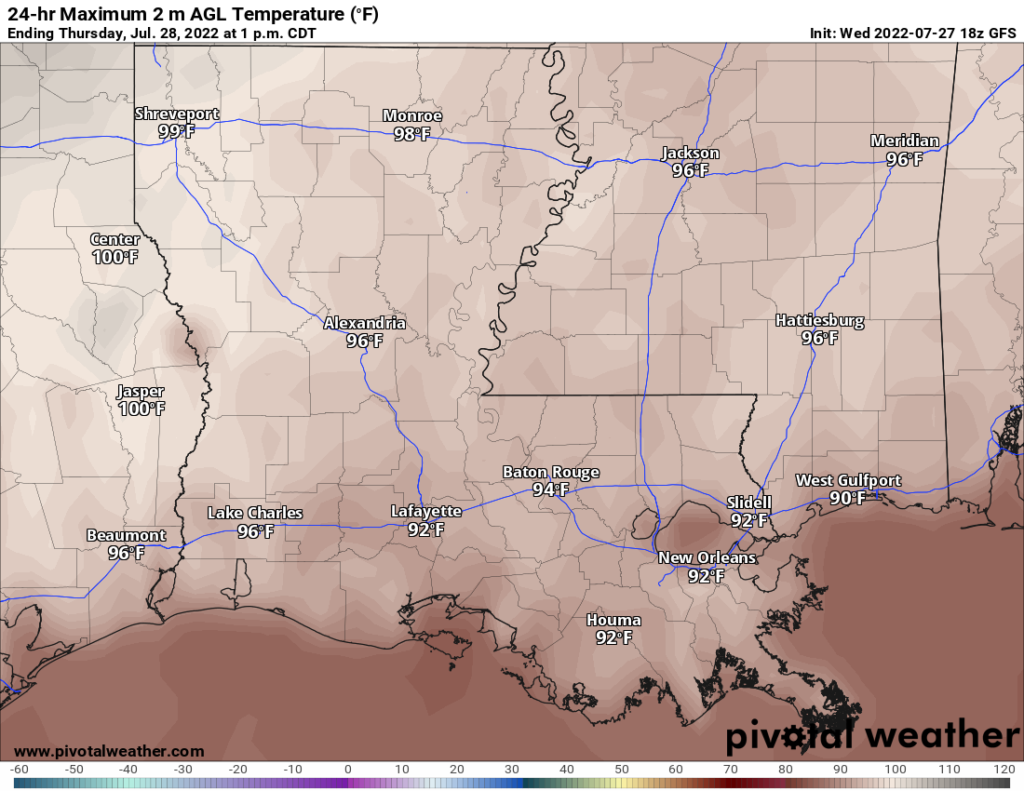
As for temperatures, expect average values of highs near the upper 80s and low 90s. With dewpoints reaching in the 70s, heat index values will range between 95F and 105F. Any rainfall will help to reduce the effects of this heat. As we head into the weekend, decreased rain chances mean not many places will see relief from the heat by the rain.
Day-to-Day Forecast
Thursday
Partly cloudy with a 60-percent of thunderstorms in the late morning and afternoon hours. Locally heavy rainfall is possible with some storms. Highs in the upper 80s and low 90s. Heat index values between 95F and 105F. Lows in the upper 70s.
Friday
Partly cloudy with a 70-percent chance of thunderstorms in the afternoon. Highs in the upper 80s and low 90s. Heat index values between 95F and 105F. Lows in the upper 70s.
Saturday
Partly cloudy with a 30-percent chance of thunderstorms in the afternoon. Highs in the low 90s and heat index values between 95F and 105F. Lows in the upper 70s.
Sunday
Mostly sunny with a 40-percent chance of precipitation. Highs in the ow 90s and heat index values between 95F and 105F. Lows in the upper 70s.
Monday
Partly cloudy with a 40-percent chance of precipitation. Highs in the ow 90s and heat index values between 95F and 105F. Lows in the upper 70s.
Tuesday
Partly cloudy with a 40-percent chance of precipitation. Highs in the ow 90s and heat index values between 95F and 105F. Lows in the upper 70s.
Wednesday
Mostly sunny with a 40-percent chance of precipitation. Highs in the ow 90s and heat index values between 95F and 105F. Lows in the upper 70s.


