A cold front is set to move through the area today, but it will be pretty washed out by the time it gets here so don’t expect a big cool down. Cooler? Sure. But this front doesn’t have a ton of bite.
Nor much of a threat for potent weather.
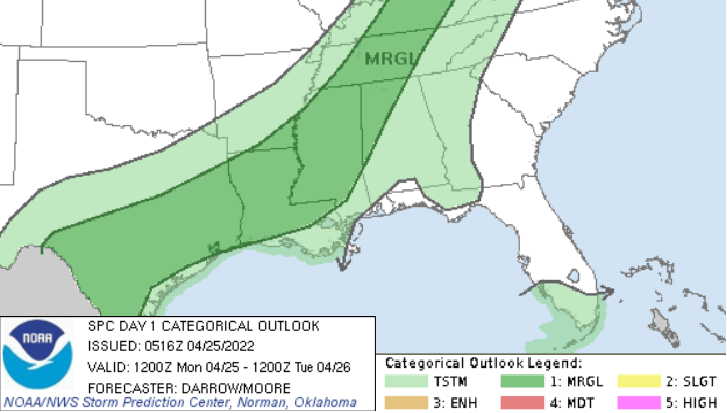
Showers and storms will be possible this afternoon and evening, but the threat for tornadoes and big hail are pretty low. In fact, even the threat for wind gusts exceeding 50mph seems pretty low. The Storm Prediction Center has opted for a Marginal Risk for severe storms. That is the “1” on the 1-to-5 scale where “5” is the highest risk for the most significant severe weather.
Wind gusts associated with downbursts will likely be the main concern for today across the region.
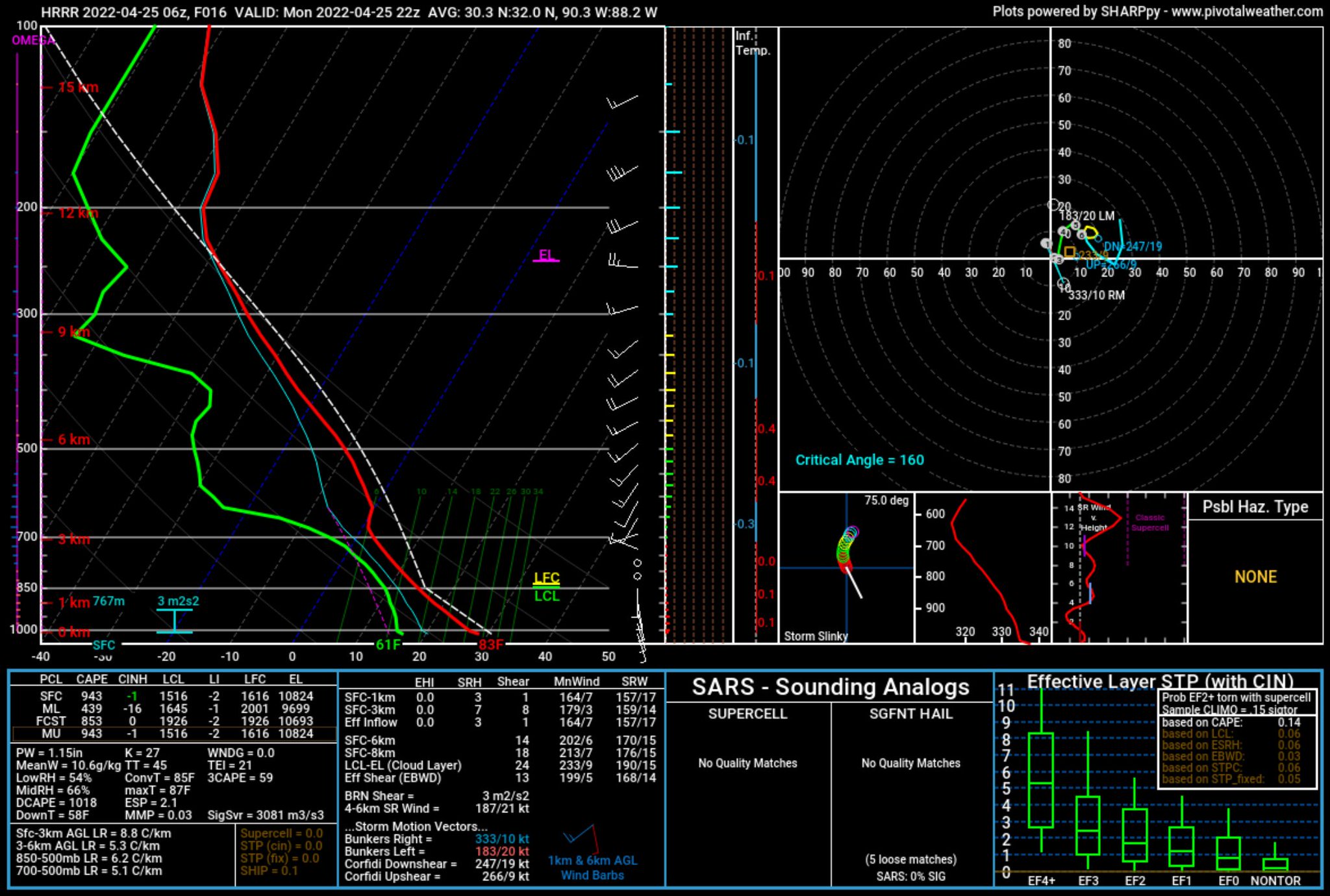
Looking at the Skew-T data, the atmosphere looks almost ‘summer-like’ with some instability but not much shear at all. That should limit storm organization today. And when storms can’t get organized, they have a much more difficult time strengthening to “Severe” storms.
So any Severe Thunderstorm Warning would be confined to storms that were ‘dropping their payload’ so to speak, producing a short-lived burst of strong wind and heavy rain.
Otherwise things clear back out Tuesday afternoon and stay nice through the rest of the week.
Day to Day Forecast
Today
Patchy fog this morning followed by partly sunny skies. Storms possible this afternoon and evening. Highs in the mid 80s. Chance of rain 60 percent.
Tonight
Mostly cloudy with storms possible before midnight. Patchy fog after midnight. Lows in the lower 60s. Chance of rain 30 percent.
Tuesday
Patchy fog in the morning with some lingering showers before 10a. Then partly sunny in the afternoon. Highs in the mid 70s.
Tuesday Night
Partly cloudy. Lows around 50.
Wednesday
Sunny. Highs in the upper 70s.
Wednesday Night
Clear. Lows in the upper 40s.
Thursday
Sunny. Highs in the lower 80s.
Thursday Night
Partly cloudy. Lows in the mid 50s.
Friday
Sunny. Highs in the mid 80s.
Friday Night
Mostly clear. Lows in the lower 60s.
Saturday
Sunny. Highs in the upper 80s.
Saturday Night
Partly cloudy. Lows in the mid 60s.
Sunday
Mostly sunny with a chance for an afternoon storm. Highs in the upper 80s. Chance of rain 30 percent.


