Welcome to Summer! But before we get there, we have some storms this morning to deal with. Her eis a look at the radar over on the app (as of this writing at 445a). These storms look to slowly fall apart as they move toward the east. But they won’t be gone by the time the push through the whole area, so be on the lookout for rain this morning.

A brief timeline would be near I-55 around 630a, along the I-59 corridor around 8a, and then into Alabama by 10a.
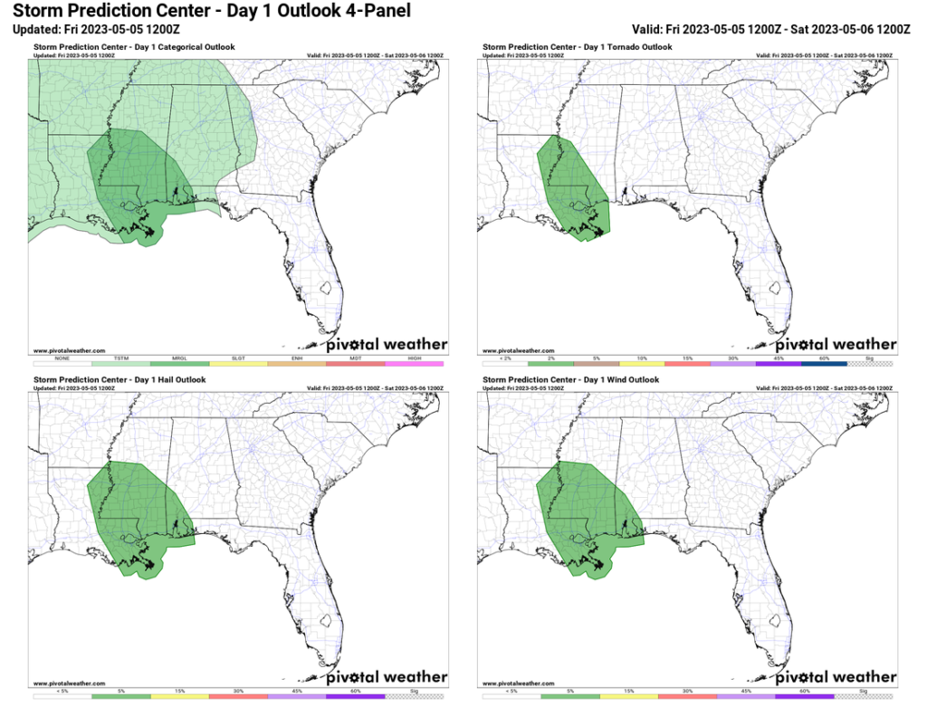
The Storm Prediction Center has the area under a Marginal Risk for severe weather as it passes. That is a “1” on the 1-to-5 scale where a “5” is the highest risk for the more significant severe weather.
Once these clear out, we should see the sun for a few hours before a few more storms try to re-develop. AGain, nothing to terribly potent, but there will be some rain, thunder, lightning, and gusty wind possible.
Then things should calm down overnight.
But we will hold on to a chance for storms through the weekend and into next week.
TODAY’S MAPS
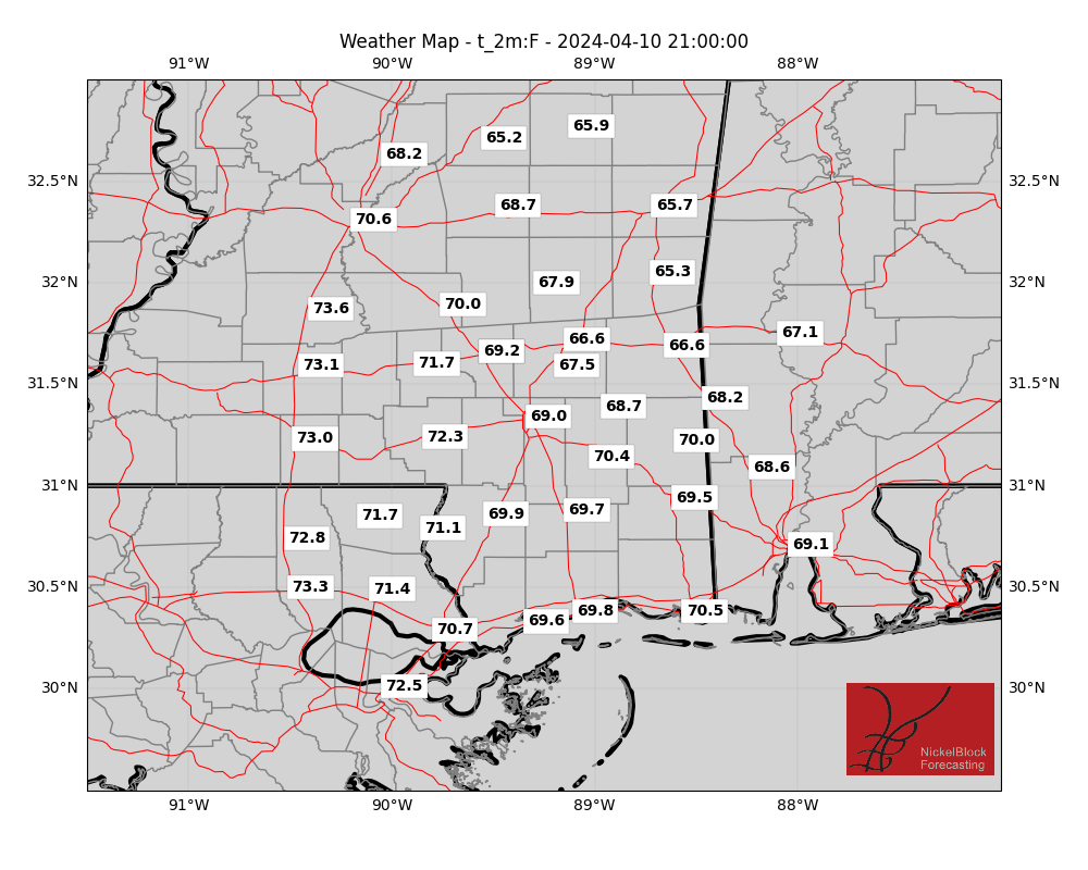
Here is a look at the maps for this afternoon (some didn’t update, I have to check the code):
In-house model data
I’m continuing to work on the presentation of these maps and will hopefully soon have a more robust viewer available for you guys!
REGIONAL DAY TO DAY FORECAST
Today: Storms should slide through the morning, and clear out by lunch, then more storms will be possible this afternoon. Highs in the lower 80s. Southeast winds 5 to 10 mph. Chance of rain 80 percent.
Tonight: Mostly cloudy. Lows in the upper 60s. Southeast winds 5 to 10 mph.
Saturday: Mostly cloudy with some storms possible. Highs in the mid 80s. Southeast winds 5 to 10 mph. Chance of rain 40 percent.
Saturday Night: Mostly cloudy with a few storms possible. Lows in the mid 60s. Southeast winds 5 to 10 mph. Chance of rain 20 percent.
Sunday: Partly sunny. A chance of showers with a slight chance of thunderstorms in the afternoon. Highs in the upper 80s. Southeast winds 5 to 10 mph. Chance of rain 40 percent.
Sunday Night: Mostly cloudy. Lows in the upper 60s.
Monday: Mostly cloudy with scattered storms possible. Highs in the upper 80s. Chance of rain 50 percent.
Monday Night: Mostly cloudy. Lows in the upper 60s.
Tuesday: Mostly sunny with a few storms possible. Highs in the lower 90s. Chance of rain 30 percent.
Tuesday Night: Partly cloudy. Lows in the upper 60s.
Wednesday: Mostly sunny. Highs in the lower 90s.
Wednesday Night: Partly cloudy. Lows in the upper 60s.
Thursday: Mostly sunny. Highs in the lower 90s.


