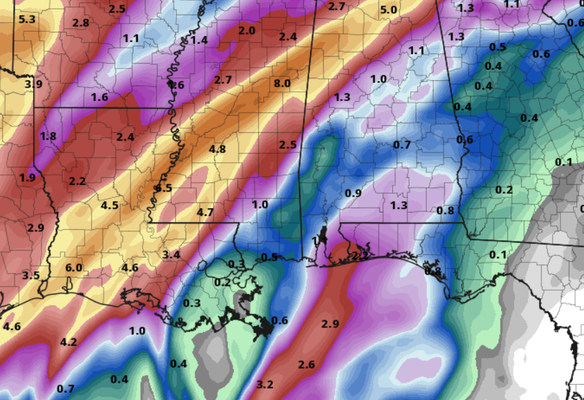
This is the start to a very damp week across the area. It won’t rain all-day, every day — but it may feel like it. With a boundary set up across the area and little mid-level systems gliding by nearly every day, we will see a chance for up to 5″ of rain and the potential for a few severe storms here and there, too.
It will also be pretty breezy all week.
Today will likely be the driest day with clouds increasing and a shot for a few showers tonight, but overall a nice day.
Then, Tuesday, Wednesday and Thursday we will see a shot for 0.25″ to 2″ of rain each day. I know that is quite a large spread, but it will depend on where the heaviest showers develop and we simply don’t know where that will be yet.
Model guidance shows the heaviest of the rain to the west of the area on Tuesday and the across parts of our area on Wednesday and Thursday
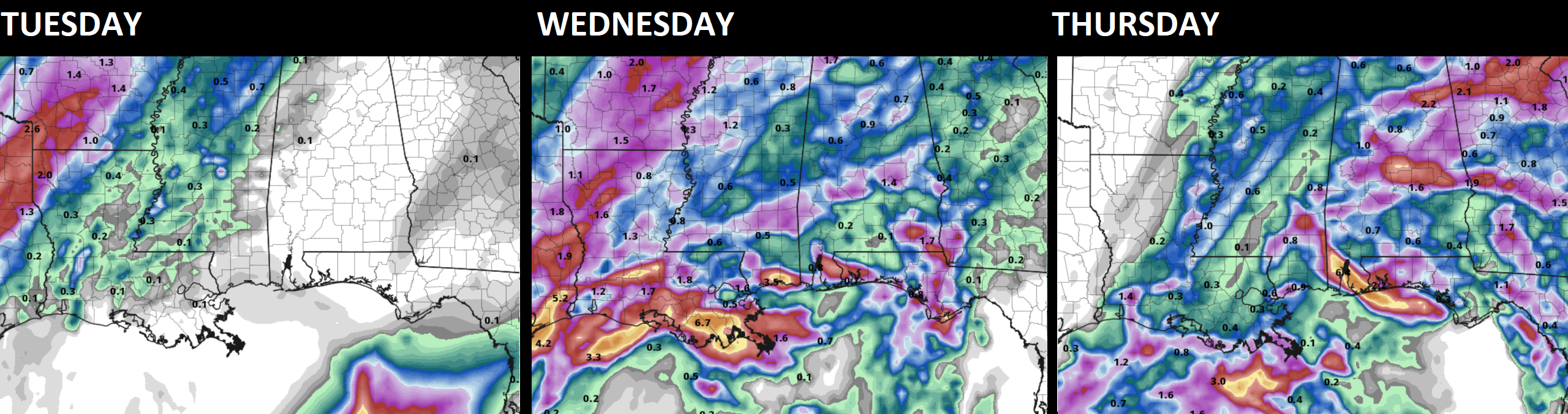
Overall totals from the hi-res guidance put about 1″ to 4″ across the area between right now and Thursday morning around sunrise.
But Thursday will feature more rain through the early afternoon, so those totals may need to be bumped up slightly.
I know many folks will be asking, ‘when will it rain each day?’ and sadly, I don’t know. This type of a pattern creates a situation where rain will be rather on-and-off and isn’t easily forecastable for a specific point at a specific time.
Looking at the CIPS Analogs, and there is a sustained risk for severe weather throughout most of the week. This does not mean there will be severe storms every day, thankfully. But it does mean that there will be a shot for one or two storms each day.
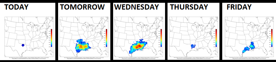
Despite the guidance shown above, I tend to think that Wednesday and Thursday will be the main days with the risk for severe weather. Based on today’s data, it looks like the main concern will be brief heavy rain, lightning, wind gusts up to 65mph, and small hail. Tornadoes will be a threat, but it looks like that risk will be pretty low. It may increase a bit on Thursday, but we will have to see how things shake out up until that point.
REGIONAL DAY TO DAY FORECAST
Monday: Partly sunny in the morning, then becoming mostly cloudy. Not as cool with highs in the upper 50s. East winds 10 to 15 mph with gusts up to 25 mph.
Monday Night: Cloudy. A slight chance of showers after midnight. Not as cool with lows in the lower 50s. East winds around 10 mph with gusts up to 25 mph. Chance of rain 20 percent.
Tuesday: Cloudy with a 40 percent chance of showers. Highs in the upper 60s. Southeast winds 15 to 20 mph with gusts up to 30 mph.
Tuesday Night: Cloudy with a 30 percent chance of showers. Near steady temperature in the lower 60s. Southeast winds around 15 mph with gusts up to 25 mph.
Wednesday: Cloudy. A chance of showers in the morning, then showers with a slight chance of thunderstorms in the afternoon. Highs in the mid 70s. Chance of rain 50 percent.
Wednesday Night: Showers with a slight chance of thunderstorms. Near steady temperature in the mid 60s. Chance of rain 70 percent.
Thursday: Showers with a chance of thunderstorms. Highs in the lower 70s. Chance of rain 70 percent.
Thursday Night: Showers likely with a chance of thunderstorms. Lows in the upper 50s. Chance of rain 70 percent.
Friday: Mostly cloudy. Showers likely with a chance of thunderstorms in the morning, then a chance of showers in the afternoon. Highs around 70. Chance of rain 60 percent.
Friday Night: Mostly cloudy with a 50 percent chance of showers. Lows in the upper 50s.
Saturday: Mostly cloudy with a 50 percent chance of showers. Highs in the lower 70s.
Saturday Night: Mostly cloudy with a 20 percent chance of showers. Cooler with lows in the upper 40s.
Sunday: Mostly sunny. Cooler with highs in the lower 60s.


