No major changes to the forecast for the next seven days – dry and mild.
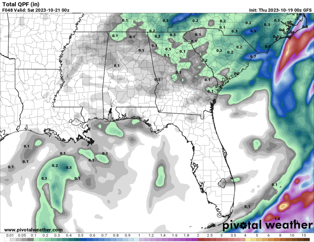
This next system system is going to do its thing and turn into a long wave trough across the Eastern US. What that means for us is we’ll start to see more clouds rolling into the area. The clouds will be at their thickest during the first part of the day on today, but they’ll ease up, giving way to some partly cloudy conditions by late tonight. We’ll also see some upward motion in the atmosphere (that’s what’s causing those extra clouds), which will add some moisture to the mix. So, don’t be surprised if you run into some light rain or showers, maybe a 20-30 percent chance,
Rainfall totals won’t exceed 0.25″ in total, though, so it isn’t like it will be very meaningful rain.
After a front swings through Thursday night into Friday morning, we’ll get some breezy conditions for the rest of Friday. The air is going to get drier and warmer, which means we’ll have low humidity values. Look for highs around 80. Unfortunately, that’s not great news when it comes to wildfire risk, so we’re going to have to keep an eye on that. The NWS is calling it a “Limited” fire danger threat for the entire area on Friday.
There’s a high-pressure system hanging out over the desert Southwest that’s going to help with some warmer temperatures. So, expect highs in the low to mid 80s through early next week.
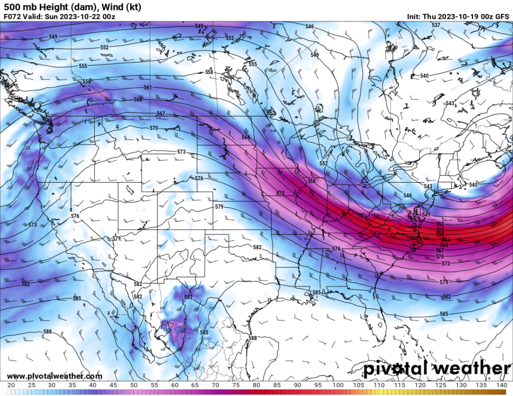
That high-pressure system is going to keep things mellow in our neck of the woods for the next seven days, with a mostly zonal jet stream and quiet conditions. Unfortunately, it won’t do much to help our ongoing drought situation, as the early models aren’t showing any rain in the forecast until late next week.
[wpcode id=”41149″]
REGIONAL DAY TO DAY FORECAST
Today: Mostly sunny. Highs in the upper 70s. South winds 5 to 10 mph.
Tonight: Partly cloudy with a slight chance of showers and thunderstorms. Lows around 60. Southwest winds around 5 mph. Chance of rain 20 percent.
Friday: Sunny. Highs in the lower 80s. West winds 10 to 15 mph.
Friday Night: Clear. Lows in the lower 50s. Northwest winds around 5 mph.
Saturday: Sunny. Highs in the lower 80s.
Saturday Night: Partly cloudy in the evening, then becoming mostly cloudy. Lows in the upper 50s.
Sunday: Partly sunny. Highs in the lower 80s.
Sunday Night: Mostly cloudy in the evening, then becoming partly cloudy. Lows in the lower 50s.
Monday: Sunny. Highs in the lower 80s.
Monday Night: Mostly clear in the evening, then becoming partly cloudy. Lows in the mid 50s.
Tuesday: Mostly sunny. Highs in the lower 80s.
Tuesday Night: Mostly clear. Lows in the upper 50s.
Wednesday: Mostly sunny. Highs in the lower 80s.


