The SPC is maintaining the Slight Risk and Marginal Risk for severe weather across the area. And the risk continues to look like brief heavy rain, lightning and gusty wind. While tornadoes can’t be ruled out, the risk for wind is higher. Hail seems like a pretty low risk, too.
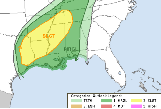
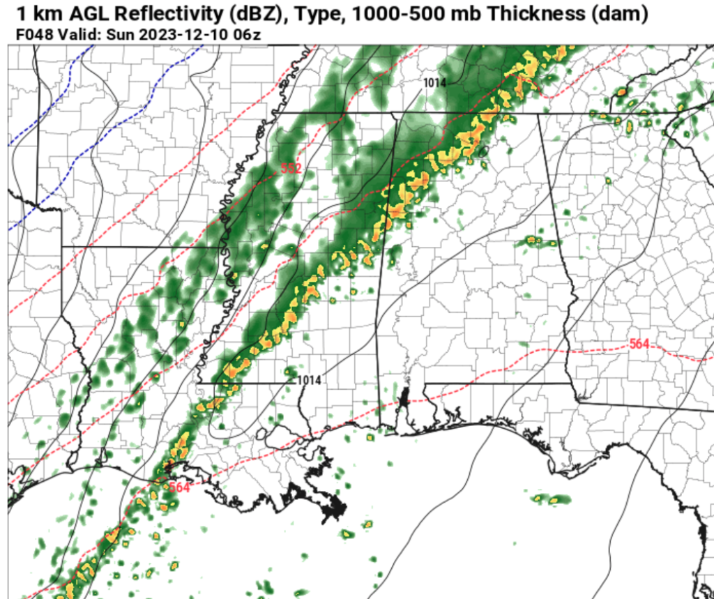
The timeline continues to be split in two. One round Saturday afternoon and evening and then another round overnight. The afternoon and evening risk for storms should be pretty isolated while the threat for storms overnight will be for pretty much everyone as the cold front moves through with a line of storms that will stratch from the Gulf Coast all the way up into Tennessee.
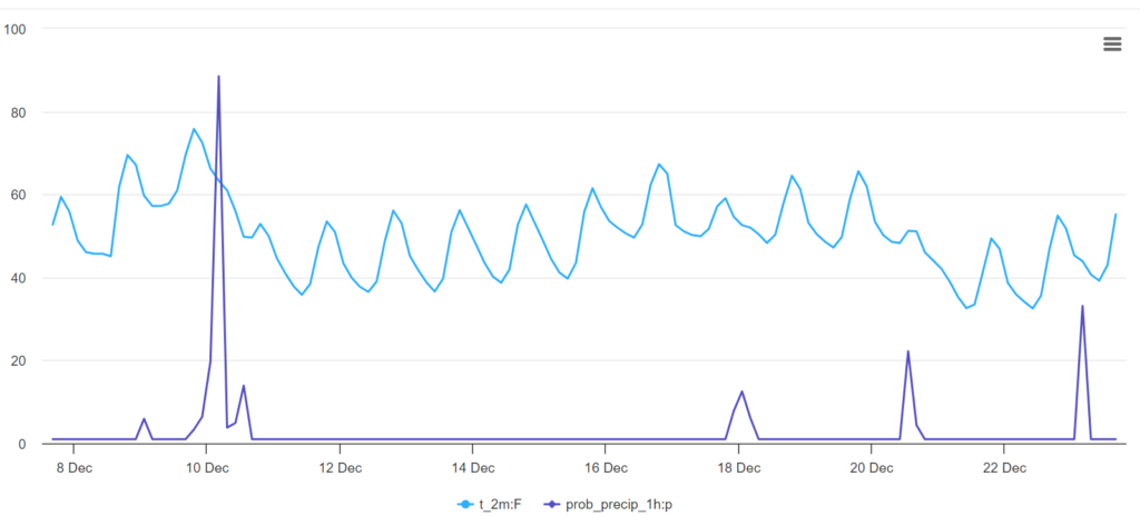
Looking beyond out shot for precip Saturday, the charts show that things cool down through most of next week with a slow, steady warm-up. We should see another few shots for rain in the lead-up to Christmas. Right now, the ‘numbers’ show that the chance for rain isn’t too high, but I will say I think the shots for rain look pretty decent a few more times leading up to the holiday.
Looking a bit farther out at the Euro 45-day forecast, the data supports a handful of chances for rain through the first week of January – but a dry Christmas. It also shows temperautres get pretty chilly once we get past the first of the year!
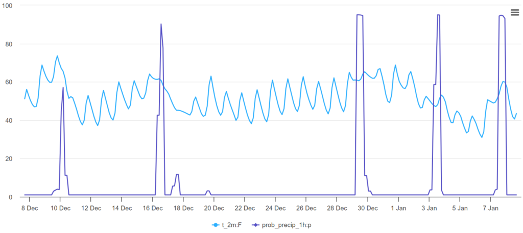
But when looking at these 45-day forecast, I always take the specifics with a grain of salt.
[wpcode id=”41149″]
REGIONAL DAY TO DAY FORECAST
Friday: Partly sunny. Highs in the lower 70s. Southeast winds 5 to 10 mph.
Friday Night: Partly cloudy. Patchy fog. Lows in the upper 50s. Southeast winds around 5 mph.
Saturday: Partly sunny. Patchy fog in the morning. Then a chance for storms in the afternoon and evening. Highs in the upper 70s. South winds 5 to 10 mph. Chance of rain 40 percent.
Saturday Night: Showers with a chance of thunderstorms. Some storms may be severe. Lows in the lower 50s. South winds 5 to 10 mph, becoming southwest 10 to 15 mph with gusts up to 25 mph after midnight. Chance of rain 80 percent.
Sunday: Mostly cloudy in the morning, with clearing skies in the afternoon. Highs in the upper 50s. Chance of rain 40 percent.
Sunday Night: Mostly clear. Much cooler with lows in the lower 30s.
Monday: Sunny. Highs in the mid 50s.
Monday Night: Mostly clear in the evening, then becoming partly cloudy. Lows in the lower 30s.
Tuesday: Mostly sunny. Highs in the upper 50s.
Tuesday Night: Partly cloudy in the evening, then becoming mostly cloudy. Lows in the upper 30s.
Wednesday: Partly sunny. Highs in the lower 60s.
Wednesday Night: Mostly cloudy. Lows around 40.
Thursday: Mostly sunny. Highs in the lower 60s.


